Friday 16 December 2011

Beenkerach winter walk

Coumeengeragh, I went up the mixed ground on the right.


Carrountoohil east face
I went back to the Reeks yesterday for a hike. The day was clear and cold so I was hopeful that decent snow conditions might be found. As I drove back the temperature rose from a chilly 2degrees at home to 7degrees by the time I arrived in Killarney. It is amazing how often this happens. If these mountains were located just fifty miles further east they would offer good climbing much more often. Anyway there was still a decent coating above 600mtrs so I decided to have a look at Coumeengeragh Gully. This starts at just about 600mtrs and forms a nice line to the Col just to the west of Beenkerach. Unfortunately it was immediately obvious that the gully was full of unconsolidated powder so I broke out to the right and climbed up the mixed ground to the ridge. This gave some reasonable fun with an average angle of 45degrees. After all the chilly weather and rail and sleet I felt sure that there would have been a big dumping on high but alas no, there was only a wind scoured dusting on top and only small accumulations on the leeward slopes. Still the day offered a nice taste of winter and who knows , maybe the cold weather will endure over the Christmas and I may get out again.
The Eastern Reeks

Saturday 10 December 2011

Pyrenees Hike December 2011, A short hop on the GR 10


A short hop on the GR 10.

Pretty much on the spur of the moment, I decided to quit the dreary dull winter we were having, and Ibooked a flight to Barcelona, with the objective of walking from the Mediterranean Sea to Andorra. So, off I set to Dublin on Thursday 1st of December and stayed overnight, before my flight on Friday morning. Everything went well and I landed in Barcelona just after 1pm. I caught the train from the airport to Figueres, and stayed there on Friday night, with the intention of heading to Banyuls Sur Mer, just over the border in France, on Saturday morning. I went for a walk around Figueres and got the maps and gas I needed. It is a nice town, with lots of quaint squares and buildings. Later, I visited a bar and internet cafe. There were about five others there besides myself, and loud dance music filled the air. The barmaid was entertaining the punters by shaking (almost vibrating) her booty as she looked at her laptop. The highlight for me was the ecstatic dance that a guy made when he won some money on a gaming machine. His beaming face and funky dance had me laughing well into the night.

Saturday Dec 3rd,


My train was leaving at 9am, so I had time to have another stroll about town, and get a bite of breakfast. I was delighted to see that a couple of the squares were now full of stalls selling all kinds of food. Lots of people were milling about getting their daily groceries. I wandered through one market, and picked up a smoked chorizo to take up the mountains with me. What can I say, but if I had the chance again, I would have got a few dozen, to hell with the weight. It was delicious. So different to what we are served here. Anyway, after a nice coffee and pastry, I returned to my digs and collected my BIG bag, and caught my train. It is a short trip, but I had to change trains in Cerbere, and there wait for an hour for the connection to Banyuls. This afforded me the opportunity to explore the little town, that tumbled down to a nice little cove on the shore. I had a little wander about, and as I returned towards the train station, a drunk with his dog fell in with me, and started pratteling away. He started in French and then switched to Spanish, when my responses dried up completely, he then asked me where I was from, and when I told him, he switched again to perfect (almost) English. It made me feel a bit ashamed of my linguistic limitations. I thought when I reached the station he would be off, but no, he followed me in and sat alongside me on the platform. When he boarded the train as well, and alighted with me in Banyuls Sur Mer, I was more than a little worried that I would have a companion for my trip, but thankfully, he said a quick farewell and I was left alone to face my adventure.

Looking back at Banyuls Sur Mer
A walk of 500mtrs, saw me reach the trail where it passed under the railway line. Seeing the red and white paint mark on the wall was great, and I knew, that now at last, the real trip had begun.  So I was off. The track twists and winds its way up the hillside, and soon I was after rising well above the village. Lovely views back towards the sea, competed with the exciting landscape that lay ahead. There is a definite arid look to the landscape here. There are large cacti and agave adorning many of the gardens, and the scrubby nature of the flora, and overall brown appearance of the landscape, gives the area an almost desert like feel. There was a stiff breeze blowing, but the temperature was mild, and it was great to be walking in just a base layer with the sleeves rolled up in December. Onwards and upwards, and each time I rounded a new corner, or crested a new ridge or coll, there were new sights to greet me. My bag was heavy, about 22kg at the start, which had food for four days, all my camping needs and clothes etc. I was actually quite pleased that I was able to climb so well with it. Of course the tracks are perfectly engineered, and are designed to allow you to gain height with the optimum of effort. Eventually I arrived at Col de Bailloury, and here I enjoyed a great view over the large plain that stretches north towards Narbonne, and blends into the blue Mediterranean Sea.
Looking north
From here on the landscape becomes wilder, and the rock buttresses of the first peak, Pic Sailfort 981mtrs, are to the fore. The track wends and winds its way up the flanks, and eventually, you emerge onto a wide plateau, and the extensive forests of Don Des Alberes, sweep away to the north. This was a grand spot for lunch, although, sitting at 3000 feet in December meant there was now a definite chill in the wind. It felt great to be here, and the feeling of freedom, and exploration, I had was exhilarating. I didn't tarry too long as I was eager to get on. The trail continued over open alpine pastures, crossing Pic de la Carbassere, and on to Pic des Quatre Termes 1156mtrs. Here, the trail dives into the forest, and I found it quite difficult to follow at times, as the forest floor was covered with leaves. At times, the only indications of the way ahead, were the often too infrequent markings on the trees. Almost inevitably, I took a wrong turn, and had to take a forest road for an extra couple of kilometers, before I regained the track . I eventually reached Col de L'Orry 1010mtrs, and was surprised to see that Banyuls Sur Mer was already 22.5 kilometers behind me. The day was now shoving on, and I still had a fair bit to go before I reached my target for the day, Pic Neulos 1256mtrs.
Still a fair bit to go.
Fatigue was now playing its part, and the weight of the bag, was taking its toll on my shoulders, as well as other places. I opted not to stay in the bothy like Refuge de la Tagnarede, and chose instead, to camp about a kilometer further on, near a water source, just under the Pic. It was great to drop the bag, and soon I was engrossed in finding a good spot for the tent, and once this was done, getting the stove going. Before too long I was settled and ready for the night. It was a wonderful spot, with uninterrupted views south to Spain, and north to France, I was right on the border on the crest of the ridge. The breeze had long since died, and it was very pleasant to sit outside, at about 4000ft, in December, enjoy a brew and wonderful views, in the fading light. This was what I had hoped for, and all in all, I was very satisfied with the day. I was beginning to realize that covering the distances I had envisaged, would be difficult if not impossible, but I was determined not to put myself under any pressure, and since I was carrying all I needed on my back, I could be completely flexible with my plans. Not long after I had retired in to my tent for the night, it started to rain, and this continued well into the night. Still, I was snug and dry in my nest, and I way happy to drift off to sleep, soothed by the patter of the rain on canvas. 
So ended day 1.

Sunday Dec 4th,
I awoke to a dry cloudless day. The rain of the previous night was well gone and the ground was dry and the air was quite mild. I had slightly overslept, and I quickly busied myself with the task of breakfasting and readying for the off. It's amazing where the time goes, and it was gone 9am before I set off once again. I could have skirted around the summit, but that would have felt like cheating, so I made the short hop to the summit, which is topped by a large communications mast. I followed the road down from this for a bit, before the route enters the forest once again. I soon lost the trail and followed another to a gite, which eventually rejoined the correct route, but this added about four kilometers to the descent. I found going down more difficult, as the weight of the bag, and the angle of descent, made me press into the toe of my boots. Soon enough, my feet were getting a bit sore. The route drops right down to the Col du Perthus 271mtrs, which has a little village. Unfortunately, the whole place is dominated by the motorway that links Spain and France. The constant noise of traffic must be a nightmare for the locals to endure. Still, I was very glad to have reached there, and I treated myself to a couple of croissants and a coke, which went down very well.
Dawn above Las Illas

From here, you climb again, past a huge old army fort, and then drop down into a wide open valley. Up again, on gentle forest tracks, to about 700mtrs before eventually dropping again to a little village called Las Illas, where there was a busy gite. The day was once again getting late, and I was now quite tired. I reckoned that I had travelled at least thirty kilometres by now. As I had approached the village, the only possible campsite I could see in the heavily wooded area, was on a treeless col above the village. This I headed for, but it meant another couple of hundred meters of climbing to end the day. Sure enough, there was a fine grassy patch at the col, and I wasted no time in the gathering gloom, in getting camp established. I had to walk down through the woods for a few hundred meters to get to a water supply, but that was OK. I wasn't too off put by the few cowpats dotted around the area, as these were easily avoided. My feet were really glad to get out of the boots, but unfortunately some blistering and blood was in evidence, and the first aid kit was required. I really enjoyed dinner, and watched the sunset in the fine evening. All in all it had been another great day, but it was now clear that I had really underestimated the distance involved, and that there was now no chance of reaching Andorra in the time I had, so a new plan would have to be thought of. I settled down to bed once again, with only the occasional hooting of owls for company, bliss. At about 9pm, I heard the ta-ting ta-ting ta-ting ta-ting of the bells that hang from the necks of cattle in the mountains. This is a sound I usually like, but now I realized why there were cowpats round and about my tent, and sure enough soon the air was full of campanology, as the herd made for, what was obviously one of their favourite spots. What can I say, but that at three in the morning, the musicality of the noise had long since gone, and I was having fantasies of juicy steaks etc. Ah well a lesson learned I think.

Monday Dec 5th,


Further than it looks
Where I'm going
Once again the day dawned mild and dry. The cattle had long since retreated, and despite the noisy night, I felt surprisingly well rested. Thankfully my feet seemed to have recovered, and once I was booted and suited, I felt good as I started the climb towards Roc De Frausa 1450mtrs, which would be the highest point so far. After about an hour, I arrived at the Refuge Salinas, near which there is a superb place for camping. It would have been a real struggle to reach there the previous evening, but one for the future I think. There was a little cloud about, and some unfortunately was covering Roc Du Frausa when I arrived, so there was no need to delay, and I set off on what promised to be another long descent. I soon reached Col Cerda. This was a grand spot, where an elegant rock spur rose up the far side. I was really tempted to climb it, until I looked at the map, and realized that it was over a kilometer to the summit, and nearly 700 ft higher. I reckoned it would take too much time, so I left it be. The plan now was to head for the town of Arles sur Tech. I followed a good track, through fine wild scenery, until I reached a tarred road. Try as I might I could not find the trail to Arles, and after going up and down the road for a couple of kilometers I conceded defeat, and went instead to Amelie Les Bains. This is a good size town at 250meters above sea level, so once again, the descent had been long, and my feet were again feeling sore. I checked with the tourist office, and found to my delight that there was a frequent bus service between there and Perpignon, so I would be easily able to reach Barcelona from there. I camped in the local campsite, and enjoyed a lovely shower and a few beers, and had a bell free night.
Amelie les Bains

Tuesday Dec 6th,

Once again, the day dawned clear and windless. An early start soon had me following the trail up to
The old barracks??
Montbolo, a charming little village some 250mtrs above. It felt great to be leaving behind the trappings and noise of the town, and to be once again entering the wilds. I was feeling quite strong, perhaps it was a combination of an ever lightening bag, or the fact that I was getting a bit stronger thanks to the previous few days. Anyway, I made good progress, and was soon at Col de la Redoute at over 800mtrs. I was quite excited, because today, finally, I was heading for the high mountains. Perhaps, at last, I would justify bringing the axe and crampons, across many kilometers of forest. A couple of hundred meters further up, I came across the ruins of an old barracks, which afforded wonderful views.
Unfortunately, there was no water to be found there, so if I was going to use it as a campsite on my return, I would need to bring an ample supply with me.

A des res with a view.
I had finalized my plan for my final few days the previous evening. It was clear that I would not be able to reach Andorra, or even Puigcerda, so my best option for being able to get back to Barcelona on Thursday evening, was to return to Amelie, and catch a bus from there to Perpignan, and then a train from there to Barcelona. So today, I was heading for Batere, where I would stay.Tomorrow I planned to climb the Serra del roc Negra. This is a spine of tops, between the major peaks of Pic Du Canigou and Puig dels tres vents. I continued up, and reached the ruin of the Tour de Batere at 1439 mtrs. There was now a threat of a change in the weather, and some cloud was rolling over the slopes of the hills ahead. I still had about four or five kilometers to go, so I pushed on. I passed the refuge and Gite, and choose to camp a little higher up in the old mining area. This was a delightful spot, with a flat grassy area, and a handy water supply. I was at just over 1600mtrs, and it was only just 2.30pm, so I had gained about 1400mtrs, and I had plenty of time to relax. Thankfully, the threat of rain seemed to have receded, and I enjoyed a lovely relaxed few hours, in really pleasant temperatures. After dinner I retreated to my tent, and once again, the weather turned. Suddenly, out of nowhere, a strong wind came, and the rain arrived. Once again, I thanked my good fortune, that I was warm and dry. I just hoped that it would have cleared up by the following morning.

Wednesday Dec 7th,

Beautiful dawn.

Serra del Roc Negre

Feeling like -20 at 9000ft.
Looking south to the mountains of Catalonia
Highest point 2714mtrs.
I awoke to what can only be described as the perfect morning. No wind, clear skies, and the start of the most spectacular dawn in the east, greeted me when I emerged from the tent. There was a good coating of frost on the tent, which was a reminder that I was at over 5000ft. Today I was leaving the tent here, as I was returning this way again, so I would have a lovely light bag. I breakfasted and got packed, and was leaving at 07.45am. The route went up to Col de la Cirere 1731mtrs, before turning west southwest to Puig de pel de Ce at 2105mtrs. Here, at last, I had my first steps in snow, and I was delighted to discover that it was rock hard neve. At 2266mtrs, I donned crampons, and for the rest of the climb I was in a snowy wonderland. As I gained height the wind strengthened. By the time I crested Pic Gallinasse 2461mtrs, it was very strong indeed, and at times walking was difficult. The views were wonderful however, and more than made up for any discomfort caused by the wind. I was glad that I brought my cycling goggles, as these kept the biting cold wind from my eyes.

Happy chappie


Vultures glide away
It felt wonderful to have, what was now, an almost empty bag on my back. I won't say that I flew along, but I was able to travel at a more normal pace. I was glad that the terrain was easy, as the wind would have made traversing narrow ground dangerous to say the least. Indeed, when I arrived at point 2698 metres, I  could see that the last couple of hundred meters before Puig del roc Negre (2714 metres) was quite narrow, so I turned around for this very reason. I didn't mind, as this was all about having fun, so I returned the way I had come,  and just enjoyed the day. Before too long I was back below the snowline, and I repacked the spiky stuff, and had a bite to eat. As I descended, I looked to my right, and to my delight, saw nine vultures glide from just a hundred meters away, towards a ridge. This, just about capped a wonderful outing, and I was thrilled as I returned to the tent. I returned to the campsite, and here, out of any wind, it felt positively balmy, and as it was only just gone 2pm, I chilled out and relaxed for an hour. I packed up again and headed down. I had intended to camp at the ruins I had passed the previous day, but I failed to fill up the water bottles in time, and had to continue on down to Col de la Redoute. All through my trip I was delighted to hear the gentle toohooting of owls, as they called and claimed their territory. The sound is surprisingly loud, when one calls from a small tree, that is literally above the tent. I found myself awake and listening to the calls at 2.30am. Still I wouldn't swap the experience for anything.

Thursday Dec 8th,

A lovely leisurely start, to yet another lovely day, saw me finish the last of the food and gas. I packed up and made my leisurely way, back to the valley floor. A nice lunch and a bus ride, saw me arrived in Perpignan. I passed the afternoon by walking miles and miles around this charming town, that bustled with Christmas markets, and quaint narrow shopping streets. I had decided to take an evening train to Barcelona, and so, I found myself in the impressive TGV for a short hop to Figueres.Another comfortable Spanish train took me to Barcelona. I chose to stay in the airport, as I wasn't there until gone 11.30pm, and trying to find somewhere to stay at that time, would have been more hassle than it was worth. By the evening my left heel was quite sore, and when I was finally settled in the terminal, I took off my boots and socks, and was greeted by the biggest blister I had ever seen, on my left foot. It stretched from right under the heel, up around the back, and when I pierced it with a toothpick, it sprayed water over the black tiled floor. Thankfully there was no one else near, and I was able to tidy up the floor, and myself, without undue disgust to others. So, I settled down for my morning flight, well happy with my little adventure, and feeling reinvigourated after a week of exercise and great weather. I will be back.

Tuesday 15 November 2011

Coomloughra Horseshoe.

Looking west on the Everagh Peninsula


Coumloughra

The Eastern Reeks
I headed back to the Kerry mountains today for a day on the hills and to test out my knee. The weather was good and as I passed Killarney I decided to do the Coomloughra Horseshoe. This is one of the finest walks in Ireland and takes in the three highest peaks in the country. The western side of the coum was free of cloud so I decided to climb up the steep slopes of Skregbeg and thus on to Beenkeerach. The views from here are great so I decided that this was a good spot for lunch. I was joined by two walkers who were a little unsure of doing the ridge across towards Carrauntoohil so they followed me across. The summit was now clear as well and the views across to the eastern Reeks was great. Onwards to Caher in the cloud and gently down and back to the car. A lovely day out and thankfully no problems with my knee. Back to running again I think.
Carrauntoohil from Beenkeerach

Friday 11 November 2011

Mangerton Stoompa horseshoe


Ruby
Last Sunday I went with the lovely Ruby for a gentle walk on Mangerton. The day was fine and I was looking forward to having Ruby along for company. She adores being out and about and I knew she would love being on the mountain. I obviously took the lead for her but she is so good now that we struck off with her free and I resolved to keep a close eye on her. There was a distinct chill in the air and this coupled with the strenghening wind as we got higher meant that hat and gloves were necessary on the summit. We set off along the summit plateau and the wonderful views were a joy. The 1000ft cliffs that swept down into the Horses Glen make this one of the most spectacular walks in Kerry. Soon we were heading up towards the summit of Stoompa.This was a good spot for a bite to eat although I wasn't allowed to linger too long by the impatient Ruby who was ever anxious to be on the move.


Looking into the Horses Glen
Looking east from Stoompa
 The initial descent from here is fairly steep and the ground has some rocks and lots of heather and then continues gently down a spur. Not long from the summit I put my left leg into a hole and my knee got a terrible snap backwards. I went down like a sack of spuds roaring. It was agony, and I was sure I was after doing damage. I writhed around for a bit and soon to my enormous relief the pain eased and I began to hope that the damage wan not as severe as I had first feared. After a short while I stood and to my delight found that the knee would take my weight. I was soon on the move again, gingerly picking my way down and making sure of each step. Bang, I suddenly found myself in a hole between two rocks. This was not going too well. Thankfully I was unhurt and hauled myself out and continued. The knee looseded out more and I was again able to enjoy my spectacular surroundings. Thankfully the rest of the walk passed without incident and we both went home happy.
Looking towards Killarney

Eastern buttress of Mangerton North

Wednesday 9 November 2011

Tyndrum Halloween 2011

On Friday Oct 28th,
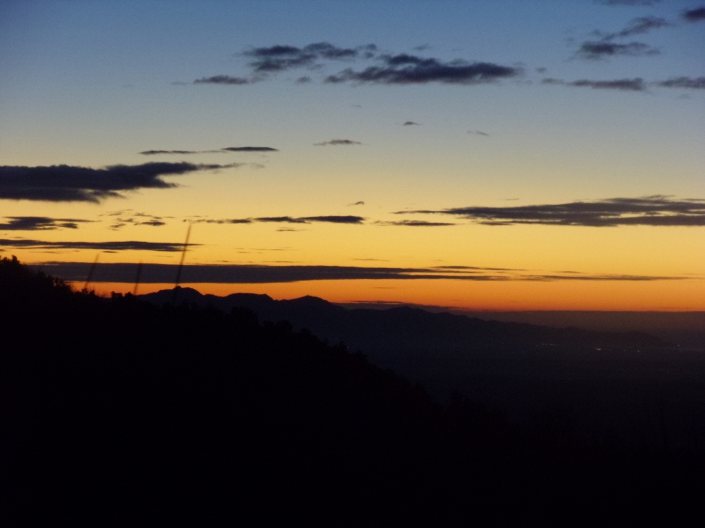
 I set off from Mallow for the long journey to Scotland, for a few days hillwalking. The travel is exhausting. A train to Dublin, followed by another to Belfast. A ferry to Stranraer, followed by a five hour wait for a train at 7am to Glasgow, followed by another train to Tyndrum. So, 22 hours after setting out from Mallow, I stepped off the station platform in Tyndrum, and into the By The Way Hostel. It is beautifully located in the little hamlet, nestled in the hills of Argyle. The reason I do this, is as I work for the railway, the travel is practically free. Anyway, unfortunately the hostel was fully booked for the weekend, so I was stuck with the tent. As the weather, was to say the least, uncooperative, even pitching the tent was an effort. Still, after I was settled in, I was restive after the confinement of travel, and decided to go for a run. I went through the adjacent forestry, and emerged on the road into Cononish. When I arrived at the farmyard, I turned right and ran up to the goldmine. Though it was pissin down, it was just what I needed, and when I turned back downhill, I was feeling strong and enjoying myself. I stayed on the track until I reached the West Highland Way, and I followed this back to the campsite. I went into the village and bought myself a few beers, had a bite of dinner, and settled down for the evening. All the travel and lack of sleep caught up with me, and I had to give up and go to sleep at eight pm. A long great sleep followed.

Sunday 30th,
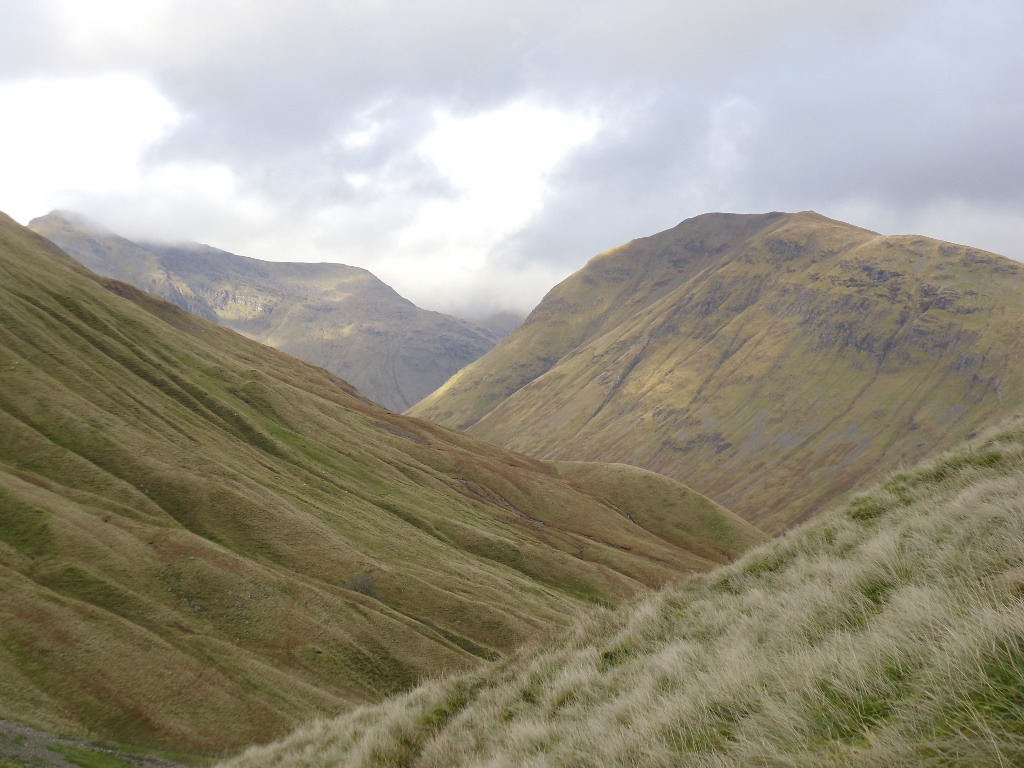
I awoke at 8am to a dull wet morning. I lay awhile and listened to the wind and rain, and contemplated staying where I was.  I hadn't come all this way to do nothing, so I groaned and groused my way up, and made ready for a day on the hills. I set Ben Lui as the target for the day, and after breakfast I set off once again foe Cononish. I was feeling very sorry for myself as I walked in. The view was limited to say the least, the wind strong, and the rain constant. All this, coupled with the memory of what the first time I came in here a year previous was like, only further dampened my spirits. It would not have taken much persuasion to make me turn about and head for home. Still, I persevered. Eventually I reached the end of the track, and the point where the climb starts only to find that the stream was in spate, and dodgy to cross. Not really being in the mood for a long detour to the bealach on the right, I turned instead for Beinn Chuirn, a Corbet which rose just to the north of the track, and would allow for a horseshoe walk (of sorts) back in the direction of Tyndrum.

There followed a steep 350meter slog before the gradient eased, and I headed for a subsidiary top. The cloud was after lifting so I didn't need any navigation aids to make my way over the bleak terrain. I turned and crossed the saddle, and climbed the easy slopes to the summit 880meters. A little cloud had come down, so I had to be a little careful to avoid the cliffs to the southeast as I made my way down the east side, and back to the track to Cononish. Now that I was actually doing something I felt much better, and my spirits were further raised, when I happened upon two startled stags, only about 50meters away, who seemed to stand and stare in disbelief at the intrusion. If only I hadn't forgotten my camera. Anyway, the rest of the walk passed without incident, and I was soon back at the campsite enjoying a beer and dry clothing. I finally felt that the holiday had begun.

Monday October 31st.
View northwest fron Coire an Dothaidh

Changing light


I know there is gold in the hills around here, but really||


I rose early, and caught the first train to the Bridge of Orchy. The plan for today was to climb Beinn Dorain and Beinn an Dothaidh. The route starts directly from the station platform, and follows a boggy path, gently up into Coire an Dothaidh and a bealach at 744mtrs. Last year, the weather here was fierce, and I had to retreat from just above the bealach, from storm force winds and horizontal blizzard conditions. Today, there was merely horizontal rain and strong winds to endure. The cloud was up at about 800mtrs, but it clung stubbornly to the summits. I opted for Beinn an Dothaidh first, as I would have the wind at my back on the way up. It is a gentle enough pull, and soon I was on the summit at 1004mtrs. The return to the bealach was less gentle, and I was battered by the full force of the wind and rain. Fortunately, on the way up Beinn Dorain, I was sheltered by the slope, and it was a pleasant enough walk to the summit at 1076mtrs. As there was nothing to be seen, I didn't tarry, and returned quickly to the bealach. I retraced my footsteps back to the train station, and here enjoyed a spot of lunch and contemplated my next move. So far, I had done 14 kilometres and about 1200mtrs of ascent, but I was feeling good. As the day was showing signs of improvement, I opted to return to Tyndrum via the West Highland Way, which meant a further 11 kilometres of a walk. This, I had also done last year, but today it was quite enjoyable, just to amble along and let my clothes dry a little.

Viaduct under Beinn a Chaisteil

Tuesday November 1st.
Tyndrum nestling in the valley


Towards Bienn Dorain
It had started raining as I returned to camp the previous evening, and it continued heavily right into the night. So, it was with some surprise and delight, that I awoke to a fine bright morning. This was my last day here on this trip, and I was catching the train home at 19.15 that evening. I decided that I would climb Beinn Odhar today. At 901mtrs it is another Corbet, and just a few meters short of Munroe status. I set off north once again along the West Highland Way. After a couple of kilometers, I turned right and went up the spur that descends gently all the way from the summit. It was great to be able to enjoy extensive views, but there was a distinct wintry nip in the air. The views from the summit were great and I savoured my time there. The eyes were constantly drawn south towards the hills of Crianlarich and Arrochar. All my previous misgivings were gone, and my mind was filled with possibilities for my next trip.
Towards Crianlarich

Gleann Achadh-innis Chailein. Wildcamp anyone?

Beautiful colour by Fillan river
 
The day was still young, so I decided to add another Corbet to my route. I turned from the summit and headed southeast towards Beinn Choarach, 818meters. This meant a big drop down to about 440mtrs, and a steep climb of over 350meters to the summit. From here, there is a great view to Beinn Challuim. I was really tempted to include this as well, but it would have meant another big drop and over six hundred meters of ascent, and I was worried that darkness would arrive before I was down. I headed instead for Auchtertyre Farm, and there, once again, joined the West Highland Way, and returned back to the campsite. The weather held good, and I was able to do all my packing in the dry. I once again settled down to wait for my transport. All in all, I was once again enthused by my trip, and I'm already planning for my return. Crianlarich next maybe, or perhaps the fleshpots of Fort William, who knows.

Monday 7 November 2011

Valentia Half Marathon

My chronology is gone to pot. How could I have forgotten about the Valentia half marathon. I headed down on Friday 30th of August in order to make a weekend of it. I camped at the lovely Mannix Point campsite in Caherciveen and enjoyed a stunning sunset. The weather forecast for the following day looked good and I settled down for a good nights sleep. A nice leisurely start on Saturday morn was in order and I made my way around to Valentia Island in good time for the midday start. I registered and collected my T-shirt and ambled around for a while and soaked up the athmosphere. The start was in Knightstown on the eastern tip of the island and the route circled the island with an out and back section to the abandoned slate quarries. I was a bit apprehensive as this was my first real road half marathon but still fairly confident that I could finish it.

Soon enough the start time arrived and we were off. It was lovely to run through the village to the strains of a pipe band. The Valentia Triathlon Club pulled out all the stops to make an occassion of it. The first couple of miles up to the quarry was up hill so I was careful not to go off too fast. After rounding the mark in the quarry we turned downhill and as I was feeling good I upped the pace considerably. Thereafter the course was more level and I was able to maintain a good pace. It is a beautiful circuit and the views were a constant distraction to the efforts of the run. Gradually the miles passed and I became confident that I could not only finish but maintain a good pace. The last couple of miles was along the seashore and I admit I found them quite tough. I was very gald when the line came in sight and far from a sprint finish it gave me all I could do to keep up the pace. I finished in just over 96 minutes and finished in 32nd overall, I was delighted. There was a fine selection of sandwiches and really good coffee on offer at the nearby hotel and this finished off the afternoon nicely.


As the day was still young I headed to the far end of island and enjoyed a short walk out to Bray Head. This proved to be a really enjoyable excursion and was the perfect warmdown. The views in all directions were spectacular and the cliffs steep and dramatic. The weather however was showing signs of deteriorating and the first drops of rain arrived as I got back to the car. I had taken my bike with me with the intention of having a good coastal cycle on Sunday morning but unfortunately there was a dense fog about as well as rain so I returned home instead. Still I was really happy with the whole experience and I hope to return to the area soon.

Friday 4 November 2011

Killarney Adventure Race

I entered the Killarney Adventure Race on Saturday October 8th. This was my second such event and I was really looking forward to it. I was very familiar with the course as the cycle was over some of the route that the Killarney mountaineering club went when they did the Gap Triathlon.  The course was a run up Srickeen Hill (6.5 kilometers and 400mtrs climb) followed by a 35 k cycle with two good hills, then  run followed by 1.5k on the kayak and an 18k run up and down Mangerton mountain with a short sprint on the bike back to the finish in the grounds of Muckross House. A total of about 60 kilometers so it promised to be a tough outing.

I was in the third wave off and this meant that I could enjoy a full Irish at the B&B at 8am and still have two hours before the start. We were bussed from Muckross to the start at Kate Kearneys cottage. Soon we were off. The track up Strikeen was really turning to muck by the time we went up it. I set a steady pace and managed to keep running most of the way to the summit. The weather was a little misty and breezy but not too bad. Conditions underfoot for the descent were treacherous and I resolved to be careful but still despite my best efforts I took a tumble not long after starting down. I managed to give my left knee a good bang and I was sore and  limping for a while. Soon it loosened out again and after a stop to wash off some of the mud and the blood I was moving well as I got back to the transition area and started the bike section.

I passed a fair few on the initial section through the Gap but at the tough climb a Turnpike rock I dismounted for the steepest section. This was half by design and necessity but afterwards I was glad not to have bollixed the legs too much. The decent into the Black Valley from the head of the Gap was treacherous to say the least and I was super careful all the way down to the valley floor. Near the top I passed an accident which had the ambulance in attendance. I later learned that it was feared that the guy was paralyzed. As I said conditions were treacherous. Along the valley floor I pushed a good gear and another guy joined with me and we took turns at the front. When we hit the climb to Molls Gap I found that I couldn't live with him any longer and he gradually pulled away. Still he gave me a target to follow and I overtook many in the effort to keep him in sight. The descent and cycle to the carpark for Torc waterfall was exhilarating and enjoyable. Here I changed back into my running shoes and turned for Muckross lake and the Kayak section.

After the bike it felt a little strange to be running again but it was all part of the experience. About one kilometer later I arrived at the lake where I was given a flotation device and a partner and we walked into the lake with our Kayak. It was comical to watch a crew in front trying to get mobile after sitting into the Kayak too early and being stuck fast to the bottom. We set off at a nice pace and with neither of us being experienced it felt good to be able to steer a straight line and maintain a good rhythm. The course rounded a large rock before heading off at an angle for a bhoy and back to the starting point. Here we said our goodbyes and I set off at a steady jog back in the direction of Torc carpark again.

Now came the best bit of the day, the 18 kilometer climb of Mangerton. The access to the mountain from Torc follows forestry trails for a good distance before you emerge at the tourist route up the mountain. Previous efforts at running up Mangerton have started here and I have found myself able to stay running for perhaps a little more than half the way up. Now however, at this stage of the event the legs were not that strong and I had to walk more than not. Progress was still faster than most others. I was surprised to arrive at the summit check in , not at the top but at the lake about 100 meters below the plateau. This was because the top was swathed in cloud and I guess the organisers feared that people would lose their way. Now I was in my element and I really enjoyed the run back down the mountain. The knees were holding up well and I was able to pass many. At the forestry trail section I managed to maintain a jog for nearly all of it and soon I was descending the steps back to the carpark. A quick change of footwear and the short 4k on the bike back to the finish line soon passed. I parked the bike and trotted the final few meters through the finish line, really tired but very happy that I had given it my all. I entered the tent and collected my times print off. 5 hours and 3 minutes. I was gobsmacked and delighted to discover that I was in 22nd place overall. Roll on next year.

Monday 24 October 2011

The Achill Roar.


The view fron my tent towards Keel
A couple of days after we came back from the UK I headed up to one of my favourite places in Ireland, Achill Island. It is the largest island in Ireland and has an amazing range of terrain. It sports three seperate mountains and along with amazing coastal scenery it sports the highest sea cliffs in Europe. So off I went intending to make a weekend of it on Friday afternoon September 9th. Unfortunately the weather forecast was poor and we were expected to get the tail end of a hurricane over the weekend. Still I was looking forward to the experience. The drive was a bit of a chore and took all of 5 hours, so I was really glad to finally cross the bridge at Achill Sound at 6.30pm that evening. I was in two minds what to do about camping and after registration I drove up to Lough Acorrymore under Croachaun and found a grand spot to wild camp. This was my first time using the North Face VE25 tent I bought from a guy in London. As this is a super tough 4season tent I wasn't too worried about whatever the weather brought but it's waterproofness would surely be put to the test.


After I got the tent up (and it takes a bit of practice), I enjoyed a pleasent dinner and retired inside for the night. Shortly thereafter the promised bad weather arrived and the strengthening wind was accompanied by fierce showers. Thankfully the tent was well up to the task and only a few drips were in evidence which didn't threaten to get into the inner. So I relaxed and enjoyed a good read and I awoke refreshed and ready to go the next morning. There was a strong wind blowing but thankfully the showers were few. Unfortunately one of them chose to appear just when I had the flysheet removed and was dismantling the tent. Things got a bit wet then but hey ho. I had plenty of time and I slowly made my way down to the starting point. There were lots of other competitors about and to my eye they were nearly all younger than me and sported the physiques of finely tuned athletes. I on the other hand had been indulging in cream teas and much more over the previous week and sported the results you would expect from a self indulgent middle aged man. My confidence was low but I was determined to have a go. There was a choice of two courses, one long, (2K on a kayak, 15K hill run and 45K cycle) and another about 40% shorter. I of course was entered for the longer one. As I went in for the pre race briefing I learned that the Kayak stage had been cancelled due to the winds and the mountain run altered to remove one section that was along a cliff edge.

There was a festive athmosphere about and I was soon relaxing a little. When the first wave of a hundred competitors was sent away I watched as they ran along over two kilometers on the beach before reaching the high ground on Menawn mountain, Soon our time came about and after a big choreographed roar we were off. I set off at a nice steady pace and was thankful to find that the sand was firm and so was much easier to run over. Of course many took off like they were being chased by a pack of rabid dogs but most of these soon slowed and I found myself gradually overtaking a few. Then we hit the boggy mountainside and all running stopped and I just walked as quickly as I could. It was tough going but I fared at least as well as most and I was pleased with my progress as I rounded the summit checkpoint and turned downhill. I made a real effort to run fast downhill as the terrain was not rocky and was nearly all heather and bog. This I was very familiar with so I went for it. I was going great guns (for me) and I passed a fair few. The only problem was near the bottom I started to really cramp up in my bottom. This was a first for me and for a couple of hundred meters I wondered if I would have to stop. Mercifully things eased out and by the time I was on the beach again all was good. I was mighty relieved, as I wouldn't like to have to have given Butt cramps as the reason I had to stop. Eventually, after taking a tumble over the only stone to be found on the entire beach, I was leaving the sand and entering the transition area and setting off on the bike.

Soon I was out on the road and pedalling hard in the direction of Achill Sound. I thought I was going well until I was passed by several groups who quickly left me well behind. It was frustrating and I redoubled my efforts but soon sense prevailed when the route changed direction and we passed through open boggy expanses and found we were heading straight into the wind. I won't describe every torturous turn of the wheel but suffice to say it was tough. There was of course the wonderful section that was with the wind along the scenic Atlantic Drive but the sting in the tail when the last 5 kilometers was straight back into the wind made me ever so glad to reach the finish. Overall I finished in 77th place and I was well happy. As the weather was to disimprove further I made the decision the return home that afternoon. I am already looking forward to returning next year.
 

Tuesday 4 October 2011

Pen Y Fan and the Cotswolds

Great hothouse

Margaret and I set off for a break to the Cotswolds on Saturday September £rd for a five day trip to see some of the best gardens in the UK. We traveled over on the Fastnet Line ferry from Cork to Swansea which gives one the best chance of getting the most of a limited timeframe as it crosses overnight. A comfortable sleep saw us arrive in Swansea at 8am on the Sunday morning and after an awful breakfast in a motorway services dump we headed to the botanic garden of Wales about twenty miles away. This proved to be an inspired choice and we were absolutely delighted and surprised by its scale, grandeur and quality. We had intended it only as a stopgap to fill in the morning and had planned to visit another garden in the afternoon but such was the variety and interest to be enjoyed that we spent nearly five happy hours exploring. It is a marvelous facility and something  which Wales should be very proud of.

Giant glasshouse.

It was now too late to visit the other garden so we decided to go for a drive up and through the Brecon Beacons. The road was quite busy and very twisty and we had the misfortune of getting caught behind a horsebox which slowed our progress for a full tweny miles or more. Still despite the delay I decided to round off the day by going for a run up Pen y Fan. We headed on down the A470 and parked at the Storey Arms car park. I changed and headed up the well made track. It is a fairly gentle route and I managed to run the most of the way up. There is a nice little downhill section before the steep final push to the summit of Corn Du 873mtrs. From here it is only about 600mtrs to the summit of Pen y Fan, at 886mtrs the highest summit in south Wales. It is a nice mountain with some nice steep ground on its northern side but overall the impression I got of the range is that it is very tame and managed ground. There is a uniformity to the ground cover that almost looks like a lawn or grass carpet covering everything. Anyway after the ferry crossing and the walk around the garden it was great to have the freedom of the hills for a while and I arrived back at the car invigourated and refreshed. From here we headed to Gloucester and our hotel, all in all a grand day.


The next few days were mostly taken up with the usual touristy things but the one thing I was really impressed by was the network of public paths that criss cross the countryside and link up the villages. What a wonderful facility these are and I took great delight in going for a couple of runs on them. It was great to enjoy the openness of the countryside and be able to avoid the roads. If the same was available here I would seldon run on the roads The Cotswolds is a beautiful area and one village after another is like a picture postcard. It is a triumph of planning and good taste. I was also very impressed by Stratford upon Avon. The town center has a great range of old beautifully preserved buildings and is mostly pedestrianised therefore is easy to get around. To finish the trip off we went to visit Prince Charles at his country estate in Highgrove. He didn't greet us in person but we did have a great tour around his garden. A visit to the nearby Westonbirt Arbouretum polished off the trip and a painless journey on the M4 back to Swansea and our ferry.

Thursday 1 September 2011

Mount Brandon Bivvy

From Brandon Head towards Benoskee
On Monday I decided on a whim to head for my favourite mountain massif in Ireland and pointed the car for Mount Brandon. In recent days for some reason I had been a bit down and was lethargic and  unenthusiastic about the outdoors. Even on the road back I was doubting my decision and I was not really looking forward to the trip. As the weather was set fair I had decided to pack the bivvy bag and food for a day and make an over-nighter of it. In keeping with my mood I actually didn't arrive in Cloghane until 13.30. I intended to traverse the full ridge so that meant that a 5mile road walk was needed to get to Brandon Head from where the walk proper would start. Now road walks are not something that I generally enjoy but this time on this day in this place it was magic. The narrow lanes were a riot of colour. Fuschia, montbretia, meadowsweet and much more were carpeting the hedgerows. This, coupled with the glorious views and clear blue skies was just what the doctor ordered and I found that I was enjoying myself immensely. As I neared Brandon head I was delighted to see a pod of common Dolphins moving along just offshore. This was just wonderful to see and raised the already great spirits even more.
Dolphins down below
Rocky shore and blue skies


The beautiful An Sas

After a nice rest looking down at the Dolphins I left the road behind and headed on to the open mountain and headed in the direction of An Sas. This was still about 5K away and on the was I followed a stream down an glen to the rocky cliffs below. This meant that I lost an unnecessary 200mtrs of height but I was determined to approach this trip in a leisurely fashion and the beauty of the blue sea crashing onto the shore more than made up for it. I continued up the ridge, keeping the sea in view the whole way. Eventually I reached the wonderful amphitheatre that is An Sas. This sunken Coum is a two thirds circle that sweeps over a thousand feet down to the sea. It never fails to inspire and I felf I made the right decision to stop and have a bite to eat here. So rested and refreshed I gloried in the airy walk around the cliff edge and headed down to the col under Masatiompan. I wasn't looking forward to the 450meter slog to the summit but on this day nothing was going to spoil the mood. Eventually I gained the rounded summit and now the vista changed again. As well as the georgous views to the north and east I could now gaze down to the magnificent panorama that streatches from Slea Head and the Blasket Islands away south over the Iveragh Peninsula and beyond.

Slea Head and the Blasket Islands

Sunset


Sunset
 It was now after six in the evening and was time to search for my home for the night. I chose the nearby Parias Mor as there was a trickle of water to be found about 100mtrs away and the view from there wasn't bad either. I really enjoyed my dinner and wasn't bothered too much by the midges. My biggest problem was deciding where to look and I was constantly turning to enjoy the varied vistas. After grub I settled down to enjoy the stunning sunset and it didn't dissappoint. All too soon it was time for bed. I had left my sleeping bag at home but was fairly confident that with my belay jacket I would be warm enough. It was a mistake. As darkness engulfed me and I was confined in the bivvy bag it grew colder and colder. Eventually after midnight I put on my hard shell and put my boots on as well. This helped a little but the chill ensured that I didn't get any sleep. Still there were compensations. When I turned to one side the few lights that sprinkled the Ballyferriter area and the faint lights from trawlers at sea were to be seen. On the other side the lights of Tralee and the other nearby towns reminded one that civilisation was not far away. Straight above the sky was a carpet of stars. Still eventually the night passed and I rose to a perfect dawn.


Dawn over Tralee Bay
Rosy glow on Mount Brandon
I didn't tarry as I was anxious to get going and warm up so I was packed up and on the move at 06.30. Soon the light show that was the sun rising over tralee bay was inspiring the soul and as I approached Mount Brandon its east face was bathed in a rosy glow. I was now warm and moving well. No aches and pains were in evidence after yesterdays exertions and it felt great to be out on the mountain and have the whole place to myself. I was now on familiar ground and the ridge passed in comfortable relaxation. After Brandon Peak the nature of the terrain changes again to a series of broad boggy saddles. Easy ground allowed the eyes to constantly scan the views and good progress was made. Another bite to eat was required around 10.30 and I was ready to push on across the Conair Pass. From here I went up Slieveanea. Down steeply to the rough ground above Coumanare and up to the sharp little peak of Slievenalecka. From here there is a short steep drop to a broad ridge and then down to Lock an Duin and enjoyed the views of the impressive waterfall under Slievenagower. A pleasent stroll along a good trail and another three kilometers on the road saw me back at the car. I was tired but well happy with the experience and most of all re-invigourated about the outdoors.


Fabulous and complex Barndon

Slievenalecka

Lock an Duin
 Day 1; 16K and 1100mtrs and Day2; 23K and 1200mtrs.