I have long held the ambition, of doing a five or six day hike from Millstreet (not too far from my home), to the sea at the western end of the Iveragh Peninsula and crossing over the mountain tops en-route. I didn't have the required time at my disposal, this time, to finish the route, but I had the most of four days, so I resolved to start on Friday afternoon, and just see how far I would get. I was being picked up by Margaret on Monday afternoon and we were commencing a holiday in the delightful village of Sneem.
The forecast was pretty good as well so I was really looking forward to the trip.
Friday September 13th;
 |
| Starting up the wooded slopes of Claragh |
I had all my packing already done, so it was simply a case of leaving work and going home to collect my bag, before Margaret drove me to Millstreet, where I could start my hike. It was 15.25 when I left the car, so I had only about four hours of trekking time before I would have to fine a spot for my tent for night one. My plan was simple, climb Claragh mountain, before then heading to Caherbarna, and just see how far I would get. Now, at just 452 metres, Claragh isn't too demanding, and indeed it is one of my favourite trails to run, but with a rucksack fully laden with my camping equipment, food etc, running wasn't in the plan today. It was a beautiful weather day. Blue skies, warm sunshine and not a puff of wind, made for very very pleasant hiking. After walking up the shady wooded lane at the start, I turned into the forest track that leads to the open mountain. After a level traverse there is a stiff climb to reach the summit. It doesn't last too long, and soon I was enjoying the wide expansive views. The agricultural land stretched away to the north, east, and west. I could also see the continuance of the walk and the broad ridge that curved away towards Caherbarna. It didn't look too far, but previous experience told me that appearances can be deceptive, and I knew that there was a good distance to cover to reach it. So, with time being in short supply, I wasted no time in setting off on the next leg of the trek.
 |
| Slopes to Claragh summit |
 |
| Millstreet |
A couple of kilometres of easy walking follows, before you cross a little road, and start to climb up towards Curracahill. Once on the flat top, the problems of the next section become apparent. While from a distance, it seems that you can take a direct line towards the higher top of Gortaveghy, once you reach this point, it is clear that you have to do a wide traverse around a deep wild glen, and this traverse crosses wet trackless bog that is no bargain. It isn't too bad though, and once you reach the slopes that stretch up to Gortaveghy, the going becomes easier underfoot. The giant wind turbines that cover the expanse of bog and forestry to the south, were completely still in the windless evening, and they stood like silent sentinels from "War of the Worlds". I was totally enjoying the whole experience. It felt great to be on another mini adventure. Once back on the crest of the ridge, it is easy going to reach Caherbarna. I was pleased with my progress, and I was now confident I would reach a camping spot I used several years before, which nestles in the boggy pass between Caherbarna NW Top and Knocknabro NE Top. This tiny patch of short dry grass, beside a stream, was a fortunate find at that time, as everything all around is super rough and wet and really unsuitable for the tent. I found my spot and dropped my bag at 19.35 so it had taken almost exactly four hours. I was well content with the first day's effort.
 |
| Towards Caherbarna from Claragh |
 |
| Not producing much power today |
 |
| Looking west not long before my first camp |
Day 1--4 hours--14 kilometres--827 metres up--494 down.
Saturday September 14th;
 |
| About the only little spot for a tent for a fair way around. Leaving no trace |
 |
| The giant TV mast on Mullaghanish |
The weather forecast for today was for a sunny, warm, calm day, and it certainly was a lovely morning to emerge into. I enjoyed a midge free breakfast, and I was on the move once again just before 8am. A gentle rise up and over the broad boggy slopes of Knocknabro NE top, and the main summit followed. The views across the deep gap the glory of The Paps was lovely, and the vista to the west was also a delight. The Reeks stood guard beyond Killarney and Lough Leane, and Mangerton's broad summit plateau resembled a sleeping whale. I have, in the past, descended into the gap, by heading towards the lake in the valley. This had quite a bit of long heather and bouldery ground, (not my favourite), so this morning, I took a line more to the left towards some forestry. This proved much better, except for the final fifty metres or so, which was quite rough. It was calm and warm down in the gap, and I was certainly warm as I climbed up the steep, near 400 metre climb to the summit of the East Pap. Finally I reached the summit and enjoyed the wonderful views to the west, but only after I had put on my jacket, as up here the wind was strong and carried a chill. I continued on over the West Pap, and then set off in a direct line west towards the semi hidden glen, that contained a road that led to near the village of Glenflesk. This was across nearly six kilometres of mostly pathless, rough wet bog, that at times made for challenging progress, but eventually, I reached some grassy paddocks and then reached the lane. This was a delight, as in gently descended through shady hazel woods, in which a tumbling stream provided soothing music. Once I reached the main road, I had to walk about 600 metres to reach the village, but this is quite safe, as there is a hard shoulder all the way, so no traffic comes too near.
 |
| A nice morning for it |
 |
| The giant cairn of the East Pap |
 |
| Straight on to Glenflesk with Crohane and Mangerton beyond |
Once I reached the village, (just a crossroads with a church and shop really), I enjoyed a bite to eat and some coffee before setting off on the next leg of the trip. This had been presenting me with some anxiety, as there is no normal route to the summit of Crohane from here. I asked in the shop about access to the mountain, but they didn't know, so I just winged it. I walked a further 100 metres along the road, crossed a couple of grassy fields, before going through a fenced ditch. Now I was entering open boggy ground once again. I had seen from afar, a track rising up through the expansive bracken that covered the slopes, and I aimed for this, and things worked out beautifully. I was able to easily reach the broad spur that leads all the way to the 650 metre summit. As I rose higher, the rough valley to the left, was wild and beautiful, and it was lovely to get a good look at another facet of this beautiful mountain. It was a near 600 metre climb to the summit, but I felt good, and after enjoying the airy views, I set off towards Bennaunmore and the Capagh Glen. A nice downward traverse around to Crohane SW Top, before a steep 200 metre descent to the narrow gap on the north side of Lough Nabroda. Next comes the steep 200 metre climb, up the shallow gully that leads up to near the summit of Bennaunmore. This is a real leg burner, but once you reach the delightful summit, then the effort is well worth it. This wild spot is a great eerie, with views over Lough Guitane and beyond, and below lies the wonderful Cappagh Glen. The descent to the glen isn't long but it does descend some rough ground, particularly near the bottom. As I descended, I contemplated whether I would camp in the glen or continue on up towards Stoompa, for perhaps another hour. It was still just 1600 and there was plenty of daylight left and I was feeling pretty good. However when I reached the glen, I immediately spotted a camping spot of such quality, that I just couldn't pass it by. A level, dry, green oasis, alongside a stream that was sheltered from any breeze, yet enjoyed full sunshine, was the stuff of dreams so I immediately dropped my bag. To make things even better, it was practically midge free, so I was able to sit in peace in the sun, right into the evening, and simply enjoy the peace and joy of this special place. Later I had visits from deer and owls, and I have to say it was one of the best wild camps I have ever enjoyed.
 |
| The way up Crohane |
 |
| The Reeks looking wonderful |
 |
| The way ahead..down left to hump on centre left..down and up gully on Bennaunmore..Capagh Glen beyond |
 |
| Lough Nabroda |
 |
| Basalt columns on Bennaunmore |
 |
| Looking down into the glen |
 |
| It really doesn't get much better |
Day 2--8 hours 20 mins--20 Kilometres--1565 metres up--1855 metres down
Sunday September 15th;
After a peaceful night I emerged to a still humid morning. The weather was to change a bit today, with cloud forecast, and the possibility of light rain. I could already see that some low mist drifted on the higher slopes, and the air held the promise of rain. I should qualify the stillness claim, by adding that the midges, that were absent yesterday, were back in force, and lets just say I regret emerging from my tent without the protection of a full set of clothes😳. The buggers were abundant and in biting form, and breakfast and packing were done indoors.
I was on the move by 7.45 and setting off up towards the wooded glen that rose to the open ground higher up. The first rays of sunshine were hitting the mist tendrils, and mini rainbows decorated the edges. It was, at times, magical. Today promised to be a challenging day. I was heading for Molls Gap, and I was under no illusions as to the difficulty of the ground that had to be covered. A fair few years ago, I walked from Mangerton to Molls Gap with Killarney Mountaineering Club, and was impressed by the wild and rugged nature of the ground. I remember at the time noting that it would be very difficult to navigate in bad conditions. I was looking forward to the challenge. The weather, I felt, could go either way. The drifting patches of misty cloud could coalesce into a cloud base, or as I hoped, gradually burn off once the sun hit them. I was enjoying myself for now, and to be fair, once I was enveloped in the mist on the open mountain slopes, things took on a mystical quality and this I really enjoyed. Once I neared Stoompa I once again emerged into the clear, and from there to the higher slopes above the Horses Glen, I was able to enjoy those beautiful views. Unfortunately once I neared the summit of Mangerton I was once again in the cloud. Then it was a case of map and compass out, and taking a bearing, to ensure I set off in the correct direction.
 |
| Looking out the glen |
 |
| There is moisture in the mist |
 |
| Leaving the glen |
 |
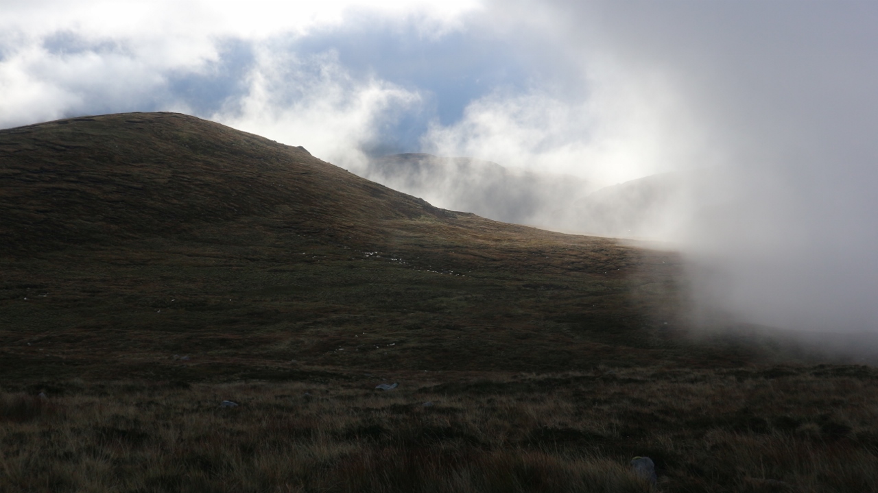
| Maybe it might actually clear up ??...ah no Ted |
It had taken me 3 hours to reach the summit of Mangerton, and I knew that it would still take a fair old while to cover the remaining kilometres to Molls Gap, but I wasn't too worried, as I had all I needed on my back. Wet, trackless, but easy bog, was the norm for the next couple of kilometres, until I finally re-emerged under the mist. It seemed easiest to continue towards the small lake ahead, but when the mist lifted a little bit higher, I could see I was a few hundred metres away from the ridge line, so I turned and returned to the crest. I could briefly see the ground ahead, as I was just at the level of the cloud base...drifting in and out of the haze. It made the jumble of hill, bog, and many little lakes, look lovely and interesting. Alas, that was the end of any views I had, and the clouds got denser and dropped lower. For the rest of the day I was enveloped in the mist. As I alluded to, the ground ahead, is a complex mix of lake, bog, rock and peaks, and on a good day is a challenge. In the mist, it offers a very difficult navigational and route finding challenge, and it is fair to say, I was fully absorbed for the next (almost) seven hours.
Yes I did say seven hours, as that is how long it took me to reach my camping spot for the night...and that was still short of Molls Gap. I made some errors in navigation, and sometimes, I endured crossing horrendous ground, in the effort of trying to regain, or stay, on roughly the correct course. In the mist, drops can look long and severe and so can the ascents. They usually aren't as long as they first seem, but the steepness is still to be respected. Several times I reached a summit, and no obvious descent route could be seen. A compass bearing would head to a severe drop, but a search usually found a way, but then it becomes more difficult to return to the correct route. Lakes were usually the best markers en route, but they were not always easy to see, and they could be hidden by ribs of rock, and be just a few metres away. From the top of Knockrower there was a semi respite from the route finding, as I could take a more or less direct line towards Coumeenslaun Lake, but no respite was to be found in the roughness and wetness of the ground. It wasn't until I was down by the lake that I was under the cloud, but all I could see was the lake and the steep ground rising beyond, that led to Knockanaguish.
Back up in the mist, this mountain presented a seemingly impregnable buttress, but as I reached the buttress, I could see a possible way to to top up a steep, narrow, vegetated ramp. I decided to give this a go. Almost immediately it presented more difficulty than first appeared, as the ramp itself sloped downwards, steeply, at the narrowest points. I pushed on, but at about two thirds the way up I reached a notch, hidden from below, which had a ten foot drop beyond with a climb on the other side. This presented a step too far for me, so I reluctantly turned, and gingerly retreated to the base of the buttress. I looked on the right hand side of the crag, and lo and behold, a simple way to the top was found. It was stuff like this that ate up the time. Another drop saw me reach the "Windy Gap" where the Old Kenmare Road crosses the route, before another straightforward climb saw me reach Peakeen. Once again, the route finding problems presented themselves, but finally I reached Eirk Lough, which sits under the final peak before the Gap. I had thought (hoped) I might mind somewhere by the lake to camp, but that notion was quickly dashed, as it was clear that the water was completely surrounded by extremely boggy, rough grassy ground, that indeed presented difficulties in reaching the waters edge so that I could fill up my water bottles. Now, fully laden with enough water for the rest of the night, I resolved to pitch my tent at the first available opportunity. Thankfully I found a rough but flat spot just after the summit of Derrygarrif which sufficed, and I wasted no time in getting my home up for the night. It was after 6pm. I was able to store my sodden gear in the tent, (the mist often turned to drizzle and wading through waist high wet vegetation left little dry,) and once changed, I was soon getting dinner on the go. I was as tired mentally as physically and it felt great to finally relax. It had been a full on day.
 |
| Approaching the rough stuff |
 |
| Camping spot for night 3...These 3 pics are the sum total of what was taken for last seven hours |
Day 3--10 hours 20 minutes--24 kilometres+--1800 metres up--1500 metres down.
Monday September 16th;
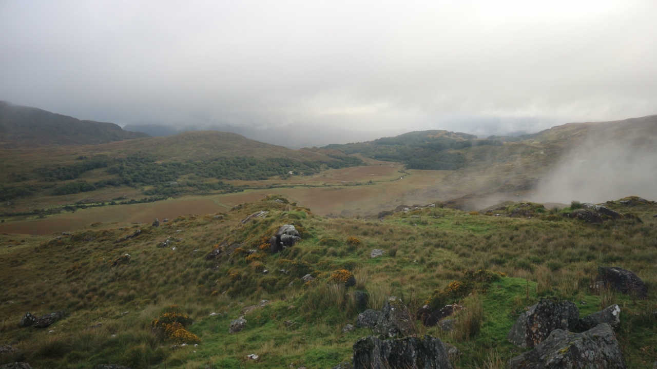
The morning came slowly, and with it, it brought more cloud and mist. It was calm, the rain had stopped, and the forecast promised improving conditions in the afternoon. Despite the gloomy conditions, I was not downbeat, as today, Margaret was meeting me on the Sneem road, and we were commencing a five day break in the excellent Sneem Hotel and apartments. I was really looking forward to a power shower, fine food, and a cool beer. I knew that the distance I would be able to travel, in the time available to me, was limited, so I enjoyed a leisurely start, and it was nearly 9am before I was on the move. Mist blanketed everything, but it was fairly straightforward to reach the road..or so I had hoped. I descended to the left a little too early, and I found myself going down a 45 degree grassy gully, where I managed to slip and have a rather rapid fall. The slick grass meant I immediately started to gain speed, but thankfully, a rock intervened early enough to stop me, and my rucksack took the force. Chastened, and a bit pissed off, I reached the road not long after, and even down here, I was still in the clag. I opted to walk along the road as far as Barfinihy Lake, from where I could climb my next peak Boughil. As I passed Molls Gap, I exited the fog, and misty views into the valley on the right, and fleeting glimpses of the slopes ahead, gave me hope that the better weather might just be arriving.
 |
| Finally some views..into the Black Valley |
 |
| Towards Boughil |

Normally when I climb Boughil, I do so via the steep gully in the face of the slopes behind the lake, but this morning, I chose to climb the more gentle northeast spur, which leads directly to the summit. After the very testing conditions of yesterday, this proved to be a very simple and enjoyable climb. All the more so, as the cloud was inclined to disperse more and more as I rose. Once I reached the top I was even able to see the route ahead to the next top, Cnoc na gCapall. The going is again easy and this was just the ticket after yesterday. After this the clearances became longer, and soon I had to "endure" some warm sunshine. It was a pure, uplifting, delight. Next up came Bascadh and more easy walking across to the the west top, before descending into the valley under Knocklomena. Now I had a choice to make. I could walk from here down to the road, and the rendezvous point with Margaret, or I could rush, and try to climb Knocklomena, and descend from there. I was was feeling strong, and frankly, could have kept going for hours yet, but I reckoned that things would have been very tight, time wise. As the day was now so good, I opted instead to have a dip in the beautiful Lough Fadda, that nestled under the steep flanks of Knocklomena. The water was certainly bracing, but it felt great after four days on the trail. It was then a simple thing to descent, along first, a rough farm track, and then a quiet country lane, to reach the road. The next several days promised warm sun and an Indian summer and this proved to be the case...Life is good.


 |
| There are few things more uplifting than when the mists clear |
 |
| Looks inviting no? |
Day 4--5 hours--14 kilometres--650 metres up--1100 metres down.
It had been a great wee adventure. Over the four days, I hadn't seen another person while on the mountains. I hadn't had the time to complete the journey as far as the sea, but I now feel confident, that if I had five full days, I would be able to complete the full traverse. It would make, I believe, one of the finest multi day outings in these islands. Variations could be done in the middle by heading to the Reeks from Mangerton instead of Molls Gap, and towards the end, you could opt to head towards Glenbeigh or Waterville. Whichever was is chosen, a superb quality outing would be guaranteed.


3 comments:
What a fabulous read and incredible pictures.
I enjoyed this so much and feel quiet envious of your adventure. Thanks for sharing.
I hope you do get to do the 5 day hike next time, without the fall down the hill :) and I look forward to reading about that adventure too!
Thanks for the reply. Much appreciated. I'm looking forward to finishing the journey sometime
Thank you for sharing Stephen, it was lovely to read and has me wanting to do it. I've never stayed a night on the mountains but it's on the bucket list:)
Best of luck next time out to get it all in
Post a Comment