
The Beara Peninsula is fairly remote. At least it certainly feels that way when it takes a train trip to Cork City followed by over two and a half hours on the bus to get to the start of my route at Adrigole. I had recently been driving in the area during a trip to Sneem and even though the weather that day was poor I was struck once again by the glorious savage scene that is Hungry Hill and I was determined to visit it in the not too distant future. Well that future day had arrived and as I alighted from the bus I had planned a three day round trip in the area that would start with Hungry Hill, before camping up high and going over the wonderful Coumeengeera Horseshoe, another camp, and then finishing with a trek on the Caha Mountains to the east of Adrigole. Well that was the plan but an iffy weather forecast had me doubting myself and when I arrived it appeared that the forecast was seemingly overly optimistic, as the cloud was down at just 200mtrs and heavy drizzle was accompanied by strong winds. Oh dear😟.
Saturday January 27th;
 |
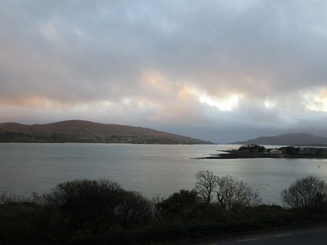
| With the cloud down this low there didn't seem any point in going high |
Who's bright idea was it to go camping in bloody January??. Walking in the little lane from Reen bridge I was asking myself why I was putting myself through this as I could have been at home relaxing and looking forward to a lovely dinner and drinks in front of the cozy fire that night. Instead I was carrying food for a few days and was going to try out my new Vango Force 10 Helium 2 tent. Even as I went along the lane the wind was strong and I was left in no doubt that anywhere up high it would have been quite viscous. Finding anywhere to pitch a tent on the mountainside would be quite a challenge if not impossible. As I walked in towards the mountain I could only just make out the waterfall and the big rocky buttresses of Hungry Hill itself were covered in the mist. I had never been on this side of the mountain and it seemed such a waste to have come all this way and not actually get to see it at all. It was around then I noticed the Beara Way posts on the roadside as I walked. I had a little lightbulb moment and it suddenly seemed like a much better idea to instead follow this trail and see what it offered and that is what I decided to do.
 |
| Slippery when wet..yes indeed |
 |
| Park Lough |
On my torn and tattered old map the Beara Way is shown to follow a track close to the main road but it seems to have been re-routed along this lane. Just before the farm at the roads' end a stile offers access to the open mountainside and the trail climbs up the southeast spur of Hungry Hill. Completely sodden boggy ground coupled with the buffeting wind made for tough going and I was even more pleased to have made the decision to forsake the summits. The trail climbs to the 280mtr contour as it crests the spur where it reaches a green road that makes for easier going as it contours around the spur for the next 1.5 kilometres. You then leave the road and continue to contour around the hillside on a rough, boggy, rocky trail that twists and turns as it finds a way through the rough ground. Finally the trail loses 100mtrs in height as it drops down to the small curiously named Park Lough. The drop to the lake took some caution as the almost bare waterlogged ground was at times as slick as ice and despite taking my time the inevitable happened a couple of times 😅. It was a relief to once again reach a green road that contoured around the southwestern spur of Hungry Hill and entered deep into the wild Coumnagappul Glen.
One of the misgivings I had about doing this route was that it would be a tame walk often on tarred surfaces and that it wouldn't offer that feeling of being in the wild, how wrong I was. So far I had found all the "wildness" I could wish for and I found myself relishing the whole experience (even the weather).
 |
| The view from my B&B..not too shabby |
At the back of the glen the trail crosses the river over a footbridge and rather surprisingly in such wet surroundings, several good spots to pitch a tent can be found near the river (one for future reference methinks). By now the green road is no more and the trail rises and falls as it cuts across the Rossmackowen commons. Another brief visit to a green road and then more bog is crossed until after another footbridge you reach a bog road. This is followed for a few kilometres before another bog-trot then another green road, well you get the picture. Suffice to say that all this was done up in the mist and it had all the wildness I could wish for. Eventually I left the slopes of Maulin and started to drop down towards the fishing town of Castletownbere. It was a relief to finally enter the bustling town 5 hours after starting out and I'd covered about 23 kilometres. Lets just say that the coffee and muffin(2😛) that I had in the supermarket café were as tasty as I had ever had. A quick search online and I had a B&B (Cottage Heights) booked for the night and I was able to finally relax. I wish I could say that I felt guilt about not trying out my tent but as I whiled away the minutes in a piping hot shower I was glad of my creature comforts.
Sunday January 28th;
The weather this morning was pretty much the same as yesterday. Mist hung down fairly low and there was still was stiff wind blowing as I left the B&B and set off on todays jaunt. I was pretty much just winging it when it came to a plan but the one thing I knew I would do was go as far as Allihies (one of my all time favourite spots) and decide from there. As my B&B was at the wrong side of town it meant I had an extra 1.5 kilometres to go to get to the trail once again but soon I was leaving town and once again following a little country lane. Montbretia proliferates along the roadways hereabouts and there was already a foot of new growth to be seen as it readied for the coming summer. Camellias were in full bloom in many gardens and frogspawn could be seen in some water pools. All this coupled with temperatures heading for the mid teens meant it felt like Spring wasn't too far away and I was straight away rejoicing in the day. After a couple of kilometres I came to a curious tree covered in bits of ribbon (gifts for the Fairies?) and across the road in a field was an impressive stone circle. I always like to visit these places and somehow try to imagine life in this place when these were erected some 3000 years before. The weather seemed to be a little better today after all but there seemed little prospect of sunny skies or blue seas. Shortly after the stone circle you leave the road and follow a green road as it enters the gentle boggy slopes and heads towards Miskish Mountain which soars to all of 386mtrs. Big the mountains here are not but the views certainly are and once again I found myself immersed in wild open country.

 |
| Superstition is alive and well |
 |
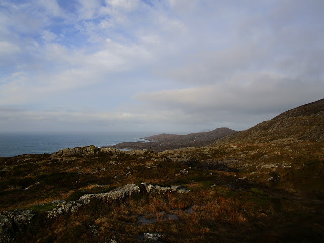
| From the shoulder of Miskish towards Castletownbere |
 |
| Towards Knockoura |
Once again the trail has been re-routed from what is on my map but I would say probably for the better. On the map the trail cuts back to meet a roadway before climbing up the hillside again but now it continues along the green road for another kilometre before climbing and cutting across the shoulder of Miskish. It then follows a spur on the other side towards some forestry under the bulk of Knockours 490mtrs. Again it seems my fears of walking on tarmac were unfounded and I was loving the wildness of the route. At the end of the spur you reach the forestry which has been extensively harvested and so resembles a chaotic no mans land but once you reach the little roadway at Knockour it is left behind. Very shortly after that you once again leave the road and climb the over 200mtrs to the shoulder of Knockgour 480mtrs which had several communication masts on its summit. Even from two kilometres away the wind could be heard blowing through the masts but it was reasonably sheltered where I was. The climb passed easily enough and once I reached the end I rested awhile and enjoyed the view back towards Castletownbere. Once over the crest the glory of the scenery that stretches between Cod's Head and Dursey Island lay beneath me. The full force of the wind was now in my face so I didn't delay and set of for the valley ahead. After another 5 kilometres I found myself on the roadway that leads to the village. I now had a decision to make as to what to do for the rest of the day so I walked into the village where I enjoyed a coffee and treat and sat and perused the map.


 |
| My eventual campsite was on the first headland on the left. |
 |
| Allihies |
It was only just 13.30 so I had been on the move for four hours and it was too early to stop for the day. I had two choices as I saw it. I could continue on the trail towards Eyeries village which was 3 to 4 hours away or I could head in the direction of Dursey and explore options to camp that way. While I descended towards the valley my eye was being drawn towards the wild but beautiful Keam Point at the end of Ballydonegan Bay where there seemed to be some green level(ish) ground. There I though it might be possible to pitch my tent. This option proved too tempting to ignore so I set off in that direction. Once again the trail differs from the map and instead of staying on the road it now follows the shoreline and this is another huge plus. From sandy beaches to rocky shores the big breakers crashed and roared and it was an invigorating joy to walk beside. An already good day was made even better and its fair to say I loved every step of the six kilometres it took to reach Keam Point. Now all I had to do was find somewhere to put up the tent. Thankfully the ground did indeed offer several places to pitch but my concern was shelter from the wind. After a little searching I did find a spot and soon I had my home for the night erected. It was only 3pm but I had been on the move for almost six hours so it felt like a worthy effort. What a wonderful place it was to be. I was like a little kid as I went first one way and then the other as I explored every nook and cranny of the immediate ground and revelled in the wild sounds and scenery of crashing waves and wild ground. Not that I was alone...a lovely dog from a house I had passed a kilometre before had decided to join me and his delight, lust for fun and seemingly boundless energy made an enchanting diversion..at least until he ate through one of the guy ropes on the tent...little bollix 😡.
 |
| Wonderful shoreline walking |
 |
| Camping heaven and my little friend |
Anyway I relaxed and whiled away the hours into darkness and settled in for the night. Around nine I decided to try for some sleep and I was soon cosy in my down bag and drifting merrily away. That is until the wind direction changed and it gained in strength when the rain arrived. I was glad I had the tent well pegged out as the gusts became increasingly strong but my hopes of a good sleep were gone as the noise of the flapping fabric was loud and incessant, but at least I remained dry.
Monday January 29th;
Time did what time does and night passed to morning and my alarm woke me at 7am. Around 4am the wind had eased and some sleep finally arrived and it was a struggle to motivate myself to get moving in the dark. The rain lingered so I brewed up in the porch and after a reviving cuppa I packed up and was on the move at 8am. The plan for today was to retrace my steps to Allihies and then continue on the trail as it headed for Eyeries before re-joining yesterdays route at Miskish and returning to Castletownbere where a lunchtime bus would leave for Cork. This meant I had over five hours to get there so I didn't delay as I wasn't too sure if I had allowed enough time. The tide was out for the return so the sea wasn't quite as fierce but it was still beautiful. The rain had cleared and to the northwest the skies were clear so I was hopeful of a good weather day. Once I reached the village I once again followed the markers as the trail climbed towards one of the old copper mines above the village before joining a delightful winding little road that twisted and turned and climbed over the hills behind the village. Soon I was leaving the wonders of Allihies behind and next I was looking down on Coulagh Bay where new and far reaching mountain and sea views delighted.
 |
| Stunning colour in Allihies Village |
 |
| Wonderful well preserved old mining pumphouse |
Before I leave Allihies behind completely I have to say a little about the fascinating history of the place. While copper was mined here as far back as the Bronze Age it was in the early 1800 a local landlord John Puxley started mining for copper. A total of six mines eventually operated in the area up until the late 1880s when things petered out. Hundreds of miners were brought over from Cornwall to work the mines and later some steam engines were also brought over to try and deal with the flooding of the shafts. As you walk around the area several impressive old pump-houses can be seen and excellent information boards tell their story. The little beach that nestles below the village was created by the quartzite spoil of the mines that was washed down the Ballydonegan River. Sawmills, forges, steam engines meant this was a large bustling busy mining community. How difficult must it have been to build such a community in such a desolate place, yet alone for one to thrive. What did the Cornish emigrants make of this wild and rugged place coming as they did from one of the wildest and most rugged places in England. It is fair to say that this area leaves Cornwall far far behind when it comes to wild rugged land. Further evidence of the Cornish connection can be found in the mining museum in the village which is housed in the old Methodist chapel that was built for the Cornish miners.
 |
| Towards the western end of the Everagh Peninsula |
 |
| Towards Eyeries and beyond |
 |
| Towards Hungry Hill..nearing journeys end |
The trail continues along the road as it contours easily down under the northern flanks of Knockoura. Eventually it leaves the road and climbs past some fenced off mine shafts and then crosses the bog around the mountain before dropping to the back of the glen between Miskish and Knockoura. Soon I rejoined the trail from yesterday up near the harvested forestry and climbed back to the shoulder of Miskish. I had been pushing pretty hard from the start as I feared that time was slipping away from me but when I checked my watch at the shoulder I was delighted to see that it was just 11.20 and I had over two hours left to reach Castletownbere just five kilometres distant. Sorted 😀. To top things off the weather had turned out just lovely with light winds and mostly blue skies. I covered the remaining ground in just an hour so I was able to treat myself to more coffee and cake in the town. It was great to change out of the mountain clothes and relax while I waited for the bus. It had been a wonderful revelation to walk some of this trail and I am resolved to return later in the year and start in Glengarriff and spend five or six days exploring it some more.
So in summary-Day 1--23 kilometres and approx. 700mtrs ascent: 5hours
Day 2--21 kilometres and approx. 550mtrs ascent: 5.45 hours
Day 3--17 kilometres and approx. 450mtrs ascent: 4hours
All in all it had paid to be adaptable.
.


No comments:
Post a Comment