Wednesday 11 May 2022

Back to the Beara. Cycling and Hiking.


 I had a week off work and I wanted to head away for three or four days but I struggled with my usual indecision on where to go. After much mulling things over I headed back to Castletownbere and decided to sample the delights of the Beara Peninsula once again. 

Sunday May 1st;

I'm not a huge fan of heading away on bank holiday weekends, as I tend to prefer the quieter less busy times, but needs must and the good weather that was forecast was too god to miss. Not only do I struggle with making the decision about where to head, but I also struggle with the choice of what to do when I get there. I kept nearly all my options open and packed up my hiking, cycling and fishing gear and set off west. The forecast for today was less than stellar, with light rain promised for much of the afternoon. I had kinda decided to fish for the day, but on the way down the day was actually quite nice so I decided that a bike ride around the beautiful Sheeps Head would be just the thing. Decision made , I was now looking forward to it. Alas as I neared Bantry dark low clouds filled the skies an it started to rain. It was however a brief affair. I drove to the far side of town and donned my cycling gear and readied for the off. Once again some rain made an appearance but I was ready now so I set off anyway. The route starts off nice and easy and undulates along a quiet road on the northern shores of the peninsula. Even in the gloomy conditions it was lovely and, as the rain had once again stopped I was thoroughly enjoying the trip. The first major difficulty is when a steep climb of the hill before Kilcrohane needs to be surmounted. It is not over long but at times it is in double digits in gradient, plus it was into the breeze. My heart was certainly pumping as I gratefully reached the crest.

If the ascent was tough, the descent was rapid. Perhaps a little too much so as the back of the bike fishtailed while braking when I met a car on the narrow road. No harm done however and once I reached Kilcrohane I turned right and headed along the ever more wild and beautiful road as it headed for the western extremity of the peninsula. Soon the landscape and the seascape become wild and even more delightful. By the time you surmount the steep short climbs to reach the roads end at Ballyroon you definitely feel that you have reached a special place. Today though I was relying on my memory for the sea views as here, the cloud had descended and all was enveloped in mist. Strangely it was none the less special because of that. A short rest and drink of water and I turned and headed back along the way I'd come. Now I was with the breeze and the road all the way to Durrus promised to be faster and easier. It was a very enjoyable return and it felt good not to have to struggle with the breeze. There are no hills on the route as you mostly follow the shoreline to the little village of Durrus which nestles at the eastern end of Dunmanus Bay. A steady climb from here followed before a fast return to Bantry and the car. Remarkably I had stayed dry the whole way and the rain returned once I had gotten changed. A total of 65 kilometres and 750 metres of ascent eased me into the holiday nicely. The Sheeps Head is wonderful.

I went and pitched my large tent in the little campsite on the golf course.The rain eased again in the evening and I spent a couple of hours of less than productive fishing at the adjacent pier but it had been a good first day.

Monday May 2nd;

The next few days were supposed to be very good weather wise and emerging from the tent to a calm sunny morning was certainly a good start. I decided that such weather merited another cycle. First up was a quick visit to the little lug bed in Castletownbere, where I spent an hour digging a good supply of bait. Once back at the tent I donned the old man in Lycra kit and headed off at 10.45. I decided to do a decently long cycle today and set off initially for Allihies. It is a nice easy start until the first climb at Gour, which got the heart pumping, but it was early doors and I was feeling pretty good. The weather was wonderful. Sunny, a light breeze and while not warm, it wasn't cold either. Add to this, absolutely stunning scenery and it's easy to understand why I was having a great time. Another climb to the gap before Allihies gave a good excuse for a little rest and drink while I took in one of my most favourite views. The road from here to the top of the climb out of Gortahig is narrow, twisting, undulating and equal parts wonderful and exhausting. It includes a couple of particularly tough climbs and once at the top of the final one, another rest was required.

Always worth a stop to look at Allihies

Next up is the long relatively easy stretch as far as Lauragh. Major roadworks had closed the road outside Eyeries but I ventured ahead anyway and with some care I was able to get through. Indeed, where they had finished the road offered an improved surface and the section before Ardgroom was it's usual gorgeous self. Not that the rest was too shabby. Views were wonderful all the way. As I neared Lauragh I was starting to feel a bit tired and the looming Healy Pass weighted heavy on the mind. I wasn't over confident of flying up it. I turned onto the narrow road and faced into the 5 kilometre climb. It started well enough and the first couple of K went pretty well. I knew however that I was beginning to struggle. Once I reached the higher section I was beginning to bonk, and let's just say cresting the final section was pretty awful. I didn't pause for a rest and instead tried to use the long descent to recover. I wasn't feeling too bad once I was down in Adrigole and I turned for the final 11 kilometres. The first few kilometres went reasonably well but the short hill at Derreny finally did for me and it was a pure struggle to complete the final stretch. Strangely, it was as much my arms and chest muscles that were spent as it was tired legs. I guess I stood on the pedals during the climbs too much. The hour digging probably hadn't helped either. A good feed and a warm snooze in my sleeping bag went a long way to restoring me.

All told it had been an 82 kilometre outing and included nearly 1200 metres of ascent in 3 hours 40 minutes.

I ventured to a new fishing spot for me in the afternoon, just a couple of hundred metres from where I dig the lugworm.. It was a short and unproductive session. It was still a delight to bask by the water and soak in the sunshine and the views.

Tuesday May 3rd;

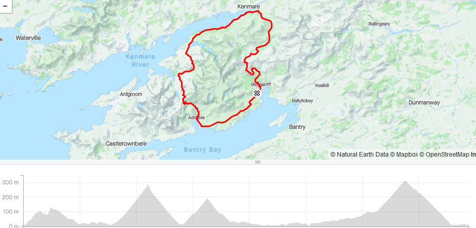
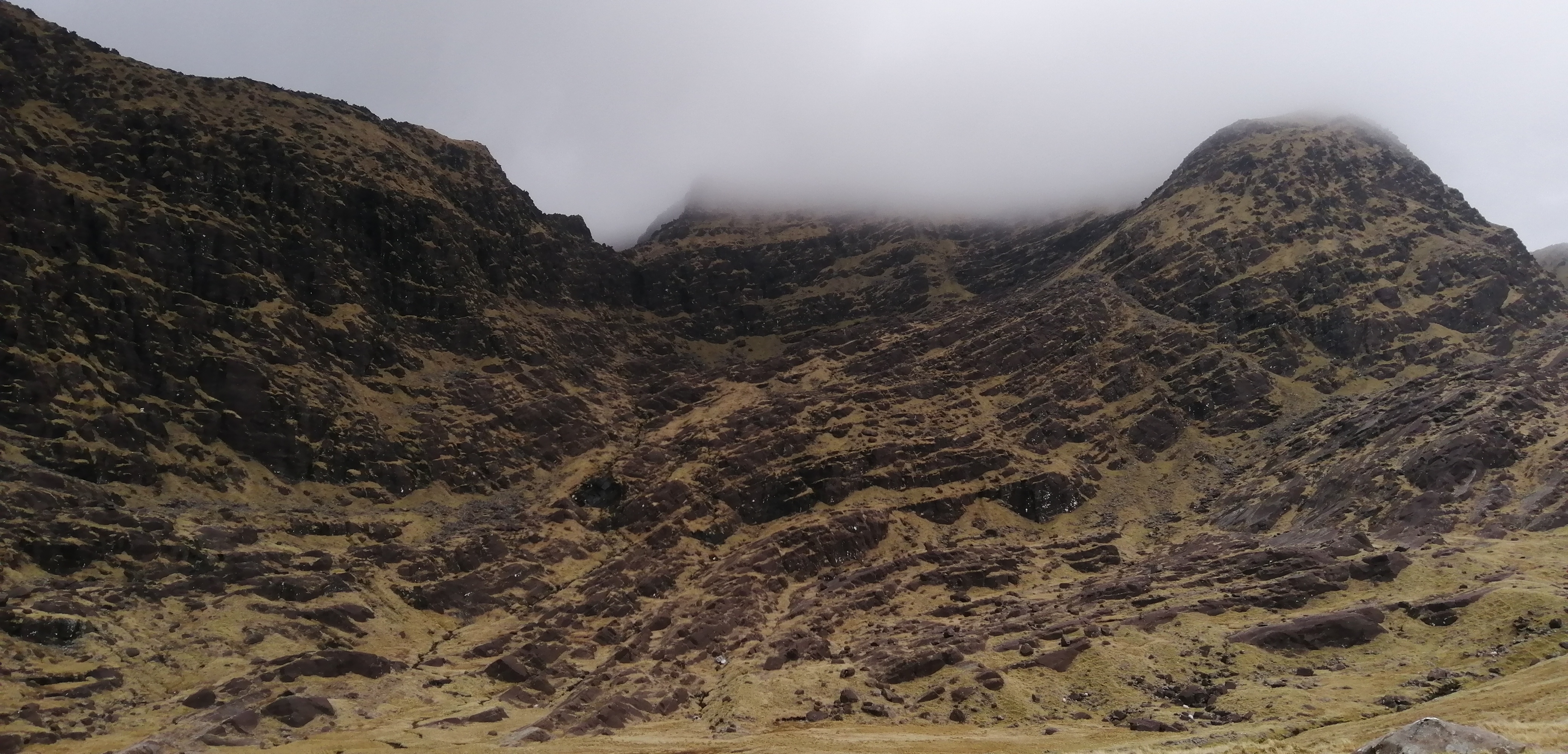
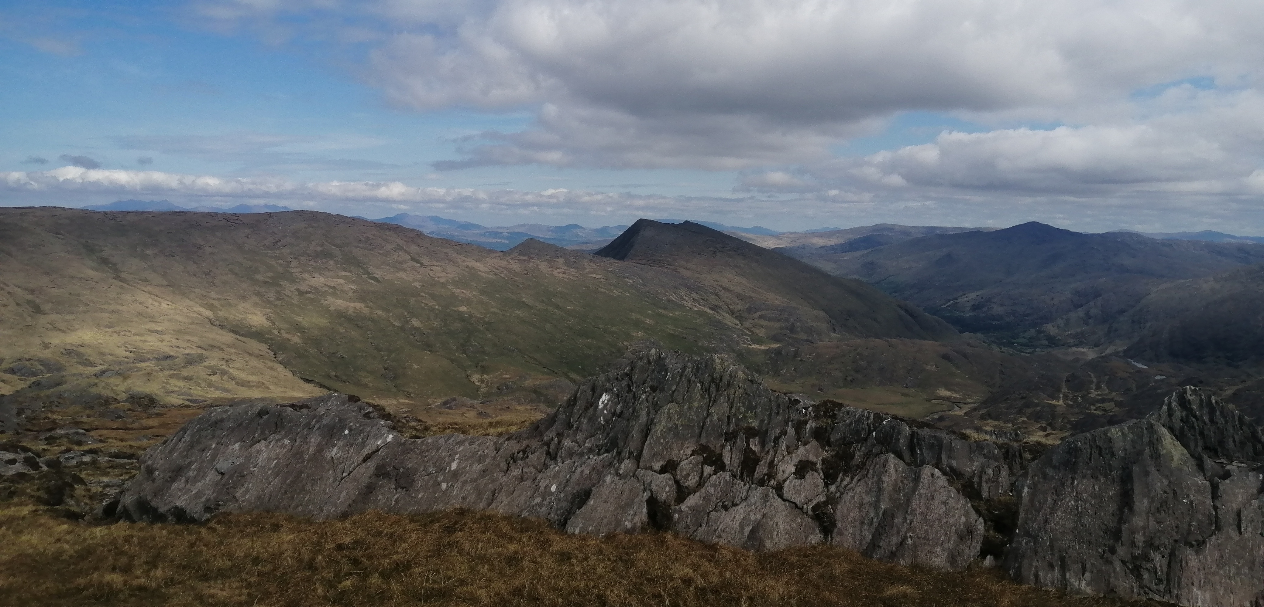
It was once again a lovely weather morning and after my struggles yesterday on the bike I decided that a hillwalk would be just the ticket for today. The delights of Hungry Hill lie about 6 kilometres from the golf course and I mostly decide to drive to the base of the west ridge and begin my hikes from there. Today, I decided to start from the tent and this meant a three kilometre hike up a quiet narrow little lane to start the day. Normally I'm not a fan of walking on roads but I have to say, with the hedgerows bursting into life, wildflowers in profusion and an accompanying score of birdsong, I loved every step. The three kilometres is also all uphill so by the time I was able to join the Beara Way and turn towards Hungry Hill I had gained 200 metres. It was a joy to be out and I must say it felt so much more relaxing than yesterday. Three more kilometres followed along the way until I reached the base of the mountain. The view of this wild and rugged mountain always inspires. I decided to miss out on the bottom section of the ridge and joined it about one third of the way up where the largest cliff section is to be found. I picked my way up the steep ground and at times enjoyed some fine scrambles and other times avoiding the hardest bits. This is a route that offers something for everyone. After climbing up through a narrow chimney the hardest bits are all done and soon I reached the easy ground of the south top. This offers an incredible panoramic view and I basked a while in the sun and enjoyed a bite to eat. 

Heading for Hungry Hill

Summit views.


The main top is easily reached and then I turned towards the rough ground that leads to the next top of the day Knocknagree. In the past I have found this section harder than it should be as it is easy to get drawn too far to the left too soon. The way isn't always straightforward, but the secret to an easier traverse is to stay high on Hungry Hill for about 500 or so metres north of the summit and then begin to track west to the ridge from there. The recent dry spell had made the going considerably easier and it was possible to walk directly across areas that at times would be very wet. The 200 metre steep pull to Knocknagree is a good test but once up here then most of the hard climbing is over. I paused for a short while to again soak in the views before I headed for the final top of the day, Maulin. There is some steep ground to be negotiated before you reach the col under Maulin but again the secret is not to try and go down too soon. Walk easily northwest for around 500 metres and then it is much easier to reach the col. Once again I appreciated the dryer than normal underfoot conditions as I crossed to the slopes of Maulin. Now a straightforward 160 metre pull saw me reach the broad top. A really easy descent to reach a bog road that led easily back to the lane I started on. This I once again enjoyed strolling down and I arrived back to the tent a very content boy with my day.


A respectable total of 22 kilometres in 5 hours 45 minutes with over 1200 metres ascent.

Once again I went for a short fishing session before dinner. Once again I didn't catch anything for dinner. It was however a beautiful place to while some time away..


Wednesday May 4th;

You can't beat a sea voyage to start the day.


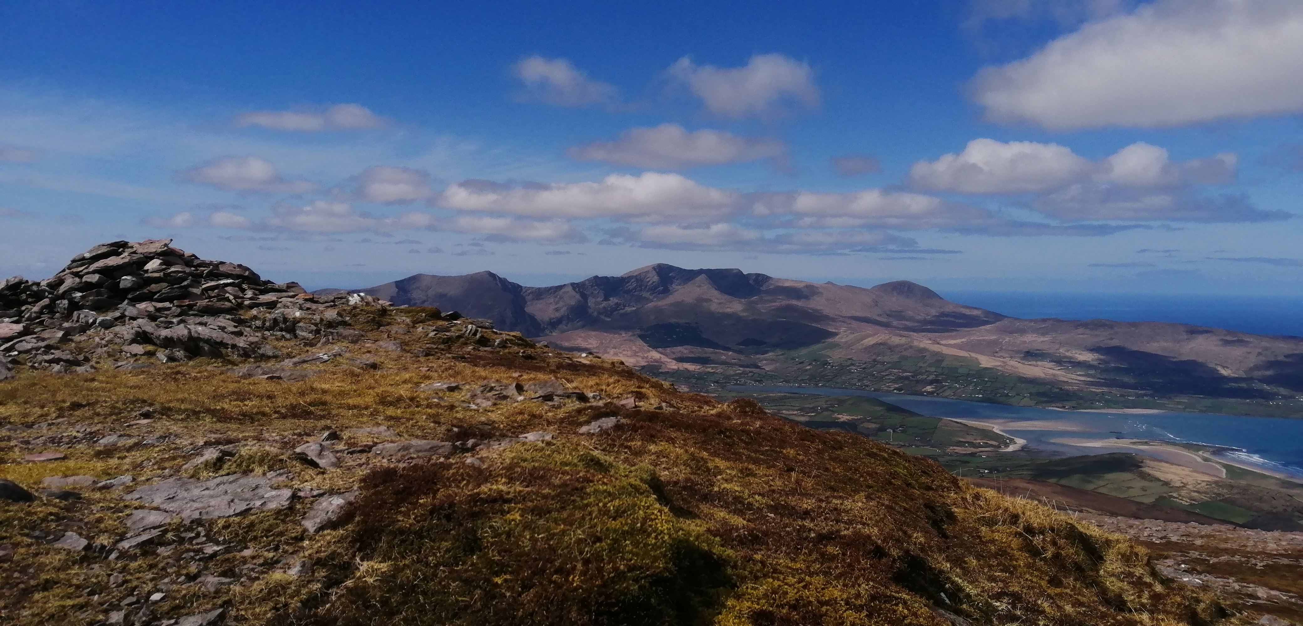
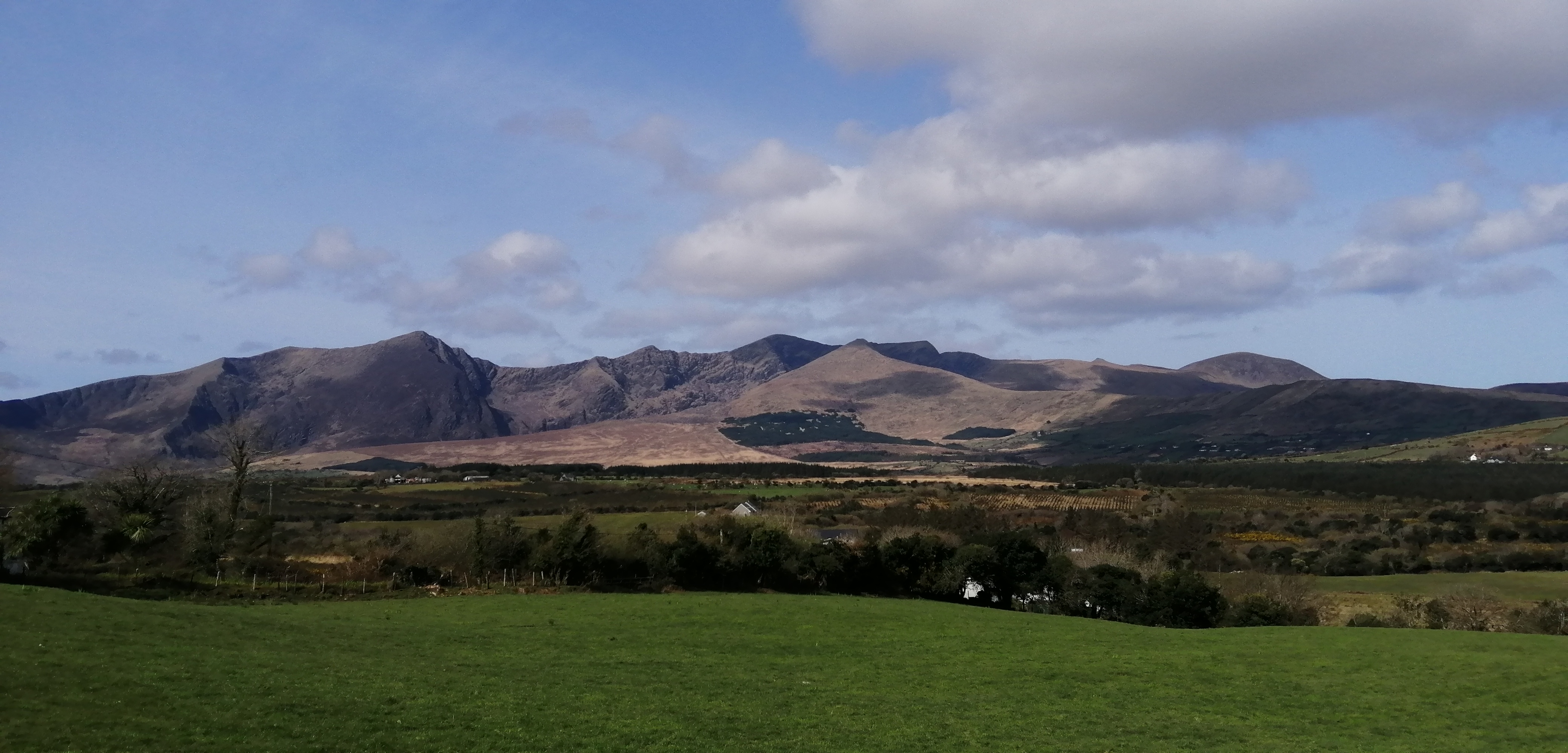
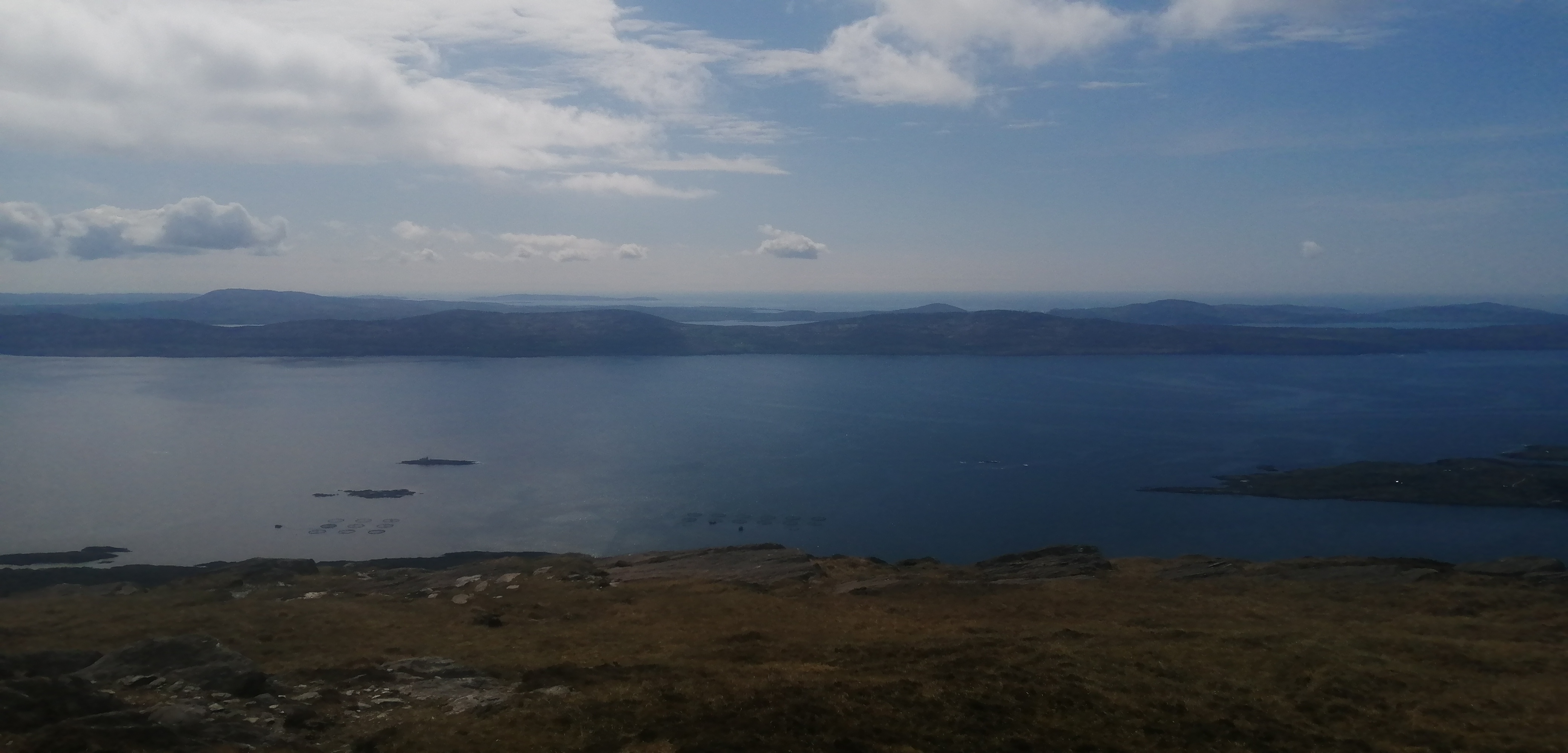
The weather was again excellent this morning and I got up a little earlier so as to catch the 8am ferry, from the jetty adjacent to the golf course, to Bere Island. A place I have long thought to visit. The very pleasant 20 minute trip saw us dock at sheltered Lawrence Cove on the eastern side of the island. I wasn't sure what to expect, but it seemed a little busier that I expected, with more cars about. Perhaps I overstate it a little but I was passed by six or seven cars in the first few minutes of my walk. I planned on doing a loop of the western end of the island and this meant I had to do the first couple of kilometres along the road. Not that this was a hardship, as once I was away from the village of Rerrin, all I had for company was birdsong and flowers. The road initially went through some shady scrubby woodland before climbing along the hillside until I arrived at a wide pass between two hills. I went up to my right to have a look at the impressive Martello Tower that sits atop the first hill. This old British fortification is one of five on the island that were built so as to guard the strategic Bantry Bay against a French invasion in the early 19th century. Indeed the whole island bears the marks of history, and old barracks and gun placements can be found at the extremes. From the tower I followed the Beara Way markers across the pass and climbed easily to the large cross that stands on Knockanallig (267mtrs), the highest hill on the island. I stopped a while and gazed across the sound and I could see my tent and car at the golf course, and above that lay the delightful vista of the ground I had hiked yesterday.

Looking across at yesterdays hike.

Looking East

Standing stone

Martello tower.

From here on things become ever wilder. I wasn't really sure what to expect, but I was a little surprised and delighted at the expanse of remote hilly ground that swept away to a series of bays and headlands. It invited me on and I didn't hesitate. I dropped towards the rather lovely Doonbed Head and then turned and crossed pathless ground towards the twin heads of Shee Head. It was so beautiful. With blue skies and seas, bathed in warm sunshine, and not another soul in sight, I was in heaven. I climbed up the hillside and joined the trail once again and followed this easily to the spectacular Arnnakinna lighthouse. I stopped here for a little while and gazed across the channel where the wild extremes of the Beara Peninsula stretch away to the west. There is a delightful green road from here that you follow towards Derrycreeveen and once again return to inhabited land. Now, after 8 wonderful and wild kilometres, I was once again on the road. It was about 7 kilometres back to the ferry so I decided that it would be as easy to run it as walk, so I set off at a very gentle jog. I felt good and enjoyed the return route and the road went across the northern side of the island. It went through a couple of little hamlets and was mostly shaded and lots of while and blue bluebells adorned the hedgerows and more. I arrived back in Lawrence Cove a comfortable 20 minutes before the ferry was due to depart and it felt great to sit and relax and dwell upon a delightful outing on a magical island. 

The wild and wonderful west


Shee Head and Doonbeg Head with the Sheeps Head and Mizen Head beyond


20.5 kilometres, 600metres ascent in 3 hours 45 mins.

Since I was back at my tent by lunchtime, I had plenty of time to once again do some fishing. This time I went to Dunboy, where I have had less than good success, and try my luck from there. It was great to relax and look across the water at the lighthouse where I had been a couple of hours earlier. This time I managed to catch some fish, the best being a beauty of a pollock which was almost 60 cms long. Great sport.


Thursday May 5th;

I was heading home today. The morning was cloudier that the previous few but it was dry and there was only a light breeze, so I decided that a cycle would finish off the trip nicely. After struggling so much near the end of the cycle on Monday I decided to take it a bit easier and do a shorter cycle. A circuit of the western end of the peninsula in the opposite direction to which I went Monday route of choice. Even though it is less than 50 kilometres in length, the hills were still as steep, so it wouldn't be a piece of cake.


An easy intro into Castletownbere to start, before a steady pull to the pass before Eyeries follows. The climb was interrupted when I came up behind a few stopped vehicles because a van had hit the ditch. It was only a minor shunt and after a few minutes the road was clear and I was able to continue on. The going is straightforward until you reach the climbs either side of Gortahig. The first one isn't too bad but the second, though only a kilometre in length, is pretty brutal and reaches a gradient of nearly 20% at one point. The remainder of the way to Allihies is not easy. Steeply up before steeply down and constant twists and turns meant that if I wasn't pumping up the hills I was hard on the brakes. The scenery is however gorgeous and helps to distract from the rigours. Another steep climb out of Allihies follows before a delightful section where I was able to relatively relax. Another climb, this time more gentle, to Gour and then it is straightforward all the way back to the tent. It was an ideal end to the trip. 

49 kilometres and 720 metres ascent.

I packed everything up before a shower of rain, good timing, and drove to the beach near Bantry for a final spot of fishing. It was once again not very productive but in enjoyable none the less. I drove home a happy chap.

Monday 25 April 2022

The Healy Pass-Caha Pass Cycle and a hike in Glengarriff.


A couple of days off gave me the green light for a flying visit to Glengarriff. As is usual I managed to pack the car full with everything I might need for camping, hiking, cycling and fishing. 

Monday April 18th;
 
A leisurely start to the day saw me head for Bantry at 11am. The plan for today was simple. Fishing. After digging sufficient lugworm for a few sessions I headed for the steep stony beach near the airstrip. The tides were big right now and I hoped that this might bring some fish to this hit or miss venue. Well, to make a long story short, it didn't. The only thing that paid any attention to the baits were spider crabs. On several occasions the traces came back with the hooks nipped off. Add to that, the strong breeze and lots of weed, it was difficult fishing. In the past I have enjoyed great sport here but most of the time it has been very poor so I think I will give this spot a rest for a while. I packed it in at 18.30 and drove to Glengarriff and booked into the small little campsite a couple of kilometres from the village. It was very quiet and I enjoyed a relaxing peaceful evening. 
 
Tuesday April 19th;

Today promised to be cool but dry and with little in the way of wind. Perfect cycling weather. It was true to its promise and I enjoyed my breakfast on a sunny calm morning. It wasn't going to be confused with warm though, so I donned an extra layer for the ride. What breeze there was, was coming from the north west so I decided to cycle my planned route in a clockwise direction. This would mean I would have the breeze against me as I climbed the Healy Pass but I hoped it would be with me for the final 30 kilometres or so from Kenmare. Right from the start the going is tough as the road climbs for the first few kilometres until it crests after a short very steep climb at about 130 metres. The reward that follows is a joy. Several gently downhill kilometres follow as you head towards Adrigole and the views get better and better. Next comes the climb of one of the most famous road passes in the country the Healy Pass. The six kilometre climb is never too steep and again the scenery is stunning. In the second half of the climb the road has a series of switchbacks that make it resemble an alpine road. A brief rest on top to catch my breath and have a drink of water and I was recovered enough to relax and enjoy the descent. I was glad to have put on an extra layer as it was quite chilly now.
There is no respite from the climbing however, as once you finish the descent in Lauragh, another climb awaits to surmount the Lauragh Pass. This is again not too steep but over 170 metres is gained so it it not to be sniffed at. Once again the views are wonderful and help to distract from the rigours of the climb. Once over the crest another enjoyable descent follows and easy cycling follows all the way to Kenmare. A right turn here and you head for the final challenge of the day..the Caha Pass. The first couple of kilometres is flat and the road is very rough. It is a bone shaker of a section. Some height is gently gained over the next several kilometres until finally after Bonane the real drag begins. Remember when I said I hoped that the breeze would be behind me here?, well it was not to be and as I got higher the breeze only made itself more manifestly into my face. That said the climb is not steep and i was able to make steady progress. My back was giving me my biggest problem and was quite painful by the time I finally reached the tunnel that marks the highest point of the day. Another rest here and a drink and it was simply a joy to coast the remainder of the route all the way down to Glengarriff. The final couple of kilometres to the campsite passed easily and I arrived back to my tent very satisfied and pleased with the outing. A total of 79 kilometres in 3 hours 10 minutes with 1050 metres ascent thrown in.
The less said about the fishing that afternoon the better, except that I did get sun burnt.  

Wednesday April 20th;

It was another fine weather day and once again it promised to stay good for the day. I decided that a hillwalk would be just the ticket to end this little trip before I headed home to begin another round of nights. One of my favourite things is being able to leave the car where it is and starting a hike without having to drive to the start. Today was like that as I was able to leave the campsite on foot and after a few metres on the road I turned onto a quiet little lane that morphed into a farm track that entered a beautiful open valley that led towards Sugarloaf. The first three kilometres were a delight as easy walking saw me draw ever nearer to the base of the hill. After consulting the map it showed the trail continuing right to the base of the steep climb but things became very different as the trail entered a plantation. It was actually a very pleasant change and  the route became quite enclosed and the world shrunk to the dark undergrowth. The forestry was more extensive that it first appeared and the trail I was following became more difficult to navigate due to fallen trees and encroaching rhododendron bushes. I reckoned I was gone beyond the ridge I wished to climb so I made a break for it up steep ground through the trees until I reached open ground. I had indeed gone too far, so I was faced with a steep climb directly up the side of the mountain. I guess I could have traverses back across the mountain but the way up seemed doable so I set off up. I found myself progressing up a series of mini gullies up the face that provided some scrambling and route finding kept the mind busy. It was pretty straightforward really but I wouldn't have enjoyed it as much if the day had been wet. The call of a cuckoo in the woods below made me smile and was a sure sign that summer is just around the corner.
 
Like a scene from "The Field"

Straight up the face.


A  wonderful walk in..and out

After 300 metres of steep ground I reached the crest of the mountain and now I was able to enjoy a glorious 360 degree panorama of this most special of areas. The breeze was a little chilly but an extra layer allowed me to relax and soak in my surroundings for a while. I looked at the possible continuance options of the hike and it looked very possible to continue all the way around Barley lake and make my way back to Glengarriff through the beautiful woods of the national park. I set off and after a drop of just 80 metres another climb of 80 metres followed before I came across the way markers of the Beara Way. On a whim I decided to turn and follow these and return that way. It is a pleasant enough way down, sometimes mucky and boggy and sometimes on a good track. When I reached the point where the trail descends in a more direct manner to the valley floor I once again changed course and decided to climb the rugged top of Derrynafulla and perhaps descend back to the valley I walked in. It was a steep climb to the top and the descent on the far side was no cakewalk as I had to at times pick my route carefully so as to avoid the steep slabs of rock that barred the way. It kept me entertained until finally I was past the worst of them, then the ground underfoot became very pitted, wet and rough. The next kilometre was something of a battle until I finally emerged onto a surprisingly dry, grass paddock, right in the middle of all the boggy rough land all around. A little was beyond this and I was able to join a track that returned me easily back to where it all began. 
It had been an adventurous 17 kilometres over sometimes very rough and steep terrain, but it's fair to say I really enjoyed the whole thing. Just shy of 5 hours in total and just shy of 900 metres of climbing was a fitting end to this little trip. Glengarriff has soooo much to offer.

Wednesday 13 April 2022

A Wonderful Couple of Days In Cloghane..Benoskee and Brandon


Saturday April 9th;

 Saturday finally arrived and after 11 days in a row at work I was very glad when a couple of days off, and I could head away. I couldn't make my mind up where to go and I had kinda decided that I would head to The Reeks and Rossbeigh, however as I drove back I decided to head to Cloghane instead and I booked myself into the excellent Brandon Hostel for the night.

It was a beautiful morning and it promised to stay fine all day. Tomorrow was supposed to be windswept and rainy, so I was determined to make the most of today. As is usual the sight of the wonderful mountains in the Brandon area was breathtaking. I formulated a plan as I drove back and decided to do a hike up Benoskee first, check into the hostel in the afternoon, and once I had dug sufficient bait, to fish Fermoyle beach until after 10pm. It promised to be a full day. I parked at the junction for Cloghane and after a three kilometre walk along the road I was able to finally gain access to the beautiful valley on the western flanks of Beenatoor, an outlier of Benoskee itself. A good track enters the valley and in the sunshine everything looked wonderful and the nearby woodland was full of birdsong. I was immediately enchanted. The easy going didn't last for long before I turned and commenced the long, steep near 500 metre pull to the top of Beenator. This certainly got the blood pumping but I was feeling quite strong and I made good progress. The calm of the valley was replaced by a chill breeze as I got higher and this added incentive to keep moving. From the broad boggy top there is a gentle drop of 70 metres before a gentle climb of 90 metres saw me reach the next top Coombane at 610 metres. This offers a great place to relax a while and take in the super vistas on display around you. The Brandon massif looks stunning, jagged and spectacular as it rises from the blue shores of Brandon Bay. The Maherees stretch out into the deep to the north and of course the bulk of Benoskee looms large nearby. Next up came the 300 metre climb to the 820 metres summit.This is not too bad as it isn't too steep and the ground is pretty solid underfoot. The odd patch of snow and ice was to be found in shady nooks and that, coupled with the strong cold breeze, told that winter hadn't fully retreated just yet. I found a sheltered spot at the summit to have my lunch and savoured much more than the food. Up here the views were to be found in a full 360 panorama. Loop Head in Clare speared the ocean way beyond the Maherees in the north. Baurtregaum and Caherconree looked majestic as they buttressed the eastern side of the peninsula. The mountains of the Iveragh Peninsula were neatly arranged over Dingle Bay and I could even make out Mount Hillary away in the distance.


I have seldom enjoyed myself more on the mountains and it wasn't over yet. I now had over 950 metres ascent done, so the bulk of the climbing was done for the day, but there was still a few climbs in the offing as I planned to cross over each top that lay between me and Slievanea. The descent to reach the long boggy area between the hills that overlook dingle Bay and the tops I was doing that looked over Tralee Bay is straightforward. Down here, over 400 metres lower down, it was once again warm in the sunshine and the breeze was light. The recent good weather had dried somewhat the normally drenched ground, and it was easy enough to head towards the first top Beenbo at 477 metres. This offers a new perspective on the valley below and actually has some nice rock ridges if you climb from the valley. An easy drop and another rise saw me reach Slievenagower at 486 metres. The hills here drop spectacularly to the lakes in the valley floors and are proof positive that hills don't have to be super high to be mountains. Time was shoving on and if I wanted to avoid having to rush the remainder of my day I would have to forego Slievanea and descend from the next top, the beautiful Slievenalecka 458 metres. The initial 50 metres of descent from this airy top requires some care as it is quite steep. A fall here would be serious. The difficulties are soon past though, and the remainder of the descent is easy. I dropped to the track at the end of Lough Adoon and this actually led directly to the car. I arrived back after taking 5 hours 10 minutes to cover the nearly 19 kilometres and all in all had climbed over 1300 metres. I was delighted.


A short drive saw me reach Cloghane, where I checked into the hostel and collected the room key. I returned to the lagoon at the back of Fermoyle beach and dug lugworm for over an hour. Once I had sufficient, I drove the kilometre or so to the beach and readied myself for some beach fishing. I wasn't too hopeful given my recent rate of success, but it transpired to be a delightful session with plenty of small bass being caught and one fine specimen landed. The rod tips were hopping into the darkness and I was a happy chappie when I finally called time at nearly 22.30. It had been a simply great day.

Sunday April 10th;

I wasn't expecting this morning to be anything other than wet and windy, so it was actually quite pleasing to find that, while the sun was hidden behind a layer of cloud, there was no rain and it was only the highest tops that were veiled in mist. I decided that I would go for a straight up and down Mount Brandon and that it would be a bonus outing for the trip. I left the car where it was and walked up from the village. The first kilometre follows the Dingle Way and is a delight as it rises from the village through grassy paddocks and alongside a stream before then joining a narrow road that rises to the car park near the grotto. The views are lovely and the elegant triangle of Brandon Peak is the star of the show. I also looked across the bay and admired the peaks I had been on yesterday. The breeze was quite stiff and it promised to be windy on top, but the bulk of the route is fairly sheltered. After the grotto the trail rises fairly gently on the flanks of the spur that rises towards Benagh and the Faha Ridge. I would have liked to do the ridge, but with the wind as it was, it would have been too dangerous. At around the 600 metre contour the trail rounds the shoulder of the mountain and heads into the back of the savage ground below the north face of Mt Brandon. This is always a spectacular place to be and as I walked in I reminisced on the time I walked in here in the fierce winter of 2010, when I needed crampons from just above the car park.


After completing the steep 150 metre climb to surmount the back wall of the coum, all that was left it the easy pull to the summit of Mt Brandon itself. I was now in the mist but fleeting breaks in the fog gave misty views towards the wonderful coastline near Ballyferriter and Slea Head. The wind was buffeting but not too bad so I decided to continue along the ridge as far as Parias Mor and descend towards Teer before crossing back over the spur of Benagh and returning to the main trail once again. It was a lovely addition to the day and allowed me to enjoy the superb views of the huge coum that rests on the north side of the ridge. Some rough ground has to be crossed to treach the crest of the ridge again but thereafter the descent is easy. Today had been a short day but it still gave me a lot of satisfaction and ended the trip nicely. 15 kilometres in 3 hours 40 mins and over 1000 metres climbed...nice