Time flies. It's been over two years since I was last in the Lake District, when I enjoyed a lovely four day hike, from Conniston, around over Bowfell and Scafell, then onto Great Gable and Honister Pass, before finishing off over High Raise and the Langdale Pikes.. (https://howlingmist.blogspot.ie/2016/05/four-days-in-lake-district.html ).
Saturday May 12th:
This time, I wanted to explore eastern side of the region, and with that in mind, I caught a train to Penrith and a taxi to Pooley Bridge. It was after 12 noon when I was starting to walk,so I didn't have a lot of time to waste. The forecast was pretty good, and the weather as I set off was excellent. Warm sunshine and no wind, was certainly a rarity for me this spring, and I revelled in the conditions. There were quite a few people milling about in the pretty village, so I wasted no time in setting off. A couple of kilometres on the road, saw me reach a large caravan park, and as there was access onto the open hillside from there, I walked up through it. I'm getting a little better at lightening my backpack, and this time, I was carrying about 13 kilos, and that included food for four days, plus a couple of litres of water. My Force 10 GR 55 litre rucksack was nice and comfortable, and was proving ideal for this trip.
 |
| Grand day for it lads |
 |
| Looking down along Ullswater |
 |
| Easy springy ground |
 |
| Approaching High Street |
Once out on the open hillside, it was easy walking, on the dry springy turf. There was a wide easy path to follow, so it was a simple task to stay on route. The views were lovely. Particularly down and along Ullswater, which nestled under the craggy ground, on the east side of Arthur's Pike and Bonscale Pike. In the distance I could see Helvellyn and co, which would be tomorrows adventure, but first, I had the aforementioned Arthur's and Bonscale Pikes to reach, and then the big dome of Loadpot Hill. The terrain is really a series of ever higher broad elephant backs, that offer no steep slopes, and generally easy walking. To the east, the north Yorkshire hills rise gently, and to the west, the major peaks of the area can be seen. A long walk followed, over a series of barely discernible tops, before more interesting ground is reached as you approach High Street, which led to the high point of the day at 828mtrs. It was now 5pm, so I was turning my mind to finding a spot where I could pitch my tent for the night. I had been on the move for five hours, but I was feeling pretty good, and if nothing became obvious I could carry on for little while yet.


 |
| Thornthwaith summit |
The weather however, was showing signs of change, with a high thin layer of cloud having formed, which dimmed the sun, and some rain had appeared over the flatlands to the east. Being pretty much on a ridge the whole way, there was little in the way of water sources, and I had pretty much resigned myself, that I would have to drop down a fair distance, to find a suitable spot for the tent. As luck would have it though, just after High Street, under Thornthwaite Crag, there was the beginnings of a gully, up quite high, and I went to investigate there. I only had to lose about thirty metres, before I reached a spring, and I loaded up my bottles and climbed to the summit of the crag, in search for a place to camp. There was a large cairn and a stone wall, and there was several good spots for my tent, so I was set fair. It was almost 17.45 when I finally dropped my bag, and I wasted no time in setting up house for the evening. Rain was now hitting High Street, but thankfully, I stayed dry. There was little or no wind, and it was a joy to amble around, and take in the wide ranging views. I enjoyed a good meal, and, as is often the case with me, I was sleepy after all the travel, so I retired to my sleeping bag at 8pm. It was dark when I woke later, and raining steadily, and from what I could gather, it continued to do so until after the dawn.
 |
| The rain missed me |
 |
| Towards Windermere |
Day 1 = 5.25 hours-Approx 18 Kilometres and 950 mtrs of ascent
Sunday May 13th;
 |
| Morning |
I rose, feeling refreshed, at 06.30, and as the rain had stopped some time before, I emerged to a stunning blue sky morning. I felt restored after a good sleep, and I was looking forward to the day ahead. I must say, I love this type of trip, where you walk as far as you feel like, before finding somewhere to pitch your tent, and then, doing it all again the following day. It feels like proper freedom. The usual breakfast and packing up, meant I was on the move by 07.20. First up, was the steep(ish) drop down into a gap, before a steep pull, up to Stony Cove Pike. This broad boggy top, offered great views, both to the north, and especially southwards, with Lake Windermere, seeming to stretch almost to the sea. Next up, was the descent to Kirkstone Pass, which went okay. I passed a couple of similar vintage guys to myself, who were enjoying the morning outside their tent above the pass. It seemed they had enjoyed the previous evening as well, if the empty wine bottles were any indication...and why not 👍. Even though it was still early, there was a fair number of people at the pass, so I didn't delay and soon they were left behind, as I started up the long steep climb to the top of Red Screes, over 300 metres above. I forsook the path, and decided to tackle the climb in a direct line, which offered some nice easy scrambling higher up.
 |
| First drop and climb of the day |
 |
| Heading for Kirkstone Pass |
After the steep craggy ground, the summit and ground beyond, once again, reverted to a broad boggy expanse, which offered an easy descent to Scandale Pass. Another steady climb was needed to reach Dove Crag. I was now on the Fairfield Horseshoe, which is obviously a popular walk, (isn't everything hereabouts), and lots of people were on the trail. It is all easy going, until you reach the summit of Fairfield, which at 873mtrs, offers a wonderful viewpoint of the entire Lakes. By now, I had climbed not far shy of 1000mtrs, but the day was still young, and I had a ways to go yet. Next up was the drop down to Grisedale Tarn 325 metres below, and I again took a direct line down to the lake. It was quite steep, but some sections of nice scree, made for swift easy progress, and soon I was down by the lakeside. One more big pull remained, and I set off up the 300+ metres, to reach the wonderfully named Dollywagon Pike. Now all the steep climbing was over for the day, and the broad ridge that led to Helvellyn, was straightforward. The ground to the east, dropped precipitously down to the Grisedale valley, and offered spectacular views. I was by now, not too far from the area I had covered when I was last here, and the jagged skyline, was a constant draw for the eye. As I had climbed a total of around 1500 metres by the time I reached the summit of Helvellyn (950mtrs), I reckoned it was about time to find somewhere to pitch my tent again. Looking about, I decided to drop down to Brown Cove, where there seemed to be some nice flat ground, with the all important water source. I descended the first half of Swirral Edge, and as I was going down, I spotted another possible spot for the tent, higher up the slope, nearer the broad gully that rises to the gap between Helvellyn and Lower Man. I dropped directly down the steep ground, and crossed to the spot. It was just outside an old mine shaft, and it was flat and dry, so I had found my home. One thing I hadn't reckoned with, was that I was on the shaded side of the mountain, and the sun disappeared behind the upper slopes by 17.30, which meant it got quite cool for the evening. Still, my down jacket ensured I stayed toasty, and I enjoyed a very pleasant evening.
 |
| Red Screes summit |
 |
| Fairfield |
Towards Helvellyn
 |
| Some spectacular ground |
 |
| The view up to the ridge from my tent. |
Day 2 = 7.5 hours-Approx 19 kilometres and 1500 metres of ascent
Monday May 14th;
The chill breeze of the previous evening had disappeared in the morning and I exited my tent into another stunning morning. Man there is little to beat camping in the mountains when the weather is as good as this. If I was in the shade last evening I was in the sun in the morning and with not a puff of wind it was such a pleasure to bask in the sun while I ate my breakfast. I was all packed up and on the move 08.10. First up was the steep 150 metre climb back up to the ridge. Slow and steady was the way to go and it passed soon enough. Now I was faced with about 11 kilometres of easy walking over the curiously named "Dodds" until I reached the final abutment at Clough Head where a steep drop to the village of Threlkeld awaited. What a beautiful morning it was to amble along over each rounded top. The walking was predominantly on dry crispy moorland and the rises and drops were never too taxing. That said, by the time I reached Clough Head I had climbed a total of 600 metres. I walked northeast from the top of Clough Head where a path dropped quite steeply directly down towards an old coach road. It was a bit of a knee wrecker after the miles of easy ground but the 300 metre drop didn't last too long. It was now quite warm in the unbroken sunshine and I set my mind to wondering if there was somewhere for a nice treat in the village ahead. Once I reached the coach road I crossed some rough ground to reach the western side of a disused quarry. A convoluted roadway led eventually to the public road and then to the heart of the pretty village. Lo and behold there was a café open and I enjoyed a big slice of "rocky road" and two delicious coffees. All this while sitting outside on the deck enjoying the great views...well it was lunchtime after all.
 |
| Looking along "The Dodds" |
 |
| Back towards Helvellyn. Campsite marked in red. |
 |
| Leaving the Dodds Looking down to Threlkeld with Skiddaw and Blencathra behind |
 |
| Towards keswick |
 |
| Blencathra looms large behind the village |
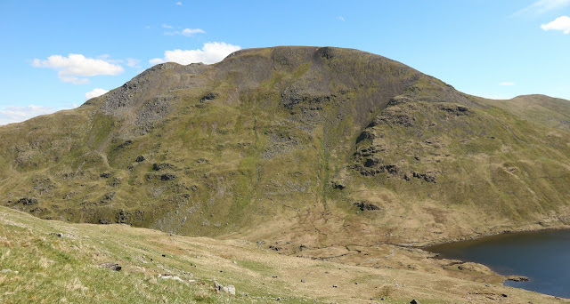
So, with around 15 kilometres done and 600 metres climbed it was briefly tempting to stay in the village and while away the afternoon, but only briefly as the imposing spectacular bulk of Blencathra was too big a draw and the day was still young. Now all I had to decide was which way to climb it. I opted for the most direct route so after leaving the village via the carpark I followed Blease Gill up onto the open mountainside until you come to a stone wall and the path mirrors this up the steep slope. Perhaps it was the coffees or the cake (or both) but I was feeling strong and made steady progress until I eventually reached the wonderful viewpoint at Gategill Fell. The mountain is quite spectacular from here with a series of ridges book-ending three coums that all finish at the near level summit ridgeline. My ridge was never too narrow and after a series of little bumps I reached the final steep step to gain the crest. This gave some nice scrambling but it was over all to soon and I stood on the top. What a great viewpoint and the easy ground to the highest top meant I could keep enjoying it as I walked. A brief rest on the summit and I set off for the nearby Atkinson Pike and then I dropped to and crossed the wide boggy plateau of Mungrisdale common. This was a delightful easy walk and I now set about finding somewhere for my tent. There is no water source on the plateau so once I reached the point where the ground drops down towards the valley below Skiddaw I traversed left (south) until I reached Sinen Gill and almost immediately I found an ideal spot to call home for the night. I had super views across towards Skiddaw and also south towards Scafell and others. Unlike last night I had sunshine until after 9pm and enjoyed a nice sunset.
 |
| If you are going to enjoy a coffee you might as well have a nice view |
 |
| Up and to the right |
 |
| Not a bad view back |
Day 3 = 8 hours-Around 22 kilometres and 1400 metres of ascent.
Tuesday May 15th;
The forecast today was not so stellar and it promised to cloud over at around noon with rain arriving in the later afternoon. When I got up though it was a beautiful morning with clear blue skies and again little or no wind. Today was my last day and I was catching the overnight ferry back home so I had literally all day to kill. The natural conclusion to this trip, given my location was to climb Skiddaw which at 931 metres was another of this areas 3000ers. To make the day a bit longer I decided to start by climbing the nearby Great Calva (690 mtrs) which would make a somewhat extended horseshoe outing. I traversed the slope easily down towards the wide valley and headed directly towards the wide heath covered slope that extends south from the summit. Unusually for hereabouts there was no sign of a trail or path but I hoped that things wouldn't be too difficult. I was wrong. After crossing the small river at around the 400 metre contour, directly east of Skiddaw House, and crossing a fence I was immediately waist deep in heather growing out of a deep mossy morass. Every step was hard won and the only saving grace was that I only had a couple of hundred metres of this to cross before I reached the slopes of Calva. Another stream and fence crossing followed and its true things did improve. Now all I had to negotiate was the waist deep heather. Even though it was less than 300 metres of climbing to reach the summit, the first 200 metres were the hardest of the entire trip before I mercifully came to a track that led to the summit. The ground to Little Calva was an easy arc across boggy ground that was heaven in comparison to what went before but it soon passed and I then descended steeply to the road that leads towards Skiddaw House.
 |
| Skiddaw House |
 |
| Calva summit views |
Back down again at the 400 metre contour I now set foot on the Skiddaw massif for the first time. There was now a bit more of a breeze and cloud scudded across the summit slopes high above. The forecast seemed to be panning out exactly as predicted and things had a hazy grey look when you looked towards the sea. I didn't mind though as it was still dry and where I'm from that is always a bonus, First up was a 270 metre pull to Bakestall which was a shoulder on the mountain. A level patch allowed respite before another 150 metre pull saw me gain another shoulder. Another easy stretch across the wide nearly flat ground passed and now it was quite breezy and chilly as well. The final 100 metres to the summit was next and again it is nothing too steep or taxing. It was an easy decision to but on my jacket while I had a bite to eat on the top. The cloud lifted enough to allow hazy views but I didn't stay long and continued on towards Little Man 865 metres and here I lingered as the views southwards towards all the major peaks of the area was wonderful. Even though it was a Tuesday the mountain was very busy and the tracks on the slopes were huge. I dropped down along Jenkin Hill and headed across the easy ground as far as Lonscale Fell. I followed a light trail that took a direct line towards the carpark for the main track. This was quite gentle at first but eventually it was a steep descent of over 200 metres to reach the easy ground. The weather was now returning to warm and sunny and remained so for the rest of the afternoon. I followed the Cumbria Way down into the busy bustling town of Keswick there every second premises seemed to be an outdoor gear shop of some sort. My walking was done when I reached the bus station and all that remained was the long trip home. It had been a very enjoyable trip and camping in such perfect weather was a real treat. One thing, don't head to the Lake District in search of solitude..It is a very busy place.
 |
| Skiddaw summit |
 |
| Heading to Little Man |
 |
| Derwent Water and Keswick |
 |
| Back towards the summit..Another super sunny afternoon |
Day 4 = 6.25 hours-Around 18 kilometres and 1050 metres of ascent.


