Sunday, 31 May 2015

Tomies and Shehy...Four Seasons In One Walk

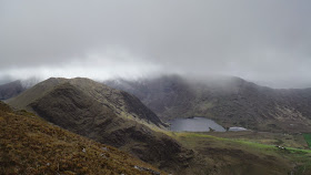
First views of Cruach Mhor
Today I went with Frank for a bimble in the Kerry mountains. It was my last chance to stretch the legs before I head to the Pyrenees tomorrow. We opted to climb Tomies from Tomies wood and we headed from there to Shehy west before turning and going over Shehy east and then headed further east and descending steeply to the wild valley below. Frank was suffering the after effects of a boozy night a couple of nights before and I made sure to give him all the sympathy he deserved :o) but he soldiered on, cause thats the way he rolls :o). We experienced the four seasons today with a strong breeze/wind to complete the weather set. As we went from Tomies to Shehy we were blasted by a wicked squall that had big hailstones mixed with some snow. The hail made a mighty noise as it clattered into out hoods. It was short lived and shortly afterwards we were enjoying sunshine and great views. About 850 meters of ascent over a wild 14 kilometers made for a worthy outing. It is a round that would make a very interesting and I think enjoyable hill run. A short report today as I have a few things yet to do. The Pyrenees here I come.
Frank with a ready smile...to hide his pain

Wonderful views to the east

Purple and the Reeks from Tomies

The squall left as quickly as it arrived


Muckross lake with Crohane beyond

An interesting little ridge

Pretty Rhododendron Ponticum...but a real pest

Monday, 25 May 2015

Mullaghanattin And Curve Gully Ridge..A Lovely Weekend

Just after leaving the car looking at the back of the round.
 On Saturday I went down to Mullaghanattin 773m with Frank. It had been a while since I was last here and it would be only Franks second visit. For years there have been access issues on the south side of the mountain and this has meant that I hadn't done the beautiful and very natural horseshoe that goes around "The Pocket" since 2003 so I reckoned that it was high time that I revisited this side. I collected my new La Sportiva Trango Cube boots at Kerry Outdoor Sports before we set off and this meant that it was 11.50 before we left the car. The day was warm (relatively speaking) and humid and there was some cloud clinging to the tops but on the plus side it promised to stay dry and we had gotten a couple of friendly salutes from some locals before we set off. We did the circuit in a counter clockwise direction so we had a steep 400 meter plus pull to our first top Cnoc Riabach. The broad ridge continues northwards from here but the going isn't easy as over the next couple of kilometers there were lots of little ups and downs. once the ridge reaches point 594 mtrs the ridge turns west and a steep 100 meter climb follows before the easier summits slopes are reached. Frank was moving well today and we caught up with and passed another group before the summit. Alas we were in the misty cloud but once we reached the top we enjoyed a relaxing bite to eat in the benign conditions.

Frank looking determined...or is it knackered.

Looking across towards Knockduff

The Pocket

Steep ground all around..Looking towards The Reeks
 We didn't tarry too long and we set off down before tackling the next three tops. This involved a further 270 meters of ascent to add to the more than 800 meters already done. We were once again under the cloud and we got handsome views to the north and west as we made our way along the pleasingly airy ridge. It was lovely and warm as we descended and the sun shone almost continuously. By the time we reached the valley things felt really quite warm but we were in great spirits and really enjoying the day. For sure it wont be too long before I go back to this, one of the finest horseshoe walks in Kerry. Thanks Frank.

Lough Reagh

Looking east across the round.


On Sunday I returned to Kerry with Denis O'Brien for an outing of a more technical nature,,,Curve Gully Ridge (Severe) on Carrauntoohil. This is my favorite route on the mountain as it is sufficiently interesting and difficult to feel like climbing it is an accomplishment and it has the added bonus of finishing almost at the summit. The last time I came here with Denis the rain had made the rock less than inviting and I backed off it at the start but today it was lovely and dry and a much more pleasant prospect. We made the long climb up to the start of the route and we were looking forward to the prospect. This would be Denis' first time on the route and he was really keen. He is an accomplished mountaineer who had climbed extensively in the Alps and among his summits are The Matterhorn, The Eiger and in South America --Aconcagua at almost 7000 meters. The cloud was again shrouding the summits but unlike yesterday there was a distinct chill in the air by the time we arrived at the rock.

Topo of the route
We donned out hardware and I set off up once we were ready. I always find the start of this route the trickiest but once I was established on the route we made good progress. Denis I believe really enjoyed it and is already looking to make a return visit. The route comprises of a series of steep sections with easier scrambly sections between. The crux of the route it near the top and provides a steep wall but the holds are excellent and protection is readily available. Once beyond this we moved together for the final steep but enjoyable fifty or so meters. We turned some heads on the crowded summit as we arrived with all the accoutrements of the climb dangling from us but we were delighted with the effort. A nice lunch and we returned to the valley via the Heavenly Gates. The coffee and cake in a busy Cronins Yard went down a treat. Well done Denis and I'm looking forward to our next outing.
Always a delight to see as we walked into the Hags Glen

Denis having a good time

Excellent fun in prospect.


Monday, 18 May 2015

A Circuit Of The Gap Of Dunloe

Yesterday I went back to Killarney for another hike on the Kerry mountains. My trip to the Pyrenees is getting close so I wanted to get a fairly big hike done to try and improve my fitness before I go. I decided to do a full circuit of the wonderful Gap of Dunloe. Surprisingly I think I had only done this hike once before but it is a lovely outing with wonderful views, especially to the East Reeks. I parked at Kate Kearneys cottage and set off in the Gap road. Once over the skew bridge I set off up the steep pull up "The Chimneys" and onto Tomies Rock. The weather forecast was for rain to arrive around lunchtime but it was fine so far even if it was a bit cool with a stiff breeze blowing. On up to Tomies and from the summit it is fairly straightforward all the way to Purple Mountain 832 mtrs my high point of the day. I was really surprised not to have seen anyone so far as this is a popular spot but as I went own I passed a couple of groups coming up against me. I went almost all the way to the "head of the gap" before I stopped for a well earned lunch.
Steep ground up to "The Chimneys"

Enjoying the view

A wonderful place to be...heading for Purple

       
The East Reeks looking amazing.

After lunch I went down to the road and set off up the far side of the gap towards Drishana. The 200 meters plus of steep ground was tough but after reaching the top the slope eases considerably and makes for easier going to the next top Cnoc na d'Tarbh 655 mtrs. On the way up I met two young east European guys and the absolute delight that they felt at being out in this wonderful landscape was plain to see. The weather was holding up very well and I was hopeful of completing the day in the dry. My legs were pretty tired by now and the effects of the cycle the day before were evident as well so I wasn't looking forward to the final 150 meter climb to my final summit Cnoc na Bhraca 731 mtrs. The views across to the main bulk of The Reeks are glorious. I turned and headed down and headed towards the long spur that leads to Strickeen 440mtrs. It was really disappointing to find a new fence crossing the path as I went down and to make it more difficul it was topped by barbed wire. It ran in a straight line almost the entire length of the spur before dropping down towards the gap. When will the government ever tackle the farmers in this country?. I sometimes despair. Anyway I went to the top of Strickeen and then descended back to the road and my car. Approximately 17 kilometers long and 1700 meters of climbing in 5 hours 45 minutes made for a worthy outing.
The Reeks looking splendid from Cnoc na Bhraca

Towards Strickeen

How much did this new fence cost...and who paid??

Almost down..still beautiful.

Sunday, 3 May 2015

Another visit to The Galtees.

Its only a few weeks since I last went to the Galtees and that time I enjoyed a magic wild-camp high on the ridge near Lyracappul. This morning I left work and had an early start (8am) from the excellent Kings Yard and set off in the same direction as the last time. The weather on my previous visit was clear and dry and the ground had benefited from a decent spell of dry weather and the progress was easy as a result. Unfortunately this morning we had had two days of rain which returned the ground to its usual sodden state and water was dripping off my boots with each step. I was walking in my La Sportiva Nepals due to returning my much lighter Trango Alp boots (due to leakage) and they really are overkill for walking on bog but they kept my feet dry throughout. Anyway this morning there was a great improvement in the weather as the rain had stopped but there was extensive cloud right down to three hundred meters. My legs were feeling a bit tired but I made good progress and I reached my first top (point 629) at 9am. As I arrived the cloud cleared a bit and I was treated to fleeting views down to the deep glen on my left.

Finally a bit of a view. Straight up the left hand side.
 I descended quickly to the col and on a whim decided to drop down to the sheepfold below and add Knockaterrif (692 meters) to my jaunt. It initially seemed like a good idea but I was questioning my decision as I huffed and puffed up the steep 300 meter slope to its broad boggy top. The cloud had closed in as well so when I reached the top I immediately set off towards Lyracappul. Despite the lack of views I was enjoying myself and I was grateful that it wasn't raining or too windy. I eventually reached the summit ridge and for a short while I was treated to opening misty windows which revealed the valley far below. I was making steady progress and I had so far covered 8 kilometers and climbed 900 meters in two hours thirty minutes.

Bleak and eroded bog between Knockaterrif and Lyracapul
 The wind was noticeably stronger on the ridge and very soon it carried drops of rain with it. I put on the waterproofs and sure enough it misted or rained for most of the time I was on the ridge, mercifully stopping as I reached the summit of Galtymor (919 meters) at 11.30 where I enjoyed a welcome bite to eat. I opted to descend once again in a south southeasterly direction to the lovely spot where three streams merge. It is an easy and straightforward way off the mountain and eventually I dropped below the cloud at around the 400 meter contour and I followed the river as far as the forestry and then back to my car. I was out a total of 4 hours 40 minutes and covered 16 kilometers and climbed about 1200 meters. It was a nice way to start the day and I didn't see another person on the hills.
A magic little spot