I'm home again after another trip to The Alps. This time it was to an area that I have never visited before, the Mercantour National Park in the Alps Maritimes. I had 10 days to play with, and, in order to maximize my time on the mountains, I opted to start by doing a three day section of the Gr52A, before doing the entire Gr52 over seven days and ending up right on the coast. Hiking over the last ten days of October I was hoping that I wouldn't be too late for good Autumn colour. A big dose of vitamin D was also on the wish list. The trip delivered in spades.
Saturday October 21st;
My flight out of Dublin was leaving before 6am, so rather than head up the night before, I opted to catch the bus from Cork at 1am and travel overnight. I had hoped to catch some sleep during the three hour bus journey, but my hopes were dashed when, lets just say a rather large gentleman opted to sit beside me. Now the already small space allowed in bus travel was further reduced by 25%. To be fair he was aware of his size, but when he fell asleep he relaxed and spread himself out. I found myself in more cramped conditions than were to be found in the old Gouter Hut. It was something of a relief to disembark at the airport before 4am and I relaxed a while before boarding the flight to Nice. I then found myself in the middle of a large group of French teenage girls, which wasn't ideal for trying to get some kip en route. I guess it was no surprise that I arrived in the Cote d'Azur somewhat less than sprightly. It was nevertheless wonderful to be back in this beautiful city after a thirteen year hiatus. I had a few hours to kill before catching my train to Sospel (my starting point for this hike), so I was comfortably able to get a canister of gas in Alticoop outdoor store. I even managed a little sightseeing down at the beautiful Promenade de Anglais, where the delights of the Mediterranean meets the heartbeat of the city.
 |
| A strange but wonderful tableau in Nice |
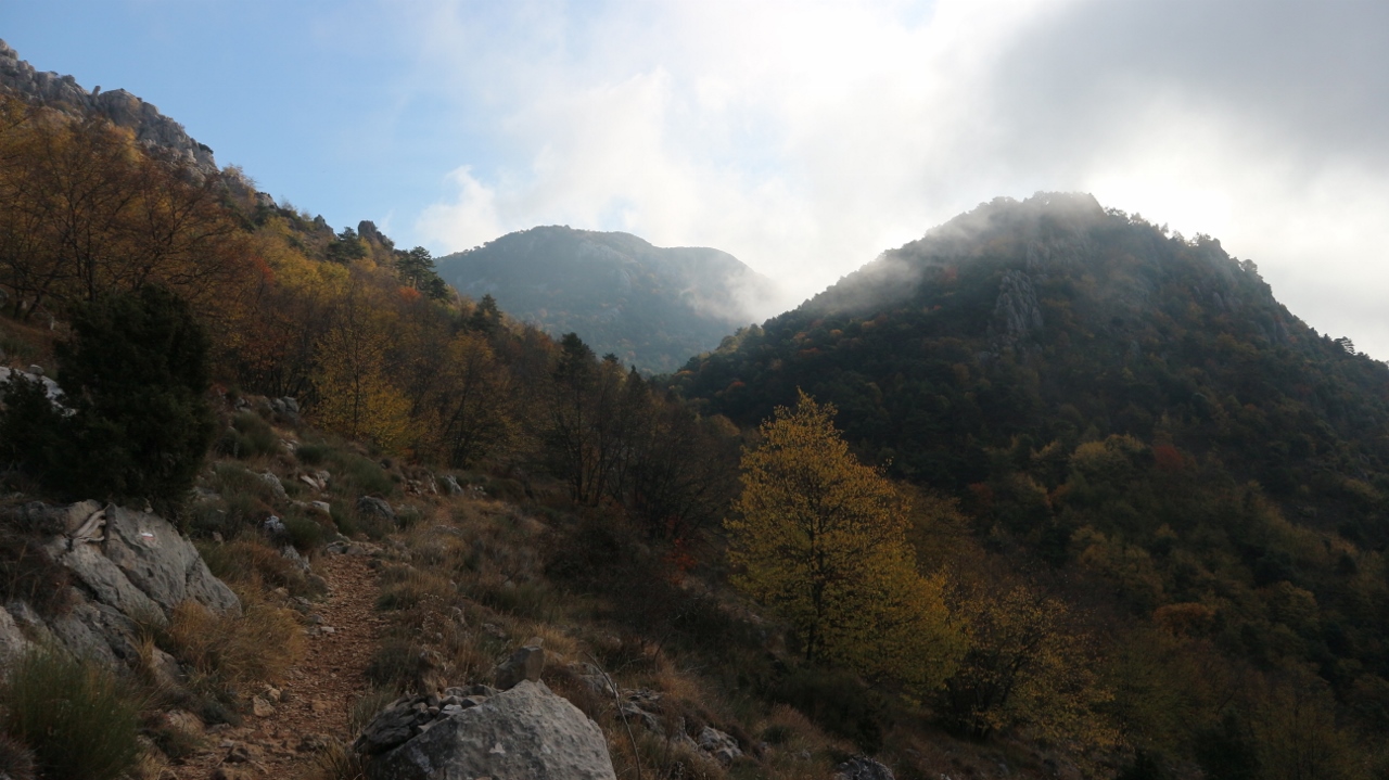
I alighted in Sospel at 13.30 and didn't waste any time in setting off on the trail. Finding the route was a simple task of crossing over the very pretty bridge in the centre of the village and once I spotted the familiar red and white paint marks, I followed them for four kilometers on the quiet little road. I had neglected to stock up with water at the start, and it was pretty obvious right from the get-go that things were pretty arid and water would not be easy to come by. Every gully and culvert on the hillside was dusty and dry. There obviously hadn't been much in the way of rain in these parts all summer. It was also really quite warm, with the temperatures in the mid twenties. All this combined with my fatigue from the traveling, meant that I was under a bit of pressure right from the start. The road initially stayed near the river but after a couple of kilometres it rose gradually and gained a couple of hundred meters in height. Suddenly, at Beroulf the trail left the road and dropped steeply through the woods. It then crossed the river and rose up again to meet another road. Here I found a water-source and enjoyed a long drink and filled up my water bottle. As I crossed the road where the trail once again entered the woods, I was startled and delighted, when three deer bolted out of the trees onto the road before making a swift return when they saw me, just ten metres away. The trail rose steeply through the woods and gained over 500mtrs in height until it reached the 900mtr contour under the impressive rocky prow of Cime de Penas(1008mtrs). This was a great vantage point and I was able for the first time to fully appreciate the colour and beauty of these forested mountains. All my hopes for delightful Autumn colour were being realized.
 |
| Sospel |


I was struggling to be honest, sweating out far more liquid than I was taking in, so I guess dehydration was also taking its toll. I was conscious of the time restrains I had for today's hike, (starting so late and wanting to be settled before dark), so I pressed on. There isn't that much information to be found online on the Gr52A, but the one site I did find, suggested that today's stage, (Sospel to Moulinet), would take 6.5 hours. This would mean that it would be well after dark before I reached Moulinet, if I stuck to that timetable. With that in mind, I kept up a reasonable pace despite the fatigue I was feeling. The trail now dropped again into the woods, traversed some steep and rocky ground, before heading towards Granges de Cous. At a junction in the trail, I opted to climb up a steep path to point 962mtrs on the ridge above and followed this to Pas de la Capelette. This perhaps added a few metres to the climbing, but shaved a couple of kilometers off the distance. Once on the ridge I could see Moulinet nestling at the head of the valley below and I was very relieved to have all the climbing for the day done and dusted. I was also pleased with the time and I was now confident that I would reach the village well before dark. The trail contoured around under Cime du Simon (1489mtrs) losing height gently all the while until finally it dropped steeply through the woods and entering the sleepy village. It was just six pm so it had taken me just four and a half hours to get there. Now all I had to do was find somewhere to camp for the night. I went into a little shop and asked the girl there if she knew where the campsite was but her English was as bad as my French and I left more confused than when I went in. I walked down past the church and where the road curved into the village there was a sign for camping that pointed in both directions. Result ! Now all I had to do was pick one and head for that.

 |
| One of the many narrow little lanes in Moulinet |
 |
| Not the best pic but if you look carefully you can see a boar looking back at me |
I opted for the one on my right and set off. This way climbed out of the village before entering a narrow gorge that sliced through the woods. Just outside the village I heard a lot of rustling in the leaf covered ground where perhaps a dozen beehives stood. I was delighted to see six or seven wild boar snuffling about but as soon as they spotted me they bolted into the trees. It was my first time seeing wild boar and I was delighted. I walked on for several hundred more meters but if anything the ground became steeper and narrower and this coupled with signs for rockfall danger over the next few kilometers made me think that the campsite could be quite a ways away. I was pretty whacked by now so I decided to cut my losses and turn back and try for the site on the other side of the village. On the way back I saw that the boars were once again to be seen on some steep ground about ten metres above the road. One was a pretty big beastie and had a fairly ferocious look about him. I walked on and I was a little startled when the boars ran down a ramp from the higher ground to the road (I was gone about 20mtrs past them) and then relieved when they ran across the road and vanished into the woods. I once again entered the village and set off out the other side in search of the campsite. It was now starting to get dark and I was anxious to get settled. I walked for about a mile and again there was no sign of a campsite so I very wearily returned to the village. There was a cafe/pub open in the square with a very unpromising hotel sign over it. I entered and inquired about a room but they were closed, then miracle of miracles the guy pointed to the large Mayors building just across the square where he informed me there was a gite. Everything was in darkness and it didn't look too promising but I went in the front door and after trying all the doors as I climbed the three flights of stairs I was astonished and delighted when the last one opened and I entered a large space with hot showers and excellent bunk beds. It was now well after 7pm so my day had been extended by over an hour so after around 13kilometers and over 1000mtrs of ascent but it felt so so good to drop the bag and shower. A very comfortable night followed.
Sunday October 22nd;
I should say that the weather forecast for the entirety of the trip was fabulous. Blue skies and no rain was what was promised and that is what basically what transpired. Emerging into a sleepy Moulinet on a calm sunny Sunday morning I set off on the next stage of the trek.Just on the northern edge of the village the trail rises up through some open scrub-land that offer very pleasant views back down the valley and ahead to higher mountains. The first target for today was Col de Turini at 1674mtrs. I was feeling better today and the bag still felt heavy but I made good steady progress. After the open ground the trail once again entered woodland and climbed gently enough until finally I reached the crest of the ridge at Baisse de Patron. Here I was at just over 1600 mtrs and expansive views were to be enjoyed across large swathes of beautiful forested mountains and some peaks that rose above 2000 mtrs. Over the next few kilometres the trail rose to above 1700mtrs before finally dropping down to Col du Turini. There are a couple of small hotels here and some people were milling about getting ready to enjoy lunch. As I had been on the move for three and a half hours I decided that I would relax and have a bite to eat myself before heading off on the next section of the day. It felt great to drop the bag for a while. It was sunny at the Col and it was a real treat to sit and soak up the rays. My lunch was a simple affair consisting of half a baguette and delicious cheese, all washed down by cool clear water.
 |
| Leaving Moulinet behind |


Next up was the long gentle descent to the village of last Bollene Vesubie about eight kilometres away. Very quickly I left the sunshine and entered once again the forest. The high ground was to my left and high above hiding just behind the crest the sun always seemed to be just out of range. Up here at over 5000ft in the shade it certainly felt more like autumn but the going was easy as I followed for the most part forestry roads and I was able to enjoy nice views into and across the deep valley. Did I say that the trip to the village was down hill?. Well it was until I reached the 500mtr contour where I found I had over 200mtrs to climb to reach the village. This came as something of a shock to the system and as it was again quite warm down here but slow and steady steps worked their magic again and I was soon walking through the charming sleepy village. It was still quite early (14.30 pm) so I decided I had ample time to get to Belvedere about five kilometres further on. After a long drink from the village fountain and another bite to I set off again on my journey. Now from a cursory look at the map (which of course I was guilty of) the section between the two villages seems fairly level and straightforward. Well such a look gives a very wrong assessment. First off you drop 100 mtrs into a glen before rising over 250mtrs to a place called Flaut which seems to be an abandoned military barracks before again losing almost 200mtrs before the final 140mtr climb to Belvedere. I walked into a deserted but thankfully open gite d'etape at the start of Belvedere just after 5pm a very tired boy. It had been over an eight hours day and at a very rough estimate I had covered 25 kilometres and climbed about 1600 mtrs. It made it a worthy effort in my book and I rested easy and content for the evening before enjoying a good sleep.
 |
| Below La Bollene Vesubie |
 |
| Above it and heading for Belvedere |
 |
| Evening light and views from the Gite |
 |
| Belvedere |
Monday October 23rd;
Today I hoped to reach the village of St Dalmas which is the starting point of the Gr52. There didn't appear to be many big climbs in todays outing but I knew things could appear deceptive on the map so I was prepared for surprises. The Gr leaves the village on the northern side and climbs gently up through the woods. One problem with walking in the woods is the restricted views. Today's outing was particularly bad in that respect and long periods of time passed with nothing to draw the eye but the immediate surroundings. Not that this is too much of an issue when your immediate surroundings are as beautiful as a deciduous forest that at times is a riot of colour. Anyway, eventually after around five kilometres and at around the 1100mtr contour the trail starts to drop towards Berthemont les Bains where I hoped to replenish my water supplies. Another problem that can be encountered while walking through the forest in the autumn is that the trail can become a little difficult to follow due to fallen leaves. This is especially the case when the predominant variety is the Sweet Chestnut. It deposits heavy layers of crisp leaves that at times completely coat the forest floor and this can lead to problems. Well that's my excuse and I'm sticking to it 😀. After saying that it will come as no surprise when I reveal that just after starting the descent I lost the trail and after following a false one for a couple of hundred metres I found myself scrabbling about on in a bouldery steep wide gully trying to find the way ahead. Eventually I returned to where I last saw a marker and after very careful scrutiny I spotted the correct route and set off again. It is quite easy to become disorientated in an enclosing treescape and sometimes the path seems to take a non logical direction and also good concentration is required to spot all the red and white markings.
 |
| Back to Belvedere |
 |
| St Dalmas on the hillside in the distance |
 |
| Sometimes it isn't easy to see the way ahead |
 |
| Higher mountains beckon |
After finally reaching "les Bains" (it had taken me nearly three hours,,where does the time go?) the trail starts to climb again. Initially the going is gentle enough but after a while the track winds up some steep ground until after a total of nearly 300mtrs of ascent you reach the crest of a ridge. Finally here some expansive views are to be enjoyed and warm sunshine only adds to the joy. Time was moving on and I didn't delay too long before setting off down again.The next section would drop down to a lovely open plateau at 1086mtrs before joining a dirt road that contoured easily all the way to the large village of St Martin-Vesubie some six kilometres distant. Remember my excuse of heavy leaf cover for losing the trail??. Well now I can't use that one😖. Not too long into the descent I arrived at a stream where I once again partook of some cool refreshment. After a brief respite I set off on the trail on the other side. This faded and disappeared after a short spell and I found myself once again confused. I returned to the stream where I once again searched high and low to try and re-find the trail, all to no avail. It isn't as if I had either energy or time to spare and I was getting mightily pissed off. I eventually decided to return back beyond the stream where I discovered the switchback I missed originally. I had followed the obvious track to the stream but now I gratefully followed the markings once again. The woods around and below Le Bioulet were a riot of glorious colour but my pair of navigational transgressions had left me with limited time to spare so I set off on the road to Vesubie. This proved a very pleasant walk and there was little or nothing in the way of climbing or descending the whole way.
 |
| Stunning colour |
 |
| St Dalmas |
The trail doesn't actually enter the village but instead skirts above and to the east of it. Alas once again the views were very restricted and I never really got a decent look at it. About two kilometres before Vesubie the dirt road becomes tarmac and at St Antoine I met traffic for the first time. The Gr rounds the northern side of the village and stays on the road for nearly the next two kilometres until you reach St Nicolas where you cross the river and join another road. Remember my two previous excuses for losing the trail so far today??, well now I have another one to add. I'm a silly bollix that leaves the map in the rucksack and couldn't be bothered to stop and take a look at it when the way ahead isn't immediately obvious 😧. Upon reaching the new road I turned left and followed it for a kilometre almost back to the village. After not seeing the markings for that whole time I then stopped and looked at the map. Realizing my error (belatedly) I saw that rather than returning to rejoin the Gr where I had joined this road I could follow a different trail from nearby and join the Gr at la Colmiane. No harm done but another lesson learned. I found the trail easily and followed it up through the woods as it gained another 500mtrs in height. About a kilometre before la Colmaine you reach an open recreation area with a small lake that tempted me as a possible place to stop and camp but it was getting decidedly chilly so I decided to head to St Dalmas where there was a gite and stay in that. From la Colmiane (a ski resort with hotels and shops) there was just over two kilometres left to go so I set off down again. St Dalmas is at an altitude of about 1250mtrs and most of the height loss was done in the first kilometre which left a pleasant downhill stroll for the remainder. About a kilometre before the village I passed a campsite but I pressed on for the gite. Unfortunately the gite was closed so after grabbing a few beers in the surprisingly fine store in the small village I had to walk the kilometre back to the campsite. I checked in at 17.20 which meant it had been not far short of a nine hour day thanks to my few navigational adventures. I was weary but the superb showers went a fair way to reviving me and I was soon getting ready for dinner. That is until my new Primus stove literally snapped in two as I attached it to the gas canister...WTF???. I stared stupefied at it in my hands as I struggled to believe what had happened. I asked a pair of nearby campers if I could borrow theirs and they kindly agreed. I was okay for this evening but what would I do for the rest of the trip??.

Tuesday October 24th;
I had a somewhat restless night and it wasn't all to do with trying to figure out how to cook for the rest of the trip. It had gotten a bit chilly overnight and I was starting to wonder if bringing just a one season sleeping bag with me to the mountains at the end of October was really such a good idea. It couldn't have been much above freezing last night and despite wearing almost all my clothes the cold still crept in. I had decided to have a look in the store in the village for a stove and if unsuccessful I would continue on the trail and light a fire that evening to cook on. I had inquired in the campsite about sports stores nearby and I was told that there was one in Vesubie but that would mean climbing up to la Colmaine and dropping 500mtrs down to the village and of course reversing that trip, all without the guarantee that they would have a stove or even be open, so fire seemed the best option. Remarkably they did have a stove in the village store but it was a large quite cumbersome yoke and it was the type that pierced a gas canister and so would have to remain attached at all times. Not ideal so I left it.
 |
| Above St Dalmas |
 |
| Higher open ground ahead |

Clear skies overnight didn't change today and it was a stellar calm sunny morning as I joined the Gr52 for the next stage of my little adventure. I planned on taking seven days to complete the route which allowed ample time to add little extras on the way if I so desired. Today I planned to go as far as Vascerie du Collet which is a regular camping spot on the route and most importantly had a water source. The trail heads due north in a glen before entering open mountain pastures. This is what I was waiting for. It was great to leave the forest behind and finally get the feeling that you were entering the high mountains. The climbing was never too steep but it was steady and good height was gained relatively quickly. The mountains around me were now reaching up to over 2500mtrs and while they were fairly rounded and covered by pastureland they were still big boyos. My route reached a mountain road and skirted it a bit before crossing it at over the 2000mtr contour and entering more remote and wilder lands as it headed for Col du Barn which at over 2400mtrs would be the highest point of the day. I was really enjoying myself today and feeling quite strong as well. As I rose above the 2200mtr mark the landscape got wilder and wilder with rounded grassy slopes giving way to rocky coums and some jagged cliffs. I stopped for a bite to eat at an almost dry mountain lake before Col du Barn and even here at nearly 2400mtrs there was real heat in the sun.
 |
| 3000mtr peaks seen from Col du Barn |
I was soon over the col and there followed a nice easy descent towards Vacherie, initially on open ground before entering the woods once again at around the 2100mtr contour. It is always amazing how much mountains and scenery varies from one valley to the next and here was no different. Once beyond the col the landscape was wilder and rougher and the vistas ahead were of higher and wilder peaks. I wasn't too long reaching my camping spot for the day and it felt strange to be done and dusted at 14.30, just six hours after setting off. The signs of heavy usage of this place by cattle were very obvious but it had been a while since they had been here and I soon settled on a nice level sunny spot and set up my home for the evening. I was at 1850mtrs altitude and I was a bit worried about how chilly it would get overnight (especially when there was still ice to be seen in the nearby streams) but there was little I could do about it now unless I could somehow conjure up my down sleeping bag. Anyhow it was beautifully warm now and I was even able to go shirtless and soak up some sun. I also set about gathering all I needed to start a small fire. All about there was super dry bits of fir branches and in these arid conditions I was confident that lighting a fire would not be difficult and so it proved to be the case. A small circle of stones encased some dry grass and twigs and this flared to life straight away and then I just topped this off with some short bits of wood. I soon had a pot of boiling water and I just whiled away the hours. Around five pm the sun set behind the hills and then the temperature started to drop swiftly. By six pm it was only six degrees and by seven if had dropped to three degrees...Oh dear I feared a cold night lay ahead😟 and so it proved to be.
 |
| Things suddenly becoming more rugged |
 |
| The view from my tent |
 |
| Camping heaven...until it got too cold :) |
Wednesday October 25th;
Despite wearing everything I had with me the cold crept through as the night progressed. I wasn't in any danger or anything but sleep proved elusive and the hours dragged into the small hours. Suddenly my tent gave a couple of shakes as though something had pulled the fabric. Startled and alert I sat up and awaited developments. A few seconds later my walking poles were disturbed and I put on my torch and went outside for a look. I came face to face with a fox who stood and faced me just a few yards from the tent. It had no fear of me and we stood regarding each other for a few moments. I shooed and waved my arms but it stood its ground. It wasn't until I picked up a walking pole by the tent that it moved a few yards further away. My word what a beautiful creature it was, a perfectly groomed coat glistened gold and white in the torchlight and those intelligent eyes stared back at me and calculated how it would get something to eat. I was both enchanted and determined to prevent the little bugger wrecking my tent or store of food. Mini charges' arms and stick waving about made it retreat several more metres but it was determined. I picked up a few small stones and lobbed them at it which drove it another ways back. One or two stones gave it a bit of a fright and it eventually retreated into the nearby woods. I wasn't convinced that it was gone and sure enough a minute or two later I could see a pair of golden eyes looking back at me and he tried his luck once more. A few more stones eventually convince it to look elsewhere and I didn't see it again. There was no way I was going to relax back inside the tent and since it was only now 5am I had a cold couple hours outside as I awaited the arrival of dawn. I lit a small fire and this offered at least the illusion of heat and it helped to pass the time as well. I'm not really a fan of the idea of lighting campfires as I feel they leave a scar on the ground and can quickly despoil an area and that is entirely aside from the dangers they pose especially in a dry environment like this. Still needs must and the warming brew certainly was appreciated.
 |
| It wasn't just the deciduous trees putting on a show |

I was cold and keen to get moving and I was packed up and on the move by 07.30am. It was no surprise to see that the runnels of water had frozen solid overnight. Today the target was to reach the Refuge du Cougourde which nestled under the mountain ridge that forms the border between France and Italy. First up though was the gentle climb up through the beautiful golden forest of Larch that predominated these slopes until it reaches Col de Salese just a couple of hundred metres higher than the camp. This served to get the blood pumping a little and I was soon into a comfortable rhythm. After the col the trail runs alongside a river that cuts through the woods for the next four kilometres. There are plenty of places along here where it would be possible to comfortably camp for the night and indeed if the cattle were still about where I camped these places would offer a better option. Anyhow the going was easy on the gentle well made trail and eventually the trail joins the road for the last couple of kilometres to Le Boreon at 1500mtrs where there is a gite (closed for the season). Once again the trail enters the woods and climbs steadily past a closed private refuge until at over the 1900 mtr contour the trail splits and I turned and headed for the refuge. I hadn't realized that the refuge would be so near and it was before 1pm when I dropped my bag.
 |
| The views around Refuge Cougourd weren't too shabby |


Even though I had taken things quite easily and eaten lunch etc it was still less than a five hour day. I felt a little guilty about stopping so soon but the alternative was to continue for another five or six hours to Refuge de Nice (which didn't appeal) or find somewhere to camp en-route and suffer another frigid night (which certainly didn't appeal) so I settled in for the day. having so much time allowed me the luxury of soaking in my spectacular surroundings. CAF refuges are usually spectacularly situated and this one was no different. A semi circle of gnarly peaks rose to almost 3000mtrs above and behind the refuge. Caire de Cougourde (2921mtrs) especially drew the eye and despite its forbidding visage it offers a hiking route to the summit. I was tempted to give it a go but lassitude won the day and I stayed put. The guardian was a bit dour and seemed a little put out when I asked to stay and even more so when I asked for half board but he eventually agreed that I could have dinner. He said the dormitory needed cleaning and wouldn't be ready until after three so I settled outside and waited. At half past two he appeared and said he would have to go down to the valley but he would be back before six. He was a bit of a bollocks and it all meant that it was after six before I could settle indoors for the night and by then it was quite cold again. Dinner though was very tasty and set me up for a nice warm nights sleep.
Thursday October 26th;
After a nice breakfast I left the hut at 9am and set off on the next stage of the trek. The target for today was the Refuge de Nice which promised to be a not too taxing day. The weather was once again perfect with clear blue skies and no wind. It wasn't cold either and there was no sign of any frost to be seen. The hut is situated at 2100mtrs but a trail contours easily around the mountain and rejoins the Gr52 at almost 2200mtrs so there is no need to lose any height (always a goo thing). Next you come to the pretty Lac de Trecolpas and another easy kilometre of walking follows before you reach the steeper ground that rises to the first pass of the day Pas des Ladres at 2448mtrs. Is was as I approached here that I saw my first Chamois of this trip and I was surprised how tame (relative to ones I have seen before) and accepting they were of me. This is also a sign that you are now in a high Alpine environment and just looking around at the spectacular peaks that enveloped the landscape confirmed that. I soon reached the pass and as there was a trail leading to the summit of the nearby Cime d'Lagnelliere, which rose to 2700mtrs, it seemed too good an opportunity to miss so I dropped the big bag and armed with my little Karrimor foldable bag (just 30grams) I set off up. Traveling light was a joy and I wasn't too long covering the kilometre or so to the summit. The final few metres offered some nice scrambling and that too added to the outing. Wow but the views were good. North East and West Alpine peaks stretched into the distance and to the south the Mediterranean glistened. It was warm and wind free and it was such a treat to relax and luxuriate in my surroundings. It was a great start to the day.
 |
| Lac des Trecolpas |
 |
| Summit views |
 |
| The Med isn't that far away |
Returning to my bag I set off down towards la Madone de Fenestra where there is a curious collection of buildings, including a CAF refuge, a church and an hotel. Below that again is another dairy where cheese can be bought. The lowest point of the trail is at 1850mtrs so a substantial amount of height had been lost and as the next pass to be negotiated was Pas du Colombia at 2548 mtrs there was a lot of climbing yet to do. The trail rises initially up the opposite side of the valley I had just come down but after a while it turns West and traverses wild rugged rocky ground under Petition Caire and Caire Barely before finally zig-zagging up the wide screen slopes to the narrow rocky pass. Once at the passport new spectacular views appear and beckon you on. Some care is needed initially on the descent as it is narrow rocky and steep and using your hands is sometimes useful. Shortly after the pass I met another hiker heading in the same direction. He was from Scotland and was heading for the Refuge de Nice like myself so we travelled on together. His name was Owen Murray and he had started from Vesubie and hiked through into Italy and crossed back just that morning. I also discovered that he had done many major hikes in both Europe and South America and it was great to listen to him and learn from his experiences. We arrived at the beautifully situated refuge at just after 4am and a very convivial evening ensued. We both carried our food and I was able to use his stove to cook. The guardian was very pleasant and there were several other groups staying. Todays outing had taken around seven hours and involved over 1400mtrs of climbing so it felt like I had done a worthy day.
 |
| Madone de Fenestra |
 |
| Approaching Pas de Colombia |
 |
| The very narrow pass |
 |
| Approaching Refuge de Nice |
Friday October 27th;
Oren was heading for the Refuge de Marveilles which was my destination as well so we kept each other company again today. There is a spectacular peak rising behind the hut (Cime Nire 2666mtrs) and the previous evening I had asked the guardian if it was easy to climb it. He misunderstood which peak I meant (I guess) which meant that we went as far as the lake above the hut and from there we turned and climbed broken ground to have a look at the west side of the mountain in the hope that an obvious line could be seen to the summit. There was an obvious line all right but it was steep and rocky and I would guess that it went at about VDiff so we went back to the lake and turned our attentions to the nearby peak Tete du Lac Autier (2740mtrs) which did have an easy way to the top via a wide laid back gully. As we started up I was teased by the glimpse of the horns of a male Ibex and I went onto the rock on the left of the gully to try and get a picture of him but he was nowhere to be seen when I got there. For the next while I enjoyed a great scramble up this rock until I was most of the way up the gully. Above the gully the ground lays back a bit and the final slopes to the summit soon pass. It was great to relax there for a while and it made for a nice little outing. We returned the same way and returned to the lake where we rejoined the Gr as it headed for the first pass of the day Baisse du Basto which at 2693mtrs wasn't too much lower than the peak we had just climbed.
 |
| Wild and wonderful ground above the refuge |
 |
| More summit views |
 |
| Oren Murray |
Refuge du Nice is situated at 2232mtrs and the valley that led to the pass rises gently for the first couple of kilometres through the spectacular rugged landscape. This is a true Alpine environment and everywhere you looked rugged peaks soared. At around the 2400mtr contour the climbing gets steeper and is sustained all the way to the pass. We saw our second Ermine of the morning at the pass and they really stuck out in their snow white pelts. After a bite to eat at the pass we set off on the trail that contours around the eastern slopes of Tete Nord and Tete Sud de Basto as it heads for the next pass Baisse de Valmasque 2549mtrs. This contouring means that there is only 200mtrs height to be gained to reach Baisse de Valmasque. Even so the going is not that easy as most of this section is through large boulders and a lot of twisting and turning and hopping from rock to rock is involved. The pass was a spectacular place to relax a while and look up at the nearby tops and down into the famous Valle des Merveilles
 |
| Rough ground |
 |
| Looking back at Lac Valmasque |
 |
| Entering the Valle des Mervieilles |
 |
| Some of the ancient artwork |
 |
| Not ancient but a tradition of soldiers writing their names. Some wonderful caligraphy |
 |
| Approaching the Refuge des Meirvieilles |
Since before I came out here I had been looking forward to reaching the Vallee des Merveilles where ancient rock art is to be found. This highly sensitive environment is strictly regulated and no camping/bivouacking is allowed and even the use of walking poles is forbidden. We dropped down into the narrow valley and shortly after passing a couple of small dried up lakes we reached some info boards about the art. One thing that became clear straight away was that you were not allowed off the path and I guess that this is totally understandable given the fragile nature of the art. We made our way through the valley and we did look at a couple of pieces en route but it was also clear that in order to see much of the carvings a guide would be necessary so we pressed on. It is only a couple of kilometres after the valley to reach the Refuge des Merveilles 2111mtrs which overlooks a lake. We settled in to the rather old fashioned and dark refuge which again had several other parties staying there. Today we had climbed (including the recce of the first peak) around 1000mtrs but it hadn't been too taxing a day. Without climbing the extra peak it would be a short easy outing. I don't know if it was because there was a fault or because the solar panels weren't working but there was so showers available and only at dinnertime did a couple of spotlights over the table come on. Very atmospheric 👥Still a pleasant evening followed and a good nights sleep enjoyed.
Saturday October 28th;
Oren was heading to Tende today so we parted ways and I set off from the hut alone.I wasn't exactly sure where I would stay this evening as I had the option of using the tent or staying in a Gite. That was for later on and the first challenge of the day was reaching Pas du Diable 2450mtrs. The trail rose easily through rugged wild ground and passed three lakes on the way. Finally I reached the small Lacs du Diable and turned for the nearby pass. I toyed with the idea of climbing Cime du Diable 2685mtrs but I don't know why but it didn't appeal and I left it for another time. Once I reached the pass the trail dropped easily and traversed under Mont Capelet. It was clear that I was now leaving the high mountains behind and the slopes ahead were predominantly grassy pastures. It felt like a landmark of the journey and felt like the descent to the Mediterranean had begun. I had filled my water bottles earlier as it was clear from the map that the next section of the hike was on or near the crest of the broad ridge and water would be difficult or impossible to come by. Chamois were still plentiful and for the next few kilometres I saw lots grazing all about. I reached Baisse Cavaline at 2100mtrs and basically from there the trail contoured one side or the other of the ridge until it reached Pointe des Tres Communes at 2080mtrs. This was an interesting place as it had a lot of paraphernalia left over from World War Two. Disused bunkers and barracks were to be found and served as a sobering reminder that here in this beautiful place (and not that terribly long ago) countries that are now close friends tore each other apart.


 |
| After leaving the refuge |
 |
| Looking down from Pas du Diable |

It was still quite early in the day but I had to decide where I would base myself for the night. On one map the Gr52 heads east to the nearby Plan Caval before turning south and heading all the way to Sospel but as I had three days left to reach Menton I decided to follow the directions of the other map (and I guess the more up to date one as the signs headed this way) and I headed for Baisse de Camp d'Argent where there was a gite. It would make for a short day ( only 4 hours) but at least I would have somewhere warm to sleep tonight. This was one of the few places where the trail follows the road but before too long I reached the Baisse. Here was a collection of shops and a large hotel and of course my gite. Alas they were all closed so I had no choice but to turn and continue on my way. My water had run out so I was resigned to having to eventually drop down quite low somewhere on the way in order to get some. For a while the trail went through Pine forest before exiting and contouring scrubby dry slopes as it headed for Cabanes Vieilles where more old military barracks are to be found. A fantastic source of information on the many fortified sites can be found on this website...http://www.fortiffsere.fr/.

 |
| It wouldn't be easy to run away with this door |
 |
| Impressive fortification |
 |
| Cabanes Vieilles |
If I had followed the route on the other map it would have been just over two kilometres to reach this point instead of the eight I had taken but what harm, it was after all why I was here :). One big bonus was, as I approached the Cabanes I came across nine or ten cows relaxing in the warm sunshine and there was a large water trough being fed my lovely sweet fresh water. I sat and drank my fill and "enjoyed" the attentions of a large curious bovine that threatened to drool all over my clothes. I filled up my bottles and headed on in search of a place to camp for the night. I passed near another Vacherie (dairy) and after climbing up the far side of a glen I reached a nice open pasture that had home written all over it. I was again at up at around 1850mtrs and I feared I would have another cold night ahead but this area seemed too good a spot to pass up. I set up my home and once again got a little fire going and enjoyed the next couple of hours before the sun lost its heat and the cold settled in. The sunset was one of the most beautiful I have ever seen and made the discomfort through the chilly night almost worth it.


Sunday October 29th;
The one good thing about last night was I didn't have any nocturnal visitors but once again the cold crept in insidiously and I found myself counting the hours until dawn. I got up in the gloaming and after trying halfheartedly and failing to get a fire going I had a cold water and bread breakfast and once packed up set off for Sospel. I had crossed a stream below the dairy I had passed the previous afternoon and I went back to replenish my water supply. When I reached it it was clear that the water was really just an outflow from the dairy and it didn't look too clean so I left it. I knew there wouldn't be any to be found before Sospel but I reasoned it was almost all downhill so I should be okay until I got there. The walk today was very similar to yesterday as it contoured one side or the other of the ridge until after six kilometres you reach the curiously named top called Mangiabo at 1821mtrs. This was a great spot to pause and look down on the now considerably nearer Med and Sospel could also be seen in the valley floor ahead.The path now dropped to the west side and after losing a couple of hundred metres in height I once again entered the forest. There was still a fair ways to go and a lot of height to lose so I didn't delay. Not that I didn't stop from time to time to once again marvel at the glorious colours that decorated the woodland and there was even a huge gun barrel (one assumes a relic from WW2) rusting away in a clearing.
 |
| Back towards the previous days ground |
 |
| Straightforward walking ahead |
 |
| Moulinet comes into view again |


It got warmer as I got lower and I began to feel that a nice cool beer would go down super well when I reached the village and this spurred me on even more. The remainder of the descent went well and it was just after midday when I entered the busy village. The first order of business was to have a long drink at the first fountain I came to and it was glorious. It must have been around twenty degrees down here and I was quite thirsty. It had taken just four hours to reach this point so todays effort really could have been combined with the day before quite easily. Not that my walking was over for the day because first I discovered that the municipal campsite was closed and after searching for the gite I discovered that this and the hotel were closed for renovations. After searching in vain for alternative accommodation I returned to the campsite and pitched my tent there anyway.While searching for somewhere to bed down I came across the cathedral in a quaint square. It's size and grandeur was something of a surprise and it was even more spectacular inside. Despite my fatigue I was enchanted and fascinated by it's beauty. It rivaled other churches can be found in large cities and seemed somewhat out of place in a village and there wasn't a tourist in sight. I also had discovered that there weren't any shops open but I did manage to catch the Boulangerie before it closed and I got fresh bread and I had a couple of beers and a bite to eat in a nice cafe before I settled into the campsite for the evening.. And it was warmer down at 300mtrs than the night before.


Monday October 30th;
After a peaceful night I rose and "enjoyed" the same breakfast as yesterday and I was soon packed up and on the move again. The little supermarket was open so I got some "Boursin" (a cream cheese) for my baguette so I was set for the day. I would have really liked to have picked up a big 16ounce coffee or similar but this doesn't exist in these parts so I set off on my final leg of the trek. The trail follows a quiet little singletrack road for the first couple of kilometres before once again entering the woods. A mix of forest roads and rough trail climbs steadily and offers occasional views to the surrounding riot of Autumnal colour. Wow, it was had to believe that I was on my tenth day of hiking today. Not only had the time flown but I didn't have any aches or pains and I felt I could have gone on forever. Not that the last few days had been over taking but nevertheless it was reassuring to feel so good. Even though the mountains were getting lower as I neared the coast, that didn't mean the climbing was over. The first target of the day was Col du Razet at 1032mtrs. Upon reaching this I had already done a healthy 700mtrs of climbing. Disappointingly some cloud had begun to form on the mountaintops (I have absolutely no luck with the weather 😎) but I remained just below and to be fair the views were still almost completely unrestricted. The trail contoured under Gramondo 1339mtrs which would have made a lovely final climb for me but as cloud clung to its top, there didn't seem much point in making the effort so I somewhat reluctantly passed its craggy limestone flanks by.
 |
| So long Sospel |
 |
| Amazing woodland colours |
 |
| Journeys end ahead |

One very noticeable difference in the landscape was that there was much more white limestone to be seen and the forest gradually was becoming more scrubby as I guess the climate became hotter and drier. It made the going interesting but a less that delightful side effect was the deterioration of the underfoot condition of the path. Rough stony gravel became the norm and at times it was like descending loose moraine so some care had to be taken. The trail dropped steeply through the scrub until it reached around the 700mtr contour. The coast beckoned but if I thought the climbing was done for this trip I was wrong. The path now turned and climbed another 400mtrs to Col de Bercea at 1100mtrs and here I was barely three kilometres from the coast and the views were as you can imagine spectacular. Another 400mtr drop saw me reach Plan de Lion and after a short level secton the final decent to Garavan (and the train station) began. I made short work of this and before long I was walking under the busy motorway that passes above the town. A series of narrow pathways twisted and turned between the villas and gated homes and suddenly I emerged at the rather nondescript train station. After a short wait I caught the train back to Nice and enjoyed the exotic sights of this beautiful (but completely developed) coastline. My hotel was only a couple of hundred metres from the station so I was soon settled in my room. The first order of business was to enjoy a really long cleansing and refreshing shower that washed away a weeks dirt and most of the fatigue. I had reached Garavan at 13.45 and I was in my hotel at 3pm so I had ample time to have a carefree wander down through the city and whiled away a very pleasant evening. Nice is certainly worth a visit.


 |
| Getting there |
 |
| Journeys over |
Notes and impressions ✎
Firstly I had hoped to catch the forests in their Autumn colours and I wasn't disappointed. Walking through woodland is always a joy but it is especially wonderful when the added glory of the colours of this time of year are added on. I was also incredibly fortunate with the weather. Ten days of immaculate dry clear windless weather is a true bonus any time of year but this late in the year it was a real boost and made the whole experience even more enjoyable. The first three days on the Gr52A were top quality and each of a good length. The seven days on the Gr52 were shorter in duration and the entire walk could easily have been squeezed into 6 or even 5 days but it was also great to relax in some warm sunshine and climb the couple of tops. Combining the two hikes also allowed for a greater variation in landscapes. While it was lovely to walk through the woods for the first few days it was also wonderful to rise into the more rugged Alpine environment that was on the Gr52. If I was going back again (and I would love to) I would do something like Oren did and extend the trip by crossing over the border into Italy and exploring that area as well. It was also something of a bonus to meet up with Oren and I really enjoyed his company for a couple of days. I also learned that this is quite an arid area and watersources are not always so readily available. If I was to go back I would take a bladder so that I could carry extra water if I wanted more camping options. Finally I would not make the mistake of carrying such a light sleeping bag again and in hindsight it was a silly mistake. Not only would a 2-3 season bag have been more comfortable but I would also have given me the option of staying higher perhaps in between huts. All in all though it was a most enjoyable experience and definitlely a place I would like to go back to.