Where to begin??. I have been doing precious little in the way of technical climbing these past two years and the last time I went rock climbing in Snowdonia I was rubbish. I set about a training regime to try and improve my abilities and I had a partner lined up for a twelve day trip of bagging Alpine peaks. All was in place but a few weeks before I was to go I found myself dithering and having doubts and so in order to give my potential partner a reasonable chance to find another companion I decided (with something of a heavy heart) to do a hiking trip instead and broke our obligation.
Friday August 25th;
I left Dublin airport on Friday August 25th and arrived in Geneva at mid day. My next objective was to get to Champery which lies under the western slopes of the beautiful Dents du Midi. A large crowd at the passport control area had me doubting that I would make my ideal train connection at 12.50. This would allow me to arrive in Champery at 15.30 and so enable me to make reasonable progress up into the mountains that day, but with the usual Swiss efficiency the delay was minimized and I comfortably made the train. Alighting in Champery I was able to get a canister of gas in a nearby sports shop and a couple of supplies in the adjacent supermarket and I was actually trail bound at 15.40. To cap things off it was warm and sunny and was promised to remain like that for the next few days at least...result😀.
 |
| The first sight of The Dents du Midi is always wonderful |
 |
| Approaching Champery |

I found the trail out of the town easily and soon I found myself walking up through a verdant pastoral landscape with ever more spectacular ground rising skyward above. One of the first orders of business was to change out of my travel clothes once I was remote enough. It was in the high 20s at least and it felt so good to don the very lightweight shorts and T-shirt. This made things more comfortable for sure but it didn't lighten the weight of my rucksack. I'm afraid I still haven't gotten the knack of traveling light and despite taking my Alpkit Delta tent out of retirement and bringing my lightweight sleeping bag, I still had about 17kilos on my back but this included food for about 4 days. I must make a more concentrated effort to cut the load before my next trip. I don't want to go down the super light road but if I could get to around 10kilos before food I would be happy. Still, despite the weight I was moving quite well and making good progress and I was really really enjoying myself. After a while I left the farm pastures behind and entered the forestry and things took on a different ambience for a while. The trail wound it's way up and around some rocky bluffs before once again emerging into open ground above a narrow glen from where I could see the Pas d'Encel ahead which offered entry into the Susanfe valley. It was there I hoped to make my home for the night. I should add that I have been here before when, back in 2010 I climbed the Haute Cime during a very successful Alpine trip.

I was now above 1400mtrs so I had gained about 500mtrs in height so far and I was reasonably confident of reaching the upper valley before it got too late. The Swiss don't really favour camping in the wild but they usually turn a blind eye to considerate bivvying where you set up the tent late and take it down again in the morning. Also, camping within sight of huts etc is not permitted. The trail rose easily up to a pretty waterfall where a wire bridge crossed about 20mtrs above the waters. Sturdy it was for sure but it is still a little disconcerting to look through the grill to the drop below. The path then does a rising traverse to the right before folding back until it reaches the narrow and somewhat forbidding pass. Now some easy scrambling has to be done with the more exposed sections aided with ironmongery and eventually things widen out and you enter the proper Alpine environment of the Susanfe valley. Here you are at almost 2000mtrs and the Dents Blanches (over 2700 mtrs) rise at the western side, the stunning Mont Ruan (3067mtrs) lies to the south, tomorrows target the Haut Cime (3257mtrs) lies to the north and another target of the trip Le Tour Salliere (3220mtrs) rises to the east. It had been a super dry summer in these parts and the peaks were completely denuded of snow buy my oh my it was still a spectacular place to find myself. I climbed on until I was about 10 minutes below the CAS refuge Susanfe and at the 2100mtr contour. Here I found a nice grassy, sheltered spot for my tent at about 18.45. There was just a trickle of water flowing in the riverbed but it sufficed for my needs and so I was well pleased. I cooked and relaxed and gazed about in wonder into the darkness. It had been a good day.
 |
| First sight of Mont Ruan |
 |
| From the airport to here on day one. |
Saturday August 26th;
I actually had some rain during the night but I emerged in the morning to a gorgeous day with clear skies and no wind. A perfect alpine morning. It was great to set about getting breakfast ready and busying myself breaking camp and I was totally into my little adventure already. I was on the move again by 8am and the first target was the Col du Susanfe 2494mtrs where I would drop the big bag and climb to the wonderful vantage point of the Haut Cime, the highest point in the massif. Slow and steady with the big bag is the way to go but is amazing how you still eat up the ground. There were several groups on the way up after leaving the refuge and I guess it being a fine Saturday morning I was unlikely to find myself alone. I passed a few and I was passed by a couple of hill runners on the way to the barren col. This was a lovely spot to rest awhile and take in the expanded views. The distant (and not so distant) mountains were a hazy delight and the giant cliffs of Le Tour Salliere made a spectacular sight. A couple of thousand feet below the glacial turquoise lake Salanfe drew the eye but I had to turn and face up to the almost 700mtr climb that awaited to reach the Haut Cime summit.
 |
| Approaching the refuge. The Haute Cime rises ahead |
 |
| Susanfe Valley |
 |
| Towards Le Tour Salliere |
 |
| The final 250mtrs to the summit |
 |
| Top of the teeth |
I stashed my bag just above the col and packed the essentials into a brilliant little fold-able sack I had picked up before I traveled. So, vastly unburdened, I set of up the fairly steep slopes. A well trodden narrow path rose through the super fine scree and initially went to the right of a rock escarpment before turning and climbing steeply to the crest of the broad ridge. Needless to say I missed the turn on the path to the crest but I realized my error and I made my own way delicately to the crest and rejoined the correct route. The mountain was quite busy but I was enjoying the buzz of excitement that this created. Traveling light I made swift progress and after passing the Col de Paresseux at over 3000mtrs the remaining 200 mtrs passed quickly and I was able to relax and enjoy the stunning summit panorama. Space was at a premium for a little while but I found a comfy niche and whiled away a delightful twenty minutes as I munched some food and soaked in the sun and views. I returned to the col and retrieved my bag and set off on the next section of todays journey.
 |
| Towards Col d'Emanay |
 |
| Spectacular ground on Le Tour Salliere |
 |
| Possible campsite not far from the snow patches. |
 |
| 700mtr cliffs back the valley |
 |
| Camping heaven...as long as it doesn't rain |
I followed the route towards Lac de Salanfe which meant a descent to just over 1900mtrs and I then crossed the southwestern side of the lake towards the slopes that would lead to the Col d'Emaney which at 2465mtrs would add a hefty 500mtrs plus of ascent to my day to add to the 1200mtrs already done. Crossing behind the lake gives a truly spectacular view of the massive 1200mtr northeast face of the Tour Salliere. It rises in a steep series of cliffs and hanging glaciers and one feels very insignificant in its shadow. The trail to the col is gentle enough and here I got my first views of Ibex on this trip. Things were quite busy at the col as this is the access point for the popular and excellent viewpoint of the nearby peak Le Luisin 2786mtrs so, once I reached it I didn't delay in setting off down once again into the spectacular Vallon d'Emenay which is backed by 700mtr cliffs on it's western end. I was a little dismayed to see the extent of the drop in height I had to make before progress towards my next pass the Col de Barberine (2481mtrs). Fatigue was definitely beginning to become a factor as well. As I went down I scanned the area for a suitable place where I could pitch my tent and I reckoned that my best bet would be to climb from the low point up towards the col until I reached the the 2200mtr contour. I would then reach a fairly large flat(ish) area where I hoped to find somewhere suitable to call home. There were plenty of people on the trail as I went down but as soon as I reached the point where my route diverged I was once again all on my own. That is if you discount the sizeable male Ibex that I passed on my way up. There was a decent torrent of water cascading in a narrow cleft well below the flat area and here I filled up all my water bottles so I would have enough start dinner and tea etc. I trudged up to the hummocky, stony and fairly rough ground but after a bit of scouting around I found a nice spot. It was in a hollow so I seriously hoped that I wouldn't get rain in the night but I was tired and I decided that rain was unlikely so I settled in. It was just 17.30 when I dropped the bag so it had been a substantial day of nine and a half hours and I reckoned the day included around 2000mtrs of ascent with 1800mtrs of descent thrown in as well. I had hoped that there would have been a water-source nearby but it was not to be so I had to drop back down to the stream after dinner to replenish my supplies in order to have sufficient for the morning as well. I whiled away a delightful few hours before dark and I was especially thrilled when a dozen or so male Ibex congregated a couple of hundred metres from my tent at dusk and there was the occasional play fight going on. A pair would stand on their hind legs, butt heads and then the evening would echo with the resounding crash of clashed horns. It was a surreal and wonderful experience to listen to these tussles as I drifted off to sleep. It had been a good day two😀.
Sunday August 27th;
I emerged to another wonderful weather morning and once packed up I set off on the next stage of the trek. Today I hoped to climb the Tour Salliere which would hopefully prove to be another high point of the trip. The 200mtr climb to my campsite last evening meant that I only had around 250mtrs of climbing left to reach the col. This is one of the things I enjoy the most about this type of outing. Traveling of such a linear nature is constantly offering new vistas and horizons and so it proved this morning when I reach the col. The turquoise waters of the Lac d'Emisson lay 500mtrs below and new peaks soared nearly 1000mtrs on the far side. Add to this the giants of the Chamonix valley soaring to the south and it was another wondrous panorama. Once I had dropped a couple of hundred metres I was in leafy grassy pastures where lots of sheep baa-ed and bells clinked as I passed. Upon reaching the lake I turned to the right and set off on the level trail towards the northern end of the lake. After a few hundred meters I once again ditched the big bag and travelled light with my little sack. After reaching the end of the lake there is a faint trail that winds its way up and around point 2312mtrs and after crossing the river a little further on it rises again up grassy slopes at Les Chaux before finally reaching the moraine and scree slopes under the still distant Tour Salliere.There follows almost 500mtrs of fairly steep slog up this unappealing ground before you eventually reach the easier more rocky slopes that lead to a little glacier (easily crossed) which in turn allows you to reach point 3011mtrs. Now you turn and face the southeastern ridge of the Tour Salliere that rises in a series of rocky steps for 200 mtrs to the summit. It looks a bit forbidding but it is classed as Grade 11 rock so I was reasonably confident as I approached. The initial entry onto the route climbs a gully on the left of the first tower and then joins the cleaner crest of the ridge. The gully was a steep horrible affair where everything underfoot was choss and grit and frankly required care going up and I surely wasn't looking forward to going back down it. It certainly gave me the willies but I pressed on, for now. I joined the crest and climbed a couple of steep but easy rock steps but the next section was more of the same grit and rubbish covering steep scrambly ground and I just didn't fancy it. I made the decision to turn around and with some care retraced my steps and exited the route. I was a little disappointed but as I ate some lunch at point 3011mtrs and watched a pair of eagles circle the peak above, I realized that I was still in an alpine wonderland, basking in windless warm sun with stunning views so it was easy to focus on the positives.


 |
| What a view down by the lake |
 |
| A long pull up and around the rock band above on scree. |
 |
| A long way back |
 |
| The ridge |
 |
| A serious amount of silt in the river in the afternoon |
 |
| A lot of ground covered..more to do. |
I returned the way I had gone up and I had another thrill on the way down when I was overflown from behind by an eagle as it glided no more than twenty metres above me and gracefully and unhurriedly scanned the grassy ground ahead before rounding a rocky abutment and disappearing from view. Once I reached the lake I retrieved my bag and I walked out as far as the busy and hugely spectacular Barrage d'Emisson. I was once again quite weary by now and I turned my thoughts on where I would pitch my tent for tonight. As I approached the dam I scanned my first option which was to cross the dam and climb towards the Swiss side of Col de la Terrasse but everything looked so dry that I wasn't confident that I could easily find a suitable place to camp. I was also put off by the near 500mtrs of climbing that lay ahead so I opted instead to head around towards Refuge Loriaz near where I hoped to find somewhere to call home. I should say that I had planned to traverse Le Cheval Blanc and Mont Buet the following day. Well the first surprise was that the trail from the dam to the refuge was initially steep and undulating and really didn't present that much of an easier option and the next thing that became obvious was that this side of the mountains was also extremely dry and well, to cut a long story short I didn't find anywhere to pitch my tent. As I approached the refuge I could see it was very busy and I really couldn't bring myself to stay there so I opted to descend all the way to Les Montets and stay in the campsite there. It was a very weary boy that entered the site in the gathering dusk almost 12 hours after I left camp that morning. A couple of my toes became very sore on the long descent so I decided to take a days rest the following day.
Tuesday August 29th;
Another wonderful weather day beckoned as I left the campsite and set off on the next stage in my journey. Today I was going to Champex in Switzerland and my only decision was how to get there. One decision that was easy to make was to catch the gondola from Vallorcine up towards Col des Possetts which would take 700mtrs of slog up through the forestry out of my day. I actually felt fully recovered today ( I was really quite strong the day before as well but my toes needed the time to heal) and I was really looking forward to entering what would be new terrain for me today. One view I have seen oft before is the one of the gigantic triumvirate of massifs that soar above the Chamonix valley. First Chardonnay and Argentiere loom before the eye is drawn to the stunning and elegant Verte and finally the Chamonix Aguilles are themselves overlooked by the massive bulk of Mont Blanc. On a still blue sky morning such as this one has to almost pinch oneself to believe that one is in the presence of such majesty. Easy walking leads to the Col de Balme 2204mtrs which was already fairly busy. I made the mistake here of wandering into the nearby refuge and inquiring if I could fill my water-bottle. I was immediately set upon by a wizened old lady who left me in no doubt about what she thought of me even though I couldn't understand a word. It put a big grin on my face then and still does. Next time I'm there I better buy something to make it up to her 😏.


 |
| After I beat a hasty retreat...a formidable woman 😃 |
Next up was the trail that would allow me to climb the Fenetre d'Arpette and so descend to Champex. This gave a fairly easy passage that rounded Les Grandes Ottanes before eventually turning and giving stunning views up to the Glacier des Grandes and Aiguille du Tour. Eventually I reached the refuge at Les Grandes and here the trail descends until you can cross the substantial glacial torrent at Chalet du Glacier 600mtrs lower down. Wow it was warm today and I had to be careful to sip regularly at some water (not generally something I'm good at) if I was to avoid dehydration. Next up was the long climb to the Fenetre d'Arpette, a wild and rugged pass that lay a full 1100mtrs above. Slow and steady was the order of the day and I was soon able to get into a rhythm that allowed me to just keep putting one foot in front of the other and I made good progress. Eventually you leave the relative cool of the trees and thereafter the trail winds its way up the steep slopes and ever improving views are presented of the Trient plateau across the valley. Finally after a rocky and bouldery section I arrived at the narrow pass. It felt great to sit and relax for a while before dropping even more steeply on the other side before then crossing a field of huge boulders and an easier path after that. It was a long way up and it seemed a long way down but I was pleased that my toes were not an issue today. Eventually I reached the pastoral land at Arpette where I saw a little black grass snake who swiftly disappeared into a muddy hole in the ground. Easy walking on well made trails leads to the upmarket resort of Champex which hugs the small lake of the same name. I booked myself into the campsite and enjoyed a fine evening.


 |
| Looking up to the Trient Plateau |
 |
| A long way back down to the start of the climb |
 |
| The Arpette side..There are hikers in the boulder field |
 |
| Fine scenery. Towards Aiguille d'Arpette |
 |
| First glimpse of Champex |
Wednesday August 30th;
My good fortune with the weather was to run out today with heavy rain predicted to arrive in the early afternoon with the possibility of some thunderstorms. Things were looking a bit poor for the following couple of days as well. I had a fancy to climb Pointe d'Orny 3271mtrs which would get me as close as possible on this trip to a true high alpine environment. Using the chairlift from near the campsite to La Breya would allow me to easily reach 2100mtrs and so make it a relatively easy task and a short day to climb the peak. I caught the first chairlift at 8am and enjoyed a quiet contemplative twenty minute ride up the mountain. It felt wonderful to just sit and let my legs dangle above the drop and soak in the wonderful views. The Grand Combin looks amazing (as always) but it was already starting to form a bit of a cloud cap by the time I reached the end of the line. It was warm again this morning but I was only laden with my small little rucksack and wanting to get up and down before any bad weather I set off at a brisk pace. The trail is narrow and a little exposed in places as it traverses around La Breya peak but chains are there for those of a nervous disposition. After a while you are traversing under the Aguilles d'Arpette and ahead the Cabane du Trient comes into view. I kept up a decent pace and I reached the hut in an hour and a half. A brief stop to admire the excellently made Ibex sculpture in front of the hut and I was on my way again.

 |
| Approaching Cabane du Trient |
 |
| Pointe d'Orny top right but walking on bare ice didn't appeal |
 |
| Towards the Grand Combin |
 |
| Long Zip Wire |
 |
| Its a fair old distance back to the far side of the Dents du Midi |
I had hoped that there would be a trail to the Cabane d'Orny on the moraine but after negotiating the trail beyond the hut it ended at the glaciers edge and no other trail was in sight. I really didn't fancy trying to make my way along the horribly loose moraine and with bare ice on the glacier (even though it was at an easy angle) I didn't fancy that either so reluctantly I turned around and retraced my steps. I sauntered down and savoured the views and the weather even seemed to be holding very well. Again I was a little disappointed not to have reached my goal for the day but it was nice to get back to the campsite and just chill for the rest of the day. I must be getting old 😟. The bad weather didn't arrive until dusk but this allowed me to sit and watch some of the light show in the high mountains after dark. It rained into the night.
Thursday August 31st;
The rain of the previous night had cleared away and I got up to a beautiful sunny morning...NOT💧. I managed to pack up everything in the tent before finally packing up the tent itself and setting off in the rain and cloud towards La Fouly. I had booked into an auberge in La Fouly for today but if things weren't too bad I might go as far as Refugio Elana just over the border in Italy. The only people out "enjoying" the morning were ducks and fishermen at the lake. After leaving town the trail drops into the woods and it was shortly after that I met the first runner coming against me. I reckoned there was some race on as he had a number with name etc. Soon he was followed by others but I was still able to make progress along the track. After a little while the numbers coming towards me became larger and progress was more difficult and when it became a steady stream I found a wide place at a bend and decided to wait for them to pass. Three quarters of an hour later I was finally able to make some progress as the numbers thinned. I had run into the Osiers to Chamonix race of the Ultra Running festival that takes place in Chamonix each year. What was even more frustrating was discovering that I had stopped only a couple of hundred meters from the junction where the race joined my route.
 |
| Stunning village before La Fouly |
 |
| I do like walking in woodland |
 |
| Brief glimpses of the mountains from the auberge |

I walked on and the rain if anything became heavier and it wasn't too long before thunder rumbled around the hidden peaks up above. I wasn't too bothered really and I enjoy walking in the rain as things often become quite atmospheric and enchanting. I especially like walking in woodland at these times, which was what almost all of todays route involved. Even though there isn't much height difference between Champex and La Fouly the walk involves around 600mtrs of height gain so it isn't completely easy. I entered a very damp La Fouly at around 13.30 and despite having reasonably good waterproofs I was still wet through so I decided against extending my day and opted to check into the very nice Maya Joie auberge. The dorm I was in had seven other bunks of which six would later be occupied but there was lots of open space so I was able to spread out my damp stuff and even get my tent dry. A few Australians told me when they arrived that they had to wait by the trail above the town for over an hour until a safe crossing point could be found for them by their guide as a landslide had occurred high up and debris had come down a couple of gullies and swept away bridges etc. Perhaps it was just as well I had decided to stop for the day in La Fouly after all.
Thursday September 1st;
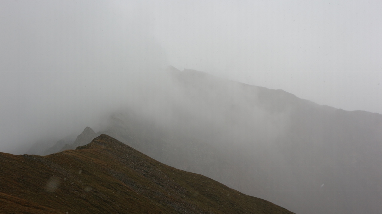
It was disappointing to discover that the mist still shrouded all views this morning and while it was lighter than yesterday it was still raining steadily as I set off on todays journey. One of the reasons for choosing this route was that it would be somewhere new to me and that I would see familiar mountains from a new and different perspective but alas it didn't seem that that would be the case today either. Still, no point in moping about it and I was still in good spirits as I set off for the first col of the day the Grand Col Ferret, which was at over 2500mtrs meant a climb of around 1000mtrs to get over it. I was feeling strong today after two short days and I found the climb pretty easy. The angle was never steep and the trail was good and smooth. As I got higher there was the odd patch of lighter grey in the sky and I hoped that I would eventually break through it and get to enjoy that most spectacular of things-a temperature inversion, but it wasn't to be. Instead when I finally passed the col and started to drop down the other side I found myself suddenly under the cloud and very soon in actual sunshine and some views were opening up in the high mountains across the valley. As I dropped down the 500mtrs to Refugio Elena my spirits soared as warm sun and mountain views again became the norm. It seemed that the mountain ridge either side of the col was a barrier to the cloud and kept the bad weather at bay. On top of this (or maybe because of it) my feeling of strength only increased and I actually jogged some of the way down to the refuge.
 |
| evidence of the landslide the following morning |
 |
| You gotta have a little rain to see the rainbow |
 |
| Refugio Elena |
The large refuge and surrounding area was quite busy and after filling my water bottle I was on my way again. Amongst the many hikers coming up against me I met my first runners😨and by the time I had gone all the way down to the parking area it was clear that today the CCC race (Courmayeur-Champex-Chamonix) race was underway. From the low point 1770mtrs there is a stiff climb up over 200mtrs and after the trail contours around towards Refugio Bonatti. I wasn't quite as accommodating today and persevered on the trail and I found I was able to most make progress relatively unhindered. The majority of the runners had passed by the time I reached the refuge, which was crowded with participants taking a food stop. Again I pressed on in the now stunning weather day and decided that I would soon start looking for a place to pitch my tent for the night. If I couldn't find anywhere I would go as far as Refugio Bertone and stop there instead. Across the stunning Val Ferret the glorious Grande Jorrasses were slowly but surely revealing themselves and before too long the trail was unencumbered with race participants. I hadn't gone that far when I came to a shelf in the mountain where a nice level meadow stretched out and a stream sprung into life at its side and I decided that I had found my home. It was still only 15.30 but I had been on the move for seven and a half hours so I decided it was a decent effort for today and besides what would be the chances of finding somewhere as good further on. A little scouting around for the perfect pitch and I had the tent up and was soon relaxing and enjoying my incredible surroundings. I have seldom enjoyed an evenings camping more as I savoured the sunshine and the finest mountain scenery in Europe.


 |
| Blue skies here but cloud persisted in Switzerland |
 |
| Things just got better and better |
Friday September 2nd;
During the night I noticed several runners out on the trail about eighty meters from the tent. I didn't take much notice but when I emerged in the morning and saw a steady trickle going by I feared the worst. Yes folks today was the day of the Ultra Tour Du Mont Blanc which is one of the toughest and most famous ultra races in the world and to cut a long story short it was more of the same on the trail. This time it would take until 13.30 for the last competitor to pass me. Its fair to say it did detract a little from the experience and if I had the choice I would walk on different days but it was still wonderful, despite all. The morning was bright and sunny yet the cloud still clung to the Col Ferret so La Fouly still seemed in cloud. I had camped only a few hundred metres from Leuchey so it was not long before I reached the refuge Bertone. Here there was another food station for the runners and it was very crowded. I pressed on and started the descent towards Courmayeur. This went well and I entered the famous ski resort at 11am and I set about finding some gas to do the remainder of my trip and a few bits of food. This was soon sorted (although I had to buy a large canister of gas 😒) and I was out of town by 11.30 and again dealing with the hoards until I had climbed up to the top of the ski area on the western side of the town.
 |
| Cloud persisted over in France as well |
 |
| First sight of Courmayeur. The way ahead climbed and followed the green slopes to the right. |
 |
| Lenticular cloud on Mont Blanc..oh dear |
 |
| The massive rock walls at the base of the Peuteray Ridge |
 |
| A little rain behind |
 |
| Massive terminal morraine slopes |
 |
| First snow of the trip |
 |
| Lovely colour in the river in Val Veny |
 |
| Refugio Elisabetta nestles under the Pyramides Calcaires |
Once here though I was above the Val Veny from which rises the series of famous ridges on the huge and savage south face of Mont Blanc. The ski area was soon left behind but the good weather was departing also. Having enjoyed a brief rain shower on the way up from the town once I entered the wilder country further on the cloud built up and settled at around the 2600mtr mark. The temperature dropped as well and when I crossed over the col at over 2400mtrs I had a brief snow shower. With the weather deteriorating I rang Refugio Elisabetta and booked myself in for that evening. By the time I had dropped the 500mtrs to the valley floor it was raining steadily and I was looking forward to reaching the refuge which I could see ahead sitting proudly under the beautiful Pyramides Calcaires. Even in the poor weather (or perhaps because of it) the setting was particularly beautiful and despite my fatigue I was enraptured by the scene ahead. Perhaps it was the cold but I found the final couple of kilometers and the two hundred meter climb to the refuge particularly tough. It was a huge relief to drop the bag in the warmth of the refuge and a particular joy to soak in the warmth of a good hot shower,,,bliss😂. They don't allow any self catering in the refuge which is fair enough but I was a little disappointed to have to carry my food and full gas can for another day. Still the food was excellent and the staff super friendly and I passed a pleasant evening in comfortable surroundings.
Saturday September 3rd;
I emerged the following morning into a clear frosty morning with a dusting of snow laying down to near the 2000mtr contour. The ridges of Mont Blanc and others were revealed in all their glory today and what a treat it was. I followed the trail from the hut up and over the pass (at over 2500mtrs) on the right side of the Pyramides and then dropped easily down into the next valley before rising from around the 2300mtr contour to reach Col de la Seigne 2516mtrs. What a view was to be had from this place. Looking east the majesty of Mont Blanc and especially the Peuteray Ridge was fully revealed. Directly above Aiguille des Glaciers and Aiguilles de Tre la Tete looked fabulous. It was truly a boon for the spirit and after having had a little poor weather I appreciated this wondrous spectacle all the more. As much as I might have wished it I couldn't stay too long and I set off down into the valley and Refuge des Motetts some 500 metres lower down. This is obviously a popular spot and lots of people were making their way up so that they too could enjoy the view. When I reached the refuge I rested a while and enjoyed a bite to eat before heading down to the next stage-post in the route Les Chapieux at 1540mtrs. It was warm and sunny today and it was such a pleasure to be out in this stunning landscape.
 |
| What a morning |
 |
| Towards Aig Tre de la Tete |
 |
| Beyond the Pyramides |
Next came the 900 mtr climb to Refuge de la Croix du Bonhomme where I had another brief rest before continuing to the next pass Col du Bonhomme. It was getting near that time again when I started to be on the lookout for somewhere to pitch my tent. The trail drops steeply until you reach easier ground a couple of hundred metres lower down and then I started to look around in earnest. Nothing quiet and level was to be seen so I said I would go as far as Refuge de la Balme at around the 1750mtr contour and stay there. I arrived at the refuge only to find it was fully booked. I asked the guardian if there was anywhere nearby to pitch a tent and lo and behold he pointed to an official bivouac area just a hundred metres away. Result😃 Seven more people arrived over the evening but it was still quiet and I slept very well.
 |
| Refuge de Motetts |
 |
| I see you😀 |
 |
| Heading for Refuge de la Croix du Bonhomme |
 |
| Campsite views |
 |
| Tomorrows route |
Monday September 4th:
My little trek through these mountains was coming to an end. I was leaving for Geneva on Tuesday evening so today was my last full day. It was really all about how far I would get today so I could get transport back to my favourite campsite in the area, Vallorcine. I had plenty of options and I could decide as the day unfolded but first up was the descent to Nant Borrant a few hundred metres lower down before I would turn and climb to the Hotel Tre la Tete. There is always a feeling of melancholy as you near the end of a trip and today was no different. It was also a little bit disappointing to be heading into familiar territory again after several days exploring areas new but I tried to focus on the positives. One of these was that I was feeling strong and this coupled with the lighter bag meant I made easy progress. I made the 500 mtr climb up to the hotel in just over forty minutes and I found that I was really hammering the estimated times for climbs these past few days. One thing that I always notice when I go to the Alps is the variety of ages that are out on the mountains. Now that I am shoving on a bit in years myself (55) it is inspiring to see so many people in their seventies and beyond out undertaking strenuous hikes. This morning though took the biscuit when I passed an elderly gentleman who appeared to be at least in his mid eighties and he was making sure and steady progress up the steepest part of the forest trail to the hotel. He was using a long handled ice axe and a walking stick for balance. Bravo Monsieur. A true inspiration.
 |
| Wild country around the Tre la Tete Hotel |
 |
| Looking down over Contamine and St Gervais |
 |
| Lunch??...I don't think so |
 |
| Back down to Chalets du Miage |
 |
| Nearly at journeys end |
 |
| The terminus of Glacier du Bionassay |

After the hotel the trail drops a bit and contours around Mont Fruegeand right into the back of the wild Combe d'Armancette above which the Domes du Miage rise. Unfortunately there was layer of cloud shrouding the summits but the scene was still lovely. Now the trail drops all the way to the 1300mtr contour near Les Granges before gaining 400mtrs to reach Chalets du Truc before dropping once more to reach the super busy Chalets de Miage. It was just lunchtime by now so I decided to head for the lift at Bellevue which would ease me down to journeys end in Les Houches. Before getting there though I had to climb up and over the Col de Tricot some 500mtrs above and then drop into the Combe de Juments, cross below the impressive Bionassay Glacier before finally climbing easily to the lift. There were masses of people coming down from the col but there was lots of room and I made easy progress. The journey down to the wire bridge that crosses over the torrent from the glacier passed swiftly and before too long I was relaxing while I waited for my carriage down. A little bit of shopping in Les Houches and I had all I needed for the rest of the trip. I wandered down to the train station only to see a train pull out as I approached but if you are going to relax and wait for a train anywhere it might as well have one like there is here.
Tuesday September 5th;
A beautiful warm sunny day today allowed me to go into Chamonix in the morning to do a little shopping. It was busy as usual in the town but I found I had absolutely no desire to remain there. I got what I needed and took the first available train out. A short stroll to Barberine and back vis the rock face by Vallorcine was all I did today and I just chilled and whiled away a quiet afternoon until my train left at 19.45. It had been a good trip and I had gotten most of what I wanted to get done done. I haven't given up on the high mountains though. I am resolved to recover my climbing ability and next year the plan is to get some more technical climbing done.
 |
| The lovely and much quieter valley at Vallorcine |


 I was now above 1400mtrs so I had gained about 500mtrs in height so far and I was reasonably confident of reaching the upper valley before it got too late. The Swiss don't really favour camping in the wild but they usually turn a blind eye to considerate bivvying where you set up the tent late and take it down again in the morning. Also, camping within sight of huts etc is not permitted. The trail rose easily up to a pretty waterfall where a wire bridge crossed about 20mtrs above the waters. Sturdy it was for sure but it is still a little disconcerting to look through the grill to the drop below. The path then does a rising traverse to the right before folding back until it reaches the narrow and somewhat forbidding pass. Now some easy scrambling has to be done with the more exposed sections aided with ironmongery and eventually things widen out and you enter the proper Alpine environment of the Susanfe valley. Here you are at almost 2000mtrs and the Dents Blanches (over 2700 mtrs) rise at the western side, the stunning Mont Ruan (3067mtrs) lies to the south, tomorrows target the Haut Cime (3257mtrs) lies to the north and another target of the trip Le Tour Salliere (3220mtrs) rises to the east. It had been a super dry summer in these parts and the peaks were completely denuded of snow buy my oh my it was still a spectacular place to find myself. I climbed on until I was about 10 minutes below the CAS refuge Susanfe and at the 2100mtr contour. Here I found a nice grassy, sheltered spot for my tent at about 18.45. There was just a trickle of water flowing in the riverbed but it sufficed for my needs and so I was well pleased. I cooked and relaxed and gazed about in wonder into the darkness. It had been a good day.