Wednesday 26 November 2014

The Galty Mountains at their stunning best.

Working the night shift has its advantages. If you can forgo a few hours sleep then its possible to take advantage of a good weather window and head for the hills. That is exactly what I did this morning when I left straight from work to head for the Galty Mountains. I usually head west when I visit the mountains and I have been somewhat neglectful of the Galtees but today was a chance to put that to rights. There had been a frost overnight which would make traveling on the very boggy a bit easier and fog was blanketing the ground which promised great views when I would hopefully rise above it during the climb. I opted to do the Attychraan horseshoe as this avoids the terribly mucky and boggy saddle between Galty Mor and Galty Beg and allows one travel the more western parts of the compact range. My mood was further buoyed by the sight of a deed crossing the lane in front of me as I arrived at the start of the route near Kings Yard.
Looking back to the start of the walk

The Knockmealdown Mountains

Dawsons Table and the summit come into view.


 The route starts very gently alongside the Attychraan river on a forest track before climbing up the broad slopes of Knocknagaltee and up to the summit of Galty Mor 919mtrs. The views were as I had hopes, amazing. To the south and the east the Knockmealdown and Comeragh Mountains rose above a sea of fog and looked wonderful. Unbroken clear blue skies and no wind made it a magical morning to be out and about. At the summit I was literally running from one side to the other to soak in the wide ranging views. I could see all the way to the Kerry mountains to the west and to the east the Blackstairs were easily spotted. As I hoped the boggy ground was just frozen enough to make progress easier and I delighted in the easy descent above Lough Curra and onwards all the way to one of my favorite spots on the range Lyracappul 825mtrs. From this airy top the views down to the intensively agriculturally farmed plain is great. An easy descent to the boggy saddle under the twin topped Knockaterrif  and slog to the 692mtr top followed and then an almost 300mtr drop into the glen to the east before a grueling 230 meter slog to the top of Carrigeen Mountain from whose summit a spur leads easily back to the car. All in all about 17 kilometers and 1100 meters of climbing in five and a quarter hours. I loved every minute of it. 
Looking east towards the summit

Summit cross

West from the summit

The wall snakes its way to the west.

Looking over Lough Curra

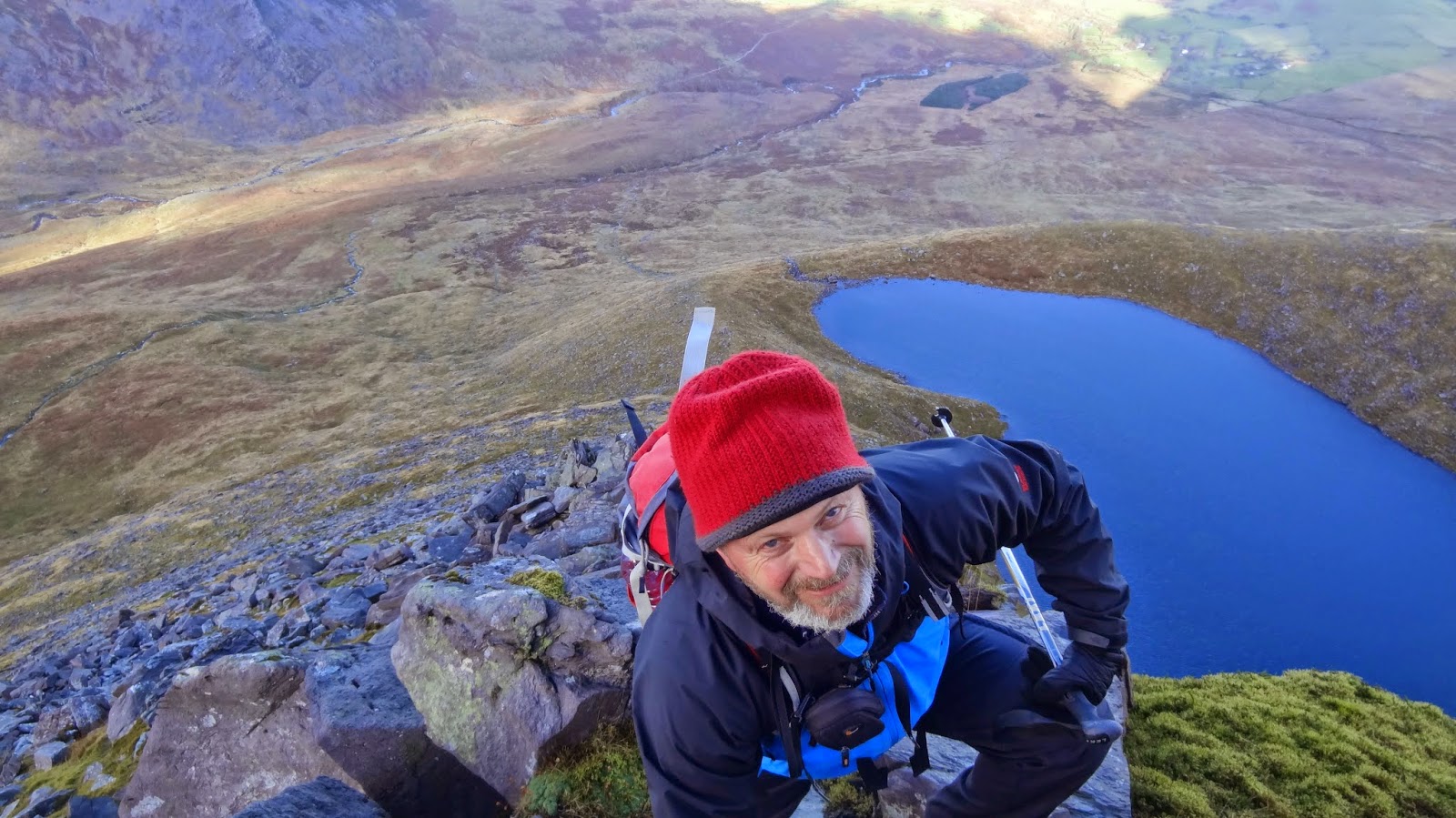
Always an excuse to stop

Lyracappul and walls end


Sunday 23 November 2014

Cnoc na Peiste to Cruach Mhor. The best of the Eastern Reeks

I headed back to Kerry again with Frank foe a day out. The forecast was good but it was a bit of a disappointment to see the Hags Glen on the Reeks looking dark and gloomy when we arrived. Still there was blue sky away from the mountains and we were hopeful of a clearance. We set off into the glen and I filled frank in on all the details from my recent trip to Snowdonia. We wanted to head somewhere a little less visited so we decided to climb up to Lough Coomeenapeiste and climb the north ridge of Cnoc na Peiste 988 meters and head across the beautiful ridge over An Garbh 939 meters(The Big Gun) to Cruach Mhor 932 meters. This is one of my favorite parts of The Reeks and it would be nice to re immerse myself in my own mountains after Snowdonia. The weather was playing ball as well and the hoped for clearance was arriving as well.
Across The Hags Glen

North towards The Slieve Mish Mtns

The slog up to the lake really has little to recommend it except for the beautiful views to the right into the Hags Glen which is backed by the savage east face of Carrauntoohil. We soldiered on and eventually arrived at the lake which sits in a delightful semi circular basin of steep ground. It was decidedly chilly so we didn't rest long and set off up the ridge. It is initially just a steep grassy slope but soon some scrambling opportunities present themselves over some steepening bouldery ground. The rocks were slippy from recent showers and chilled fingers followed, a sure sign that the winter season was coming. Some nice steep bits presented themselves as we got higher and shortly before the summit we were being warmed by some pleasant sunshine. The top arrived and we dropped a few meters to the leeward side and it was suddenly calm and quite warm in the sun. This was a great spot for lunch and allowed us to soak up the stunning views as well. These mountains really can more than hold their own with Snowdonia. After our feast we set off across the beautiful (Grade1) scramble ridge to Cruach Mhor. It was lovely and we even got a short burst of a snow shower, our first of the season, to add to the experience. The one kilometer ridge ended and we descended swiftly back to the car so I could catch my train home. It had been a lovely day out in what are truly some of the most beautiful mountains in these islands. A bit more snow would be nice, I must write to Santa.
Frank having fun

The great ridge

Looking West

A bit of snaw on the way
We will we will get there

Winter IS coming

Looking East

Friday 21 November 2014

THE 3000ers OF WALES....ALMOST

I must confess to finding this time of year tough. The days suddenly seem so short and the weather still hasn't settled into proper winter so I feel somewhat cooped in and claustrophobic. With this in mind I decided to take advantage of a long weekend off at work and head to one of my favorite places-Snowdonia. I went fully laden with my tent, equipment and food for three days. I had a vague plan to start in Llanfairfechan , just head south and see how far I could get. I did my usual train, ferry, train trip and it was dark and dry when I alighted in Llanfairfechan Saturday evening at 6.20pm. I stayed in the excellent bunkhouse at Platts Farm which was only half a mile from the station and a comfortable night followed.

Sunday  16th Nov;
Rising above Llanfairfechan

I got up at six am and after sorting out my stuff and forcing down a bite to eat I was out in the predawn in the sleepy village to begin my journey. Nothing was moving and it was quite nice to walk anonymously through the quite nice looking streets. There was little breeze and it was mild and dry with some clear skies overhead, result!. The light soon improved and by the time I was up at the golf club I could see quite well and get a good view of the village nestling in the valley below. I found the path that led up into the hills above and in good spirits set off. I was reminded of my first trip to the Pyrenees in the first week of December 2011. If you substituted the Med for the Irish sea and Banyuls Sur Mer for Llanfairfechan and the foothills of the Pyrenees for the Carneddu there wasn't a lot of difference, well okay, perhaps it is a bit of a leap in imagination but it was how I felt and I was really looking forward to what was to come. I liked the way that the route started at sea level and the hills rose in stages and stature until finally spending a lot of time above 3000 ft. The good path climbed up through good pastureland and afforded lovely views down to the village and beyond over Conwy Bay and Anglesea. Rounding the shoulder of Garreg Fawr the landscape opened up and a wild rolling range of hills rose in stages and eventually disappeared into the clouds gathered ahead. Now that I was up in open territory the wind was quite stiff and carried a distinct chill but it was dry and that was a bonus. My bag felt pretty heavy but the way ahead was gentle and I made good progress.

The first major top is Drum at 770meters and here I was in the cloud and I had to check the map and compass to ensure I was setting off in the right direction. Navigation was easy as there was a fence running all the way to the first 3000er of the day Foel Fras 942 meters. I was all the time in the mist but that didn't matter as I was just enjoying the fact of being out and about and it was nice to be on ground that was new to me. The helpful navigation aid of the fence was now left behind and the compass was again necessary to ensure correct progress across the rather featureless ground. There wasn't much of a drop or rise to the next top Carnedd Gwenllian 926 meters and as there was still nothing to see I took a compass bearing and set off for the next top Foel Grach 976 meters. There had been several occasions when the sun seemed tantalizingly close to breaking through the mist and now as I arrived at the summit I was finally rewarded with some views. The first thing to catch the eye was the rather lovely ridge leading to the summit of Yr Elen 962 Meters some two kilometers away. As I rested awhile the cloud dissipated further and the day became a wonder of blue skies and wide views across the lovely plateau of the Carneddu. I set off for the next summit and enjoyed the wonderful views before reaching the top of Carnedd Llewelyn at 1065 meters the second highest mountain in Wales. I hadn't seen another living soul all day but now I was in the honey pot of Welsh hillwalking and other walkers were here enjoying this wonderful place. I didn't stop here (having had a nice rest on Foel Grach) and set off towards Carnedd Dafydd  1044 meters.
Easy ground and good paths make for good progress towards Drum

Finally emerging from the clouds and seeing Yr Elen

Towards Pen Yr Helgi Du

The East face of Carnedd Llewelyn

 I was getting a bit tired now having covered about 14 kilometers and had about 1200 meters of ascent with a big bag. Still the going was easy and the views were a pleasant distraction. When I passed the col and turned towards Dafydd I looked across the gulf to my right and realized that I had completely forgotten to do the out and back trip to Yr Elyn. I briefly considered going back and climbing it but sense prevailed and with a tinge of regret I continued to Carnedd Dafydd. I should say at this stage that I had decided against heading slavishly south and decided that the more serpentine traverse of the 3000 footers would make for a fitting challenge, so my next top was Pen yr Ole Wen at 978 meters. Here I had a decision to make again. I had decided to camp up at Lynn Bochlwyd under the west face of Tryfan and it was much of a muchness (distance wise) as to whether I went down directly towards Idwal Cottage or the easier way to the eastern side of Llyn Ogwen. The promise of a coffee and pastry in the cafe by the cottage swung the vote and the knee wrecker and steep descent to the cottage was the way I went. I was disappointed to say the least when half way down it appeared that the cafe was closed but joy was unconfined when I discovered I was mistaken and I savored every bite of the delicious (and well earned) rocky road when I eventually arrived at the roadside.
Carnedd Dafydd

Feeling a bit tired

Campsite


 I had made good time to this point so I was able to relax a while and rest before setting off on the final 250 meter pull up to my chosen campsite. Soon the crowds of people were left behind and I forced my tired legs up the steep path beside the stream that drains the lake that nestles in the impressive Cwm Bochlwyd. The mist had returned again so the wild steep cliffs all about were mostly hidden but it was still a wild and spectacular place to be. I searched around awhile looking for a good place to pitch my tent and I eventually settled on a little peninsula that stretched out into the placid lake. There was no wind and no rain so I was able to enjoy a nice early evening and cook outside etc. Occasional clearings in the mist revealed my wonderful surroundings and added to my pleasure. I had arrived at the lake at 3pm so I had been on the move for eight hours and it was a great relief to relax unencumbered in the mild evening. Darkness wasn't long in arriving and I settled into my tent for the long night ahead. The weather changed around nine that evening and I was lulled to sleep by the sound of heavy rain on my tent while I was snug and warm in my sleeping bag. It was lovely.

Monday 17th Nov;

I had hoped that the rain would have passed in the night but in the dawn light I was still listening to the rain beat on the tent accompanied by the odd strong gust of wind. The good thing about carrying enough food etc is that there is no great pressure to keep moving so I settled back and waited for things to ease. Soon enough there was a break in the weather and I got busy making breakfast and finally breaking camp. I managed to almost get it done in the dry and I was on the move again at 9.30. The first target was to climb to Bwlch Tryfan some 180 meters above. I could feel the effects of the previous days efforts and the bag seemed heavy but the path was good. The weather too wasn't too bad and occasional glimpses of blue sky made an appearance. I wasn't too bothered by the weather anyway as I had the right clothes for winter and was ready for whatever would come my way. I dropped the bag at the col and did an up and back of Tryfan. I was once again in the mist and rain and the rocky ground was treacherous and slippery which made for careful and slow going. Its not every day that one has the summit of this most popular of peaks to yourself but today I was all alone on top. Mind you it wasn't the most hospitable of places today as the wind and rain whipped across the summit. Lets just say I wasn't tempted to jump from Adam to Eve and I quickly turned and headed carefully back down. Again things cleared and I was hopeful of better weather for a while but again things closed in as I went up the steep track that rises to the left of Bristly Ridge. Ordinarily I would head straight up the very enjoyable ridge but I'm not a fan of scrambling with a heavy bag.
Bristly Ridge and Glyder Fach

Looking up to Tryfan

Looking down at the previous nights campsite

Anyway things were pretty bleak upon arriving at the summit plateau of Glyder Fach 994 mtrs. Again care was needed as the rocks were treacherous so progress was pretty slow. The mist was dense and the strange rock formations took on an otherworldly air. The good thing was that the wind was at my back so at least I didn't have to fight that. Some care was needed in navigation but I didn't tarry and set off for the next summit of Glyder Fawr 1001 mtrs. This soon passed and I descended steeply to Llyn Cwn almost 300 meters lower. Here I emerged briefly under the cloud to see a windswept sodden pass but I was almost immediately engulfed again as I set off on the slog to the next top Y Garn 947 meters. This slope seemed to go on and on and my only reward for reaching the summit was the fact that the next bit was downhill. The next top was Elidir Fawr 923 meters and this was about three kilometers away so off I set.As I descended to the col before Foel Goch the weather suddenly cleared and I was afforded stunning views to the west. The one great thing about going out in poor weather is that when things improve the enjoyment of the day increases exponentially. I must confess to being tired though and its fair to say that I set no speed records on the pull to the long slender top of Elidir Fawr. The views were a great compensation though as was the knowledge that the climbing was now done for the day. The descent into Nant Peris went well and I turned my thoughts to where I would stay for tonight. I opted to stop in the recently refurbished hostel at the Pen y Pass. It is excellent and I would highly recommend it. A very comfortable night ensued.
Back under the cloud and looking southwest

Elidir Fawr

Heading down towards Nant Peris

Lovely evening light.

Tuesday 18th Nov;

One thing for sure that can be said about the hostel is that it is Really convenient. After breakfast and getting all my nice and dry kit together I simply walked across the road and joined the Pyg track. This leads to the base of the scramble of Crib Goch 923 meters. Solitude is not easily found hereabouts but once I passed a couple at the base of the scramble I didn't see anyone else until I rejoined the miners track below Snowdons summit. The weather wasn't too bad with light winds low down (strong on top) and cloud down to about 700 meters but it was dry. The scramble to the narrow summit ridge passed easily enough and after crossing the ridge I decided to avoid the pinnacles by dropping down to the left (south) a little and traversing steep but easy rock which afforded many holds. It added a little to the interest of the route. I rejoined the crest and walked to the next top of Garnedd Ugain 1065 meters before continuing easily to the summit of Snowdon itself. Here the wind was quite strong and chilly so I didn't linger and set off towards Y Lliwedd. The cloud had remained stubbornly down all the way despite a couple of hopeful glimpses through the mist but now once I reached col I once again reemerged under the cloud and I could once again feast my eyes on this wonderful landscape. Yr Aran to my south made a very elegant statement and I promised myself that maybe next time I would visit it. The climb to the twin topped summit of Y Lliwedd saw me reenter the mist but the size of its huge cliffs well still in evidence and in these conditions gave the mountain a certain menace. All my climbing was now done and I descended down into the magnificent amphitheatre that is enclosed by these peaks. The day saw a dramatic improvement and by the time I was walking back out it was quite sunny and warm. I caught the bus back to Betws Y Coed and started my long journey back home. I was a little annoyed with myself for forgetting to do Yr Elen on Sunday but it will give me an excuse (like I need one) to return. Perhaps this winter I will get to sample the delights of winter climbing in these parts.

Looking towards LLanberris

Finally back under the clouds looking towards Yr Aran


Nice sun and cloud

Across towards Crib Goch

Snowdon peering above the cloud

Content.


Sunday 9 November 2014

Benaunmore and Crohane, Some of Kerrys Finest.

Yesterday I went with Frank for a hike in the mountains near Killarney. It had been a fair while since Frank had ventured out onto the hills (due to work and motivational issues) so we decided to visit the wonderful Cappagh Glen. This offers one of the wildest, most scenic walks in the whole of Kerry but without the commitment of a big climb so it suited both our needs. I took the train back to Killarney and was delighted to see the sun shining and blue skies predominating. After our usual coffees we set off on the short journey to Lough Guitane. The track that runs from the road to the start of the walk is really bad now and I wouldn't advise anyone to drive in now without a 4by4. Eventually we reached the end of the track and we were soon good to go. Soon the farmland is left behind and we entered the wild ground before the glen. Frank, being always up for a challenge decided that instead of heading into the glen we would take on the north spur of Benaunmore "directissimo". It is steep in places but ,despite Franks lack of practice, we made good progress and soon more expansive views were to be had. The top at just 454 meters offers a great view and here we paused for a while before making for the saddle and descending the rough ground to the gap between the two lakes ( Lough Nabroda and Lough Crohane), before heading up steeply for the southwest top of Crohane at 477 meters. This was a good spot for lunch and we watched some passing rain showers miss us on either side. We continued up afterwards to the lovely summit of Crohane at 650 meters. A short pause here and we descended easily back down to the valley floor. All and all it had been a great outing in one of my favourite places. Well done to Frank for getting back in the saddle. Hopefully we will get out many more times in the coming winter.
Heading in towards Benaunmore

Frank looking a bit Brigadoonish

Up on the spur

Looking into the Glen

Lough Nabroda with the basalt cliffs of Benaunmore

Summit of Crohane


Almost back down

Looking towards the Reeks